MyTopo
Classic USGS Newbury Neck Maine 7.5'x7.5' Topo Map
Couldn't load pickup availability
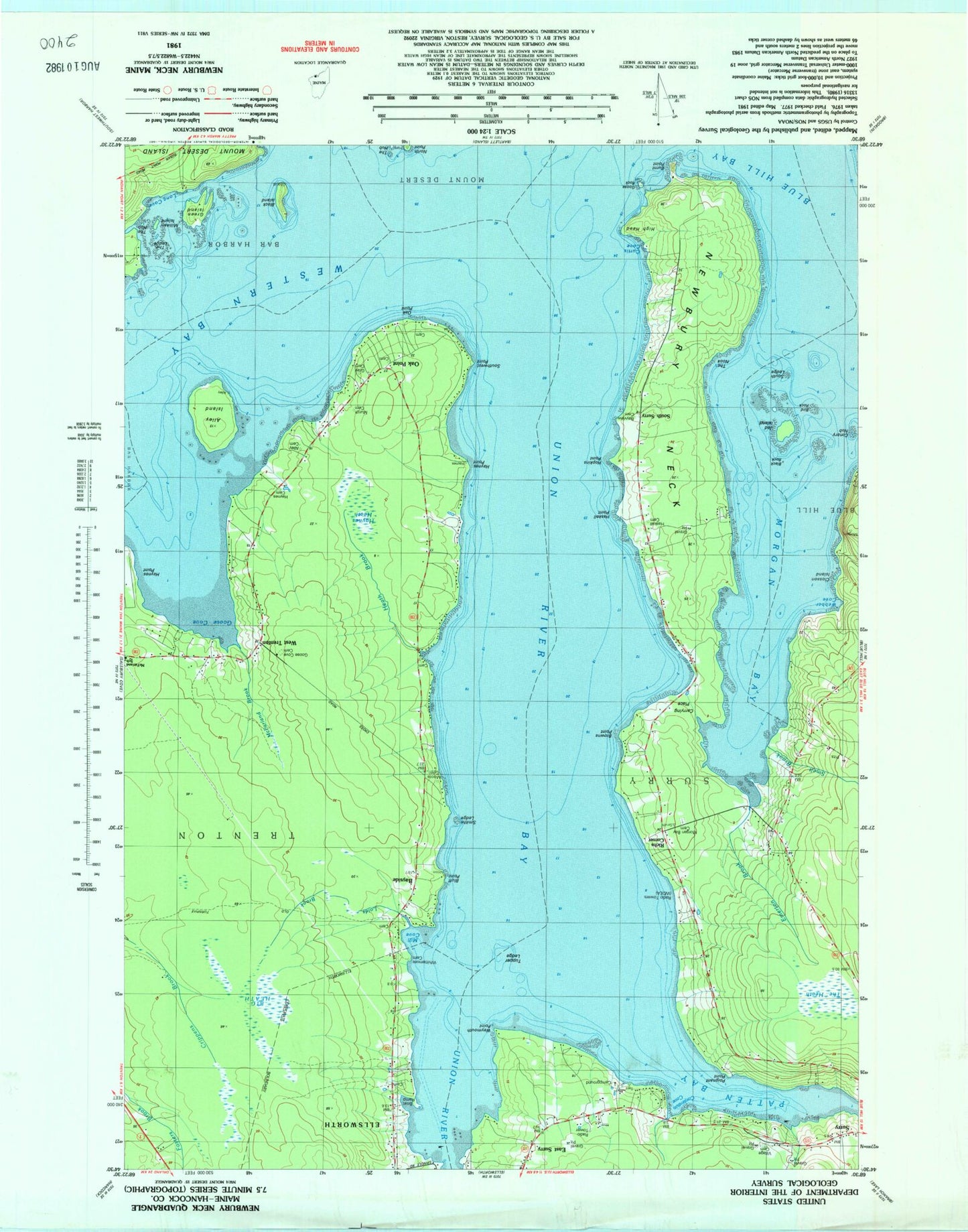
Historical USGS topographic quad map of Newbury Neck in the state of Maine. Typical map scale is 1:24,000, but may vary for certain years, if available. Print size: 24" x 27"
This quadrangle is in the following counties: Hancock.
The map contains contour lines, roads, rivers, towns, and lakes. Printed on high-quality waterproof paper with UV fade-resistant inks, and shipped rolled.
Contains the following named places: Alley Island, Bayview Cemetery, Big Heath, Bird Rock, Black Island, Bluff Point, Carrying Place, Closson Point, Conary Nub, Contention Cove, Curtis Cove, East Surry, Goose Rock, Green Island, Haskell Point, Haynes Cemetery, Haynes Point, Heath Brook, High Head, Hopkins Point, Jed Island, Loids Brook, Mill Cove, Morgan Bay, Newbury Neck, Oak Point, Patten Bay, Smelt Brook, South Surry Cemetery, Southwest Point, The Nook, Union River, Union River Bay, Webber Cove, West Trenton, Weymouth Point, Whittenmore Cemetery, Bayside, South Surry, Western Bay, The Heath, Village Cemetery, Poignant Point, Lord Rock, Emerton Brook, Tupper Ledge, Murch Cemetery, Alley Cemetery, Milliken Island, The Ledge, Gray Cemetery, South Ledge, Burnt Point, Long Cove, Haskell Cemetery, Black Rock, Seal Ledge, McFarland Brook, Haynes Heath, Grant Rock, Moore Cemetery, Browns Point, Goose Cove Cemetery, Richs Corner, Morgan Bay Cemetery, Goose Cove, Closson Island, Smiths Ledge, WDEA-AM (Ellsworth), Town of Trenton, The Reef, Surry Post Office, The Gatherings Campground, Vokes Driving Range, Anderson Cemetery, Haynes - Gilley - Jordan Cemetery, Oak Point Cemetery, Oak Point Cemetery, The Hub