
MyTopo
Classic USGS Newcastle Utah 7.5'x7.5' Topo Map
Regular price
$16.95
Regular price
Sale price
$16.95
Unit price
per
Couldn't load pickup availability
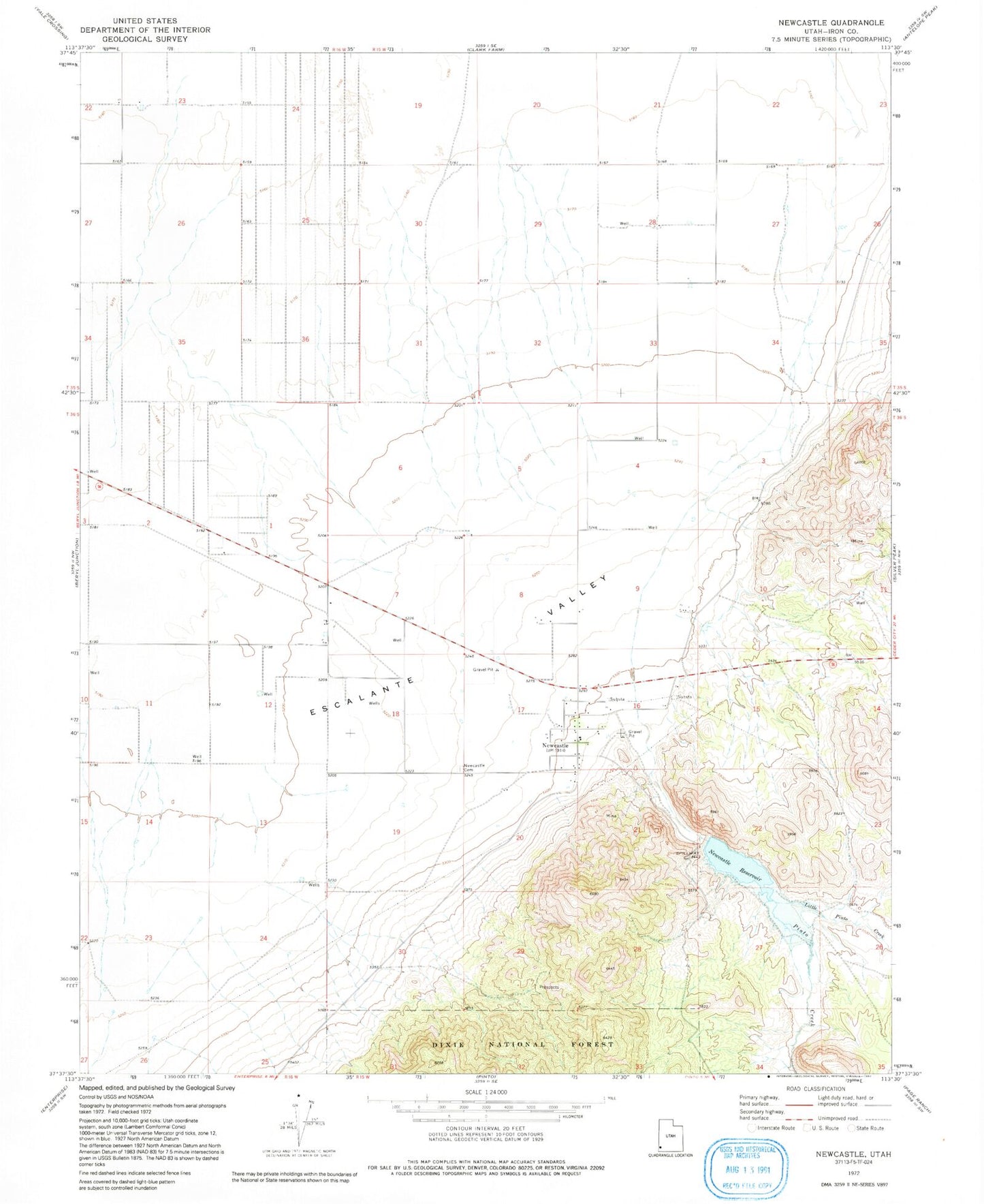
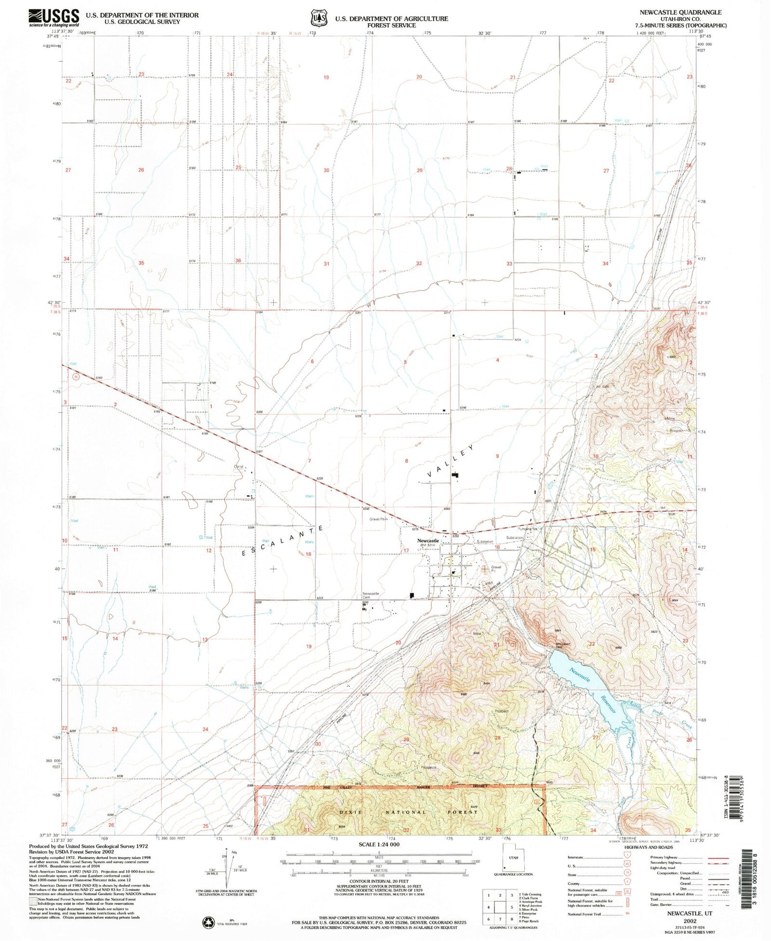
Historical USGS topographic quad map of Newcastle in the state of Utah. Map scale may vary for some years, but is generally around 1:24,000. Print size is approximately 24" x 27"
This quadrangle is in the following counties: Iron.
The map contains contour lines, roads, rivers, towns, and lakes. Printed on high-quality waterproof paper with UV fade-resistant inks, and shipped rolled.
Contains the following named places: Hamblin Valley Fire and Rescue, Jefferson Hunt Monument, Little Pinto Creek, Newcastle, Newcastle Cemetery, Newcastle Census Designated Place, Newcastle Dam, Newcastle Fire Department, Newcastle Post Office, Newcastle Reservoir, Pinto Creek, The Church of Jesus Christ of Latter Day Saints