MyTopo
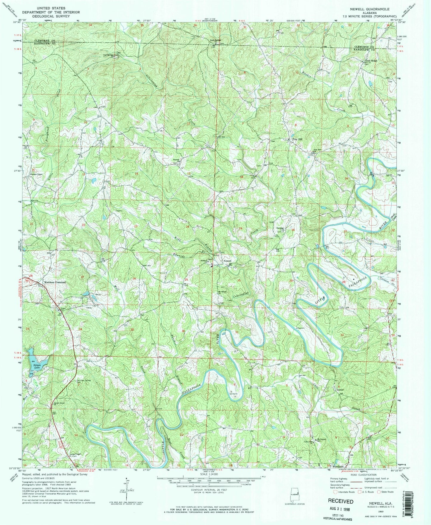
Classic USGS Newell Alabama 7.5'x7.5' Topo Map
Couldn't load pickup availability
Historical USGS topographic quad map of Newell in the state of Alabama. Map scale may vary for some years, but is generally around 1:24,000. Print size is approximately 24" x 27"
This quadrangle is in the following counties: Cleburne, Randolph.
The map contains contour lines, roads, rivers, towns, and lakes. Printed on high-quality waterproof paper with UV fade-resistant inks, and shipped rolled.
Contains the following named places: Antioch Baptist Church Cemetery, Antioch Church, Bear Creek, Butler Bridge, Butlers Mill, Cambridge, Cane Creek, Cavers Grove, Cavers Grove Church, Cohobadiah Creek, Cool Springs Church, Cutnose Creek, Eastville Post Office, Edwards Branch, Gold Ridge, Gold Ridge Baptist Church Cemetery, Goldridge Baptist Church, Harmony Church, Jordan Chapel, Kidd Branch, Knott Prospect, Lamar, Lamar Bridge, Lecta Church, Levins Chapel, Lewis Church, Lofty, Meadows Bridge, Morrison Crossroad, Morrison Crossroad Volunteer Fire Department, Morrison Crossroads Census Designated Place, Mount Carmel Church, Mount Carmel School, Mount Gilead Baptist Church, Mount Gilead Baptist Church Cemetery, Nelson Dam, Nelson Lake, Newell, Newell Post Office, Newell Volunteer Fire Department, Northgutts Store, Old Cool Spring Cemetery, Panther Branch, Pine Hill, Pine Hill Church, Rice Cemetery, Rock Springs Church, Rockdale, Shelton Bridge, Shoal Creek, Smyrna, Smyrna Church, Town of Woodland, Union, Union Church, Union Hill Church, Williams Cemetery, Wolf Creek, ZIP Code: 36280