MyTopo
Classic USGS Newell Arkansas 7.5'x7.5' Topo Map
Couldn't load pickup availability
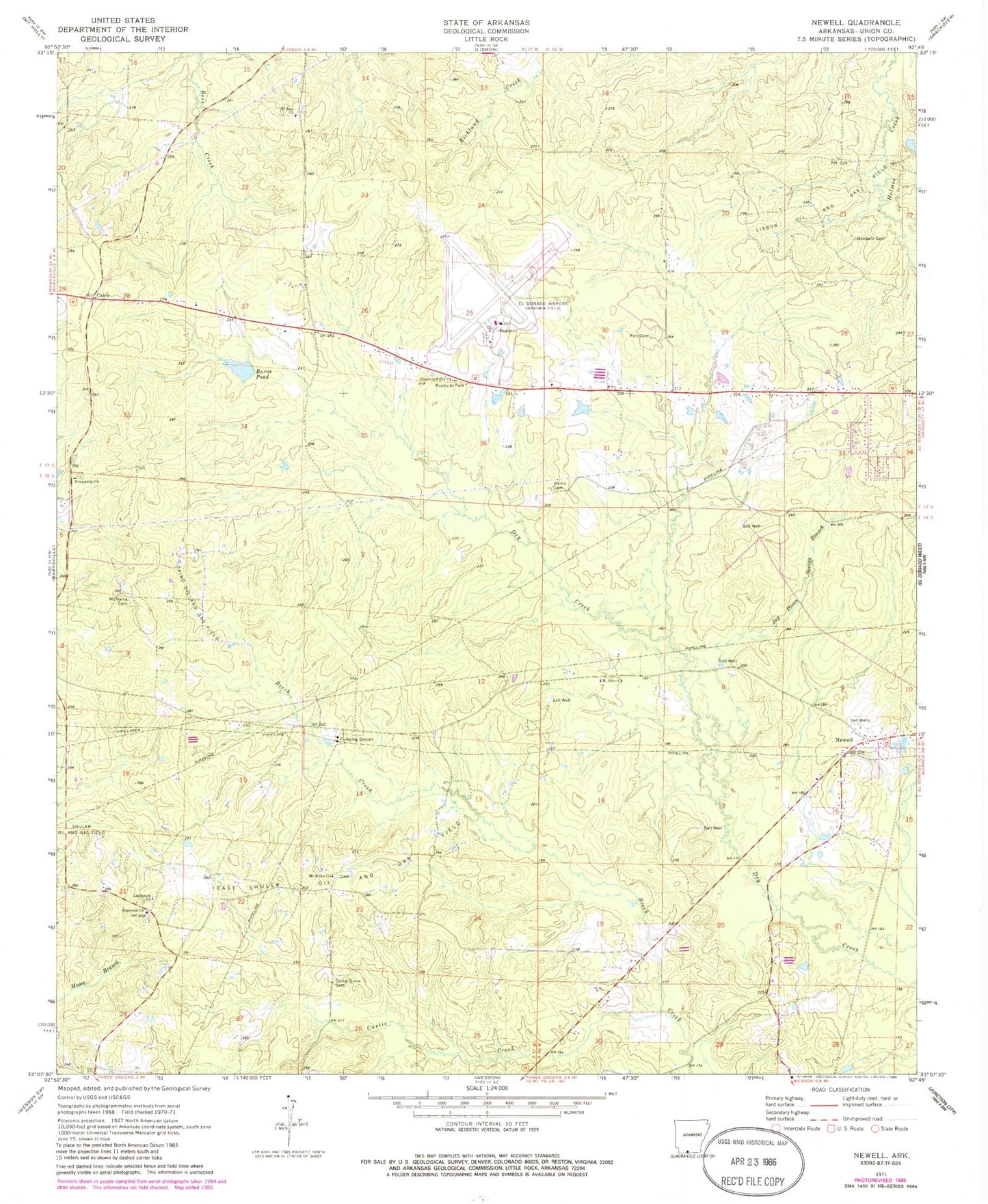
Historical USGS topographic quad map of Newell in the state of Arkansas. Map scale may vary for some years, but is generally around 1:24,000. Print size is approximately 24" x 27"
This quadrangle is in the following counties: Union.
The map contains contour lines, roads, rivers, towns, and lakes. Printed on high-quality waterproof paper with UV fade-resistant inks, and shipped rolled.
Contains the following named places: Burns Pond, Cairo, Cairo Oil and Gas Field, Cairo Rural Fire Department, Carroll Cemetery, Curtis Creek, Curtis Grove Cemetery, East Shuler Oil and Gas Field, Fast Ambulance Service, Friendship Cemetery, Friendship Methodist Church, Goodwin Cemetery, Goodwin Field Church, Griffin, Harris Cemetery, Hopewell Baptist Church, Hopewell Cemetery, Jay Dison Spring Branch, Landmark Church, Lisbon Oil and Gas Field, Mount Renia Cemetery, Mount Willie Cemetery, Mount Willie Church, Mount Zion Cemetery, Mount Zion Church, Pate Cemetery, Shuler Oil and Gas Field, South Arkansas Regional Airport at Goodwin Field, Township of Wesson, Trull