MyTopo
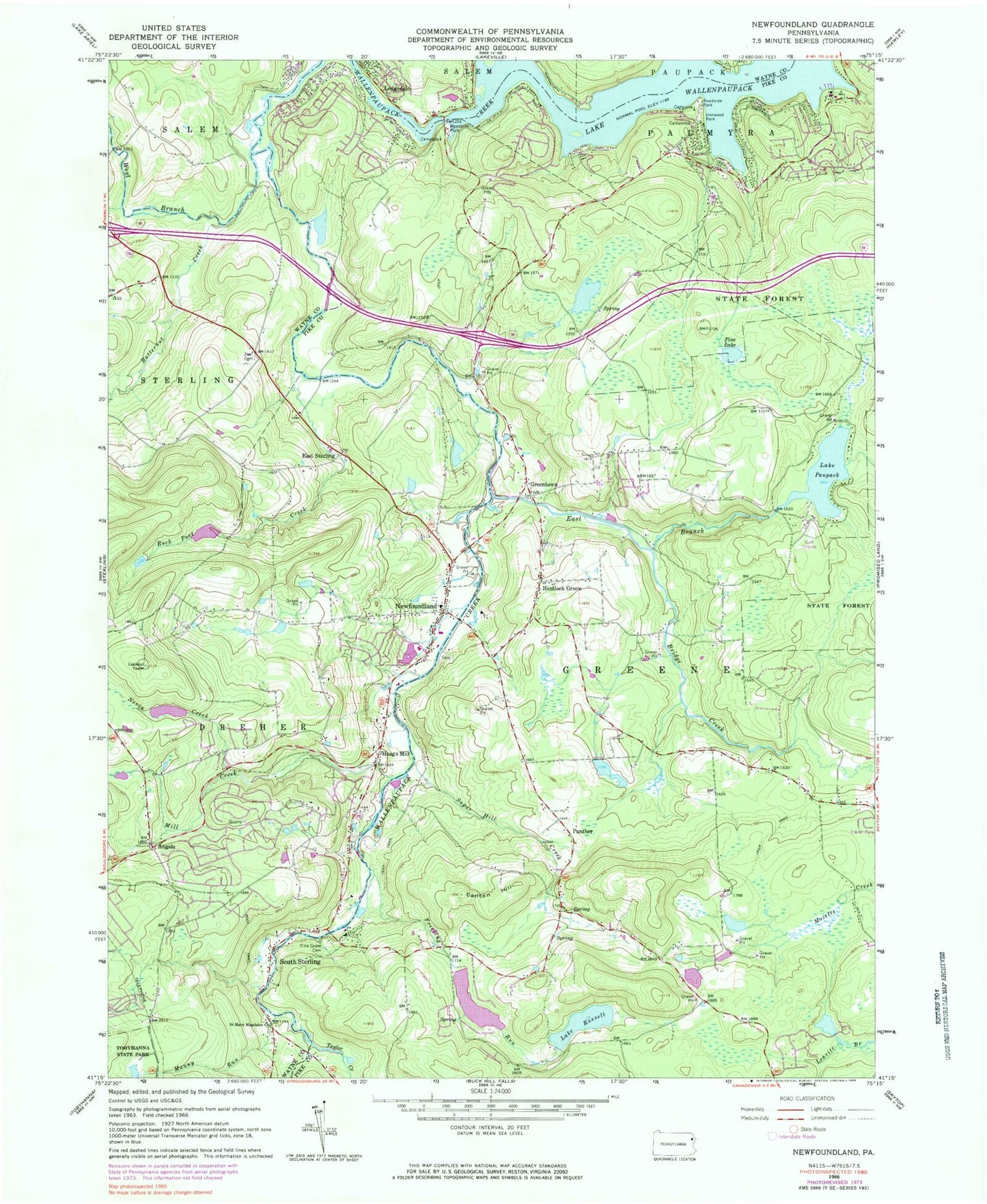
Classic USGS Newfoundland Pennsylvania 7.5'x7.5' Topo Map
Couldn't load pickup availability
Historical USGS topographic quad map of Newfoundland in the state of Pennsylvania. Typical map scale is 1:24,000, but may vary for certain years, if available. Print size: 24" x 27"
This quadrangle is in the following counties: Pike, Wayne.
The map contains contour lines, roads, rivers, towns, and lakes. Printed on high-quality waterproof paper with UV fade-resistant inks, and shipped rolled.
Contains the following named places: Angels, Butternut Creek, Carlton Hill, East Branch Wallenpaupack Creek, East Sterling, Freeling Run, Greentown, Haags Mill, Hemlock Grove, Ironwood Park, Manny Run, Mill Creek, Nevin Creek, Newfoundland, Panther, Lake Paupack, Pine Grove Cemetery, Pine Lake, Rock Port Creek, Lake Russell, Saint Mary Magdalen Church, South Sterling, Sugar Hill Creek, Taylor Creek, Uban Creek, Zion Cemetery, Bridge Creek, Kleinhans Creek, Arthur Airport (historical), Pa-447 Reservoir, Greene Dreher Dam, Lake Russell Dam, Panther Lake, Panther Lake Dam, Pa-452 Dam, Pa-451 Dam, Pa-445 Dam, Siebecker Pond, Siebecker Pond Dam, German Valley School (historical), Simonstown School (historical), Ledgedale, Wallenpaupack Creek, West Branch Wallenpaupack Creek, Cairns Island, Burns Island, Ledgedale Recreation Area and Boat Launch, Greene Dreher Dam, Freeling Run Dam, Geiges Dam, Van Bushkirk Dam, Krautter Dam, Lake in the Clouds, Pine Lake Natural Area, Lake Wallenpaupack Estate, The Escape, Township of Greene, Township of Dreher, Promised Land Volunteer Fire and Ambulance Substation, Greene Dreher Volunteer Fire Station, Newfoundland Area Ambulance, Greentown Post Office, Newfoundland Post Office, Angels, Butternut Creek, Carlton Hill, East Branch Wallenpaupack Creek, East Sterling, Freeling Run, Greentown, Haags Mill, Hemlock Grove, Ironwood Park, Manny Run, Mill Creek, Nevin Creek, Newfoundland, Panther, Lake Paupack, Pine Grove Cemetery, Pine Lake, Rock Port Creek, Lake Russell, Saint Mary Magdalen Church, South Sterling, Sugar Hill Creek, Taylor Creek, Uban Creek, Zion Cemetery, Bridge Creek, Kleinhans Creek, Arthur Airport (historical), Pa-447 Reservoir, Greene Dreher Dam, Lake Russell Dam, Panther Lake, Panther Lake Dam, Pa-452 Dam, Pa-451 Dam, Pa-445 Dam, Siebecker Pond, Siebecker Pond Dam, German Valley School (historical), Simonstown School (historical), Ledgedale, Wallenpaupack Creek, West Branch Wallenpaupack Creek, Cairns Island, Burns Island, Ledgedale Recreation Area and Boat Launch, Greene Dreher Dam, Freeling Run Dam, Geiges Dam, Van Bushkirk Dam, Krautter Dam, Lake in the Clouds, Pine Lake Natural Area, Lake Wallenpaupack Estate, The Escape, Township of Greene, Township of Dreher, Promised Land Volunteer Fire and Ambulance Substation, Greene Dreher Volunteer Fire Station, Newfoundland Area Ambulance, Greentown Post Office, Newfoundland Post Office