MyTopo
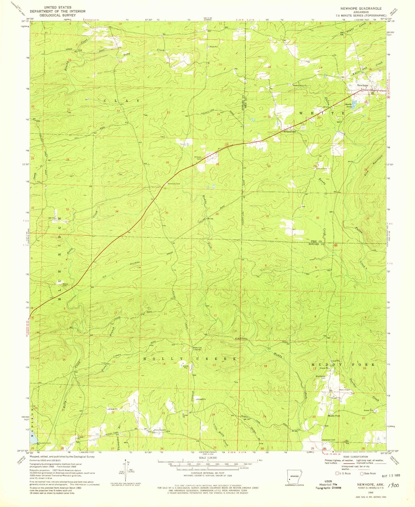
Classic USGS Newhope Arkansas 7.5'x7.5' Topo Map
Couldn't load pickup availability
Historical USGS topographic quad map of Newhope in the state of Arkansas. Map scale may vary for some years, but is generally around 1:24,000. Print size is approximately 24" x 27"
This quadrangle is in the following counties: Howard, Pike.
The map contains contour lines, roads, rivers, towns, and lakes. Printed on high-quality waterproof paper with UV fade-resistant inks, and shipped rolled.
Contains the following named places: Antioch Cemetery, Antioch Church, Bandy Creek, Bissell, Blackwood Cemetery, Dierks Lake, Grandfield, Green Plains, Green Plains Church, Green Plains School, Harmony Cemetery, Harmony Church, Hattie, Henry Cemetery, Kesterson Cemetery, Liberty Cemetery, Long Creek, Muddy Fork, New Hope Fire Department, Newhope, Newhope Census Designated Place, Newhope Post Office, Pleasant Grove Church, Slip-Up and Hitch, Township of Clay, Trout Branch, ZIP Code: 71959