MyTopo
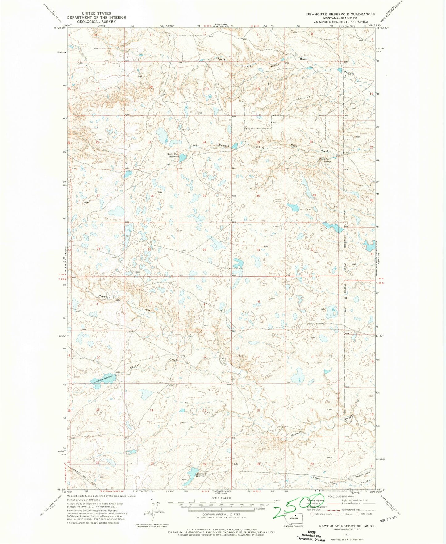
Classic USGS Newhouse Reservoir Montana 7.5'x7.5' Topo Map
Couldn't load pickup availability
Historical USGS topographic quad map of Newhouse Reservoir in the state of Montana. Map scale may vary for some years, but is generally around 1:24,000. Print size is approximately 24" x 27"
This quadrangle is in the following counties: Blaine.
The map contains contour lines, roads, rivers, towns, and lakes. Printed on high-quality waterproof paper with UV fade-resistant inks, and shipped rolled.
Contains the following named places: Anderson Reservoir, Anderson Reservoir Dam, Dogwood Dam, Douglas Dam, Gruszie Dam, Maggie Creek, Newhouse Reservoir, Newhouse Reservoir Dam, Polar Bear Reservoir Dam, Smith - O'Bryan Cemetery, Sparrow Number 12 Dam, White Bear Reservoir, White Bear Reservoir Dam, White Bear Spring