MyTopo
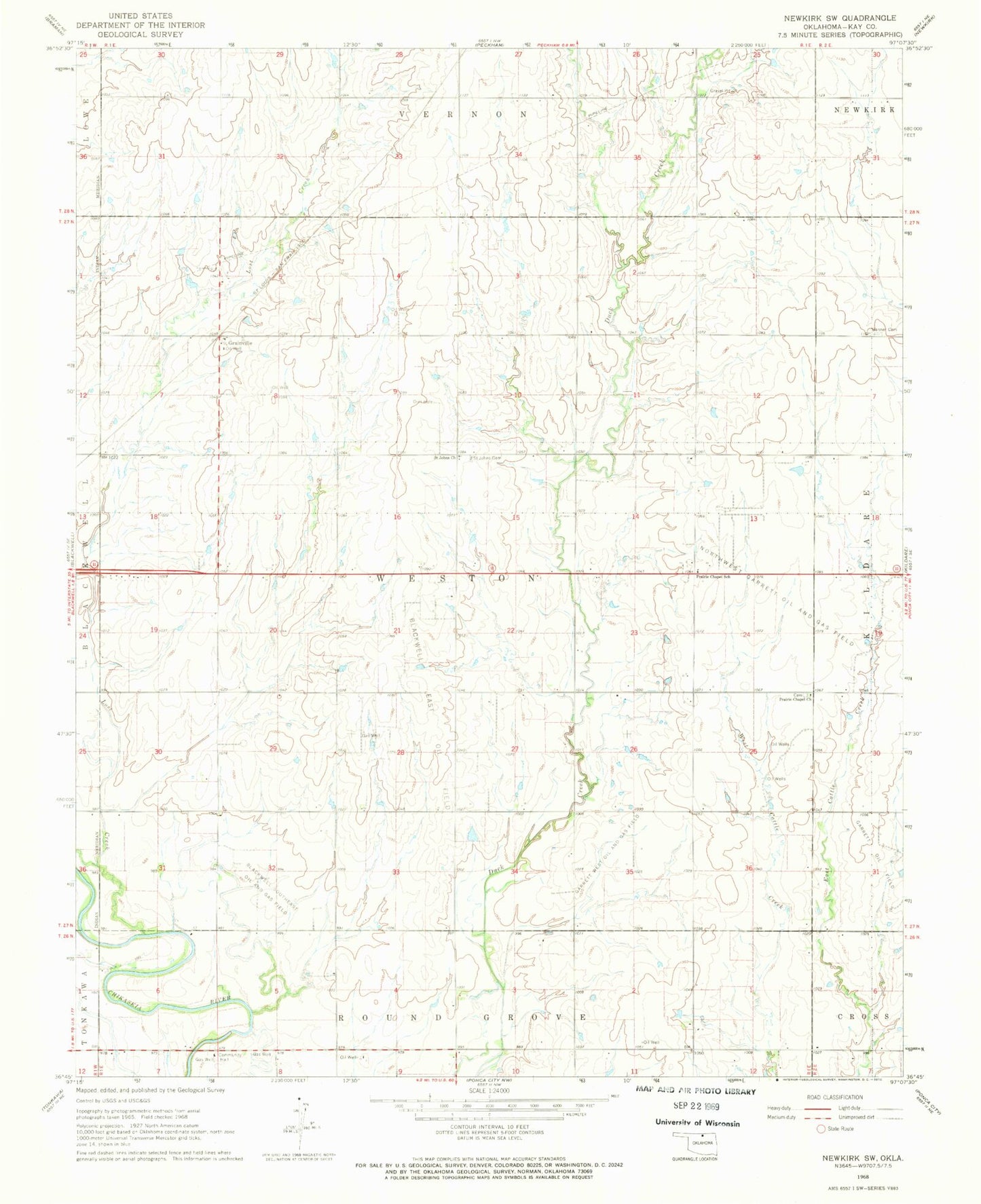
Classic USGS Newkirk SW Oklahoma 7.5'x7.5' Topo Map
Couldn't load pickup availability
Historical USGS topographic quad map of Newkirk SW in the state of Oklahoma. Map scale may vary for some years, but is generally around 1:24,000. Print size is approximately 24" x 27"
This quadrangle is in the following counties: Kay.
The map contains contour lines, roads, rivers, towns, and lakes. Printed on high-quality waterproof paper with UV fade-resistant inks, and shipped rolled.
Contains the following named places: Banner Cemetery, Blackwell East Oil Field, Blackwell Southeast Oil and Gas Field, Garrett Oil Field, Garrett West Oil and Gas Field, Grainville, Kay County, Lost Creek, Lost Duck Creeks Site D-1 Dam, Lost Duck Creeks Site D-1 Reservoir, Northwest Garrett Oil and Gas Field, Prairie Chapel Cemetery, Prairie Chapel Church, Prairie Chapel School, Saint Johns Cemetery, Saint Johns Church, Township of Weston