MyTopo
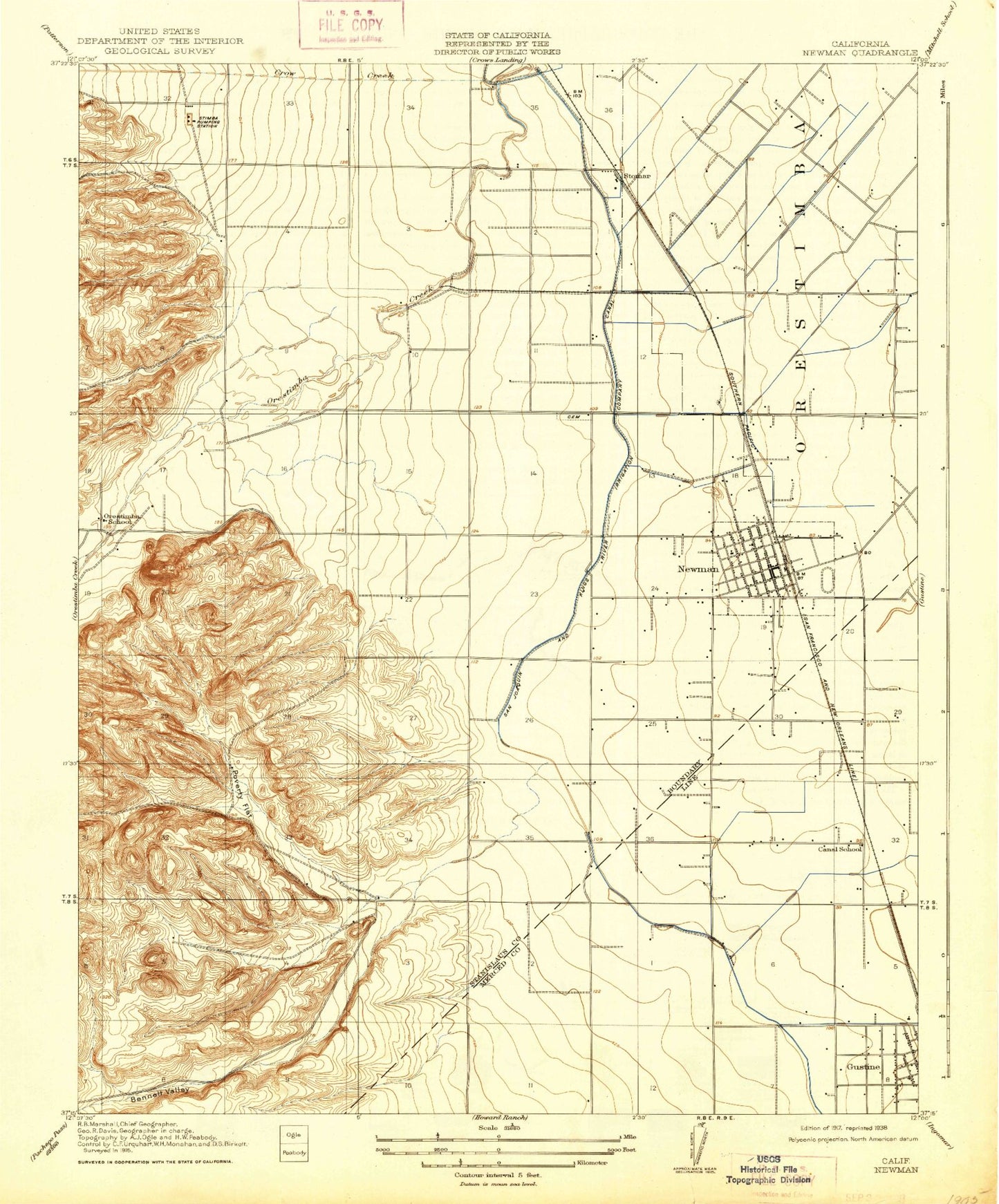
Classic USGS Newman California 7.5'x7.5' Topo Map
Couldn't load pickup availability
Historical USGS topographic quad map of Newman in the state of California. Map scale may vary for some years, but is generally around 1:24,000. Print size is approximately 24" x 27"
This quadrangle is in the following counties: Merced, Stanislaus.
The map contains contour lines, roads, rivers, towns, and lakes. Printed on high-quality waterproof paper with UV fade-resistant inks, and shipped rolled.
Contains the following named places: Bennett Valley, Canal School, City of Newman, Crow Creek, First Baptist Church, Gustine Branch Merced County Library, Gustine Community Presbyterian Church, Gustine High School, Gustine Police Department, Harry P Schmidt Park, Henry Miller Park, Highway 33 Egg Ranch, Hills Ferry Cemetery, Hunt Elementary School, Lions Park, Marks Gravel Pit, Merced County Fire Department Gustine Fire Station 74, Newman, Newman Branch Stanislaus County Free Library, Newman Memorial Center, Newman Pit, Newman Police Department, Newman Post Office, Newman Waste-Way, Newman Youth Center, Orestimba High School, Orestimba School, Our Lady of Miracles Catholic School, Our Lady of Miracles Church, Pioneer Park, Poverty Flat, Sherwood Park, Stimba Pumping Station, Stomar, Sullivan Extension, Timba, Von Renner Elementary School, West Side Community Ambulance, West Side Hospital, West Stanislaus County Fire Protection District Newman Station 5, Westside Christian Center