MyTopo
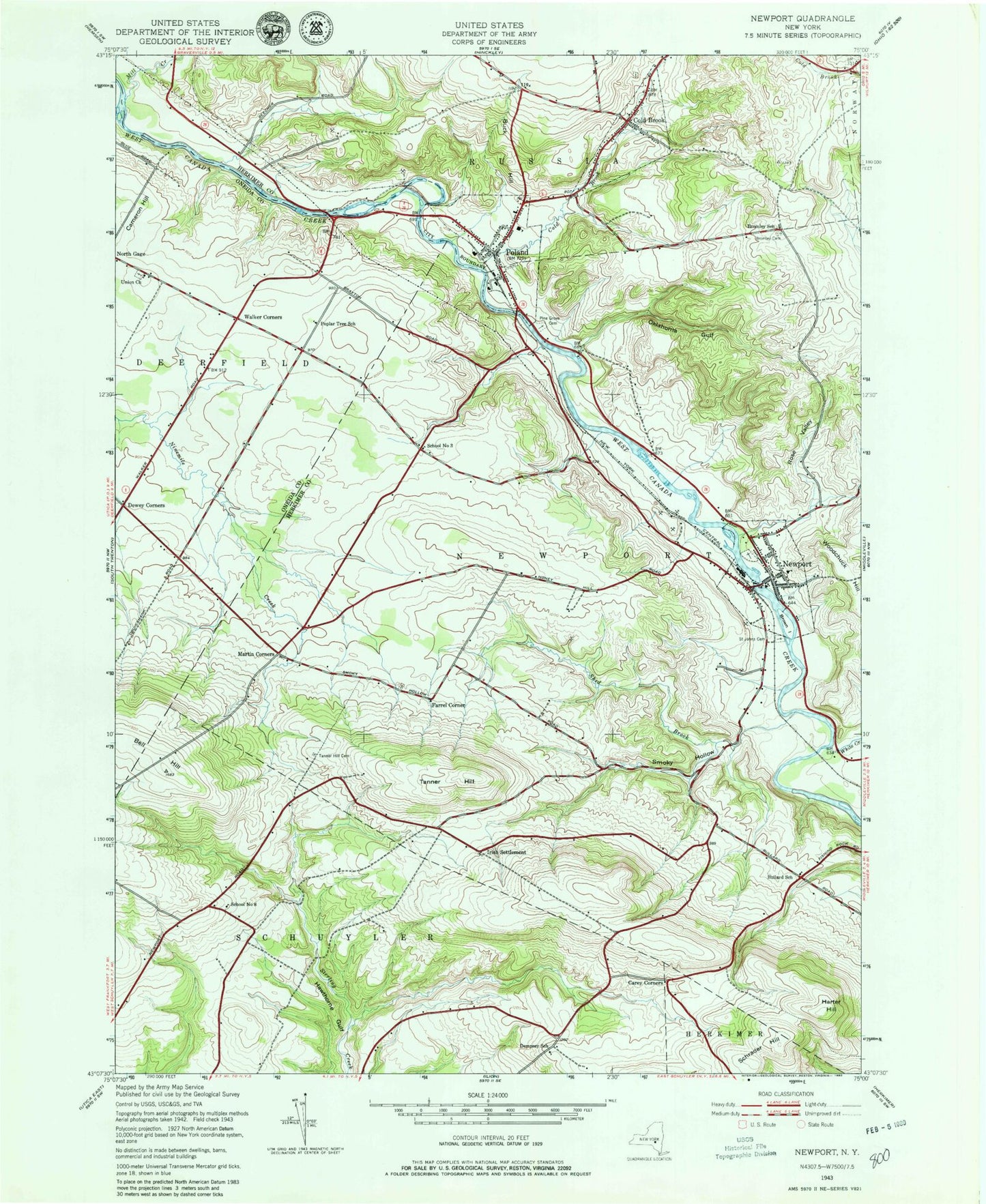
Classic USGS Newport New York 7.5'x7.5' Topo Map
Couldn't load pickup availability
Historical USGS topographic quad map of Newport in the state of New York. Map scale may vary for some years, but is generally around 1:24,000. Print size is approximately 24" x 27"
This quadrangle is in the following counties: Herkimer, Oneida.
The map contains contour lines, roads, rivers, towns, and lakes. Printed on high-quality waterproof paper with UV fade-resistant inks, and shipped rolled.
Contains the following named places: Bell Hill, Blue Anchor Park Mobile Home Park, Brayton Corners, Bromley School, Brown Island, Buck Hill, Bullard School, Carey Corners, Circle T Farms, Cold Brook, Cold Brook Cemetery, Cold Brook Post Office, Community Baptist Church, Dempsey School, Dewey Corners, Farrel Corner, First Baptist Church, Harter Hill, Irish Settlement, Kuyahoora Farm, Kuyahoora Valley Ambulance Corps, Martin Corners, Martins Corners Cemetery, Mill Creek, Newport, Newport Cemetery, Newport Methodist Church, Newport Post Office, Newport Volunteer Fire Department, Oklahoma Gulf, Pine Grove Cemetery, Poland, Poland Cemetery, Poland Elementary School, Poland Junior - Senior High School, Poland Post Office, Poland Public Library, Poland Volunteer Fire Department, Poplar Tree School, Rose Valley, Saint Johns Cemetery, Saint Patrick's Cemetery, School Number 3, School Number 8, Schrader Hill, Shed Brook, Smoky Hollow, Swezey Hill Cemetery, Tanner Hill, Tanner Hill Cemetery, The Golf Club of Newport, Town of Newport, Union Church, Village of Cold Brook, Village of Newport, Village of Poland, Walker Corners, Welch Calvinistic Methodist Cemetery, West Canada Valley Elementary School, White Creek, ZIP Code: 13431