MyTopo
Classic USGS Newton Hamilton Pennsylvania 7.5'x7.5' Topo Map
Couldn't load pickup availability
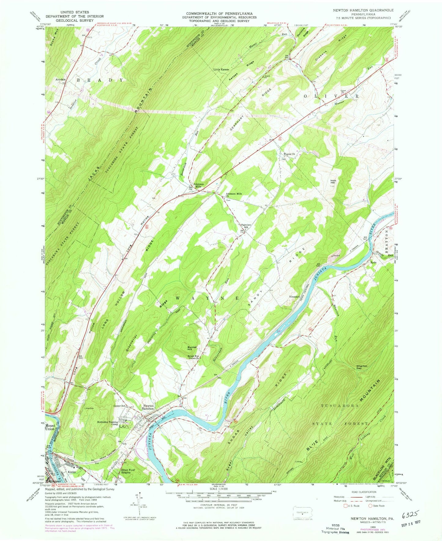
Historical USGS topographic quad map of Newton Hamilton in the state of Pennsylvania. Typical map scale is 1:24,000, but may vary for certain years, if available. Print size: 24" x 27"
This quadrangle is in the following counties: Huntingdon, Juniata, Mifflin.
The map contains contour lines, roads, rivers, towns, and lakes. Printed on high-quality waterproof paper with UV fade-resistant inks, and shipped rolled.
Contains the following named places: Airydale, Atkinson Mills Church, Brush Run Union Church, Bunker Hill, Center School, Fairview School, Gearhart Ridge, Greenbrier Ridge, Hill Valley Creek, Irvin Hill, Kansas Ridge, Kistler, Long Hollow, Long Hollow Ridge, Methodist Training Camp, Musser Run, Newton Hamilton, Orebank Ridge, Ryde, Sandy Ridge, Shanks Run, Sugar Ridge, Wayne Church, Wharton Gap, Wharton Run, Silver Ford Heights, Long Hollow School (historical), Center School (historical), Brush Run School, Wharton School, Pine Grove School, Ross Grove School, Vance School, Beaverdam Run, Atkinson Mills, Little Kansas, Vineyard, Long Hollow Run, Borough of Kistler, Borough of Newton Hamilton, Township of Wayne, Atkinson Mills Census Designated Place, Newton Wayne Volunteer Fire Company Station 26, Newton Hamilton Post Office, Newton Hamilton United Methodist Cemetery, Wayne Cemetery, Ryde Cemetery, Allen Cemetery, Heister's Mill Cemetery, Atkinson Mills Methodist Cemetery, Newton Hamilton Memorial Cemetery