
MyTopo
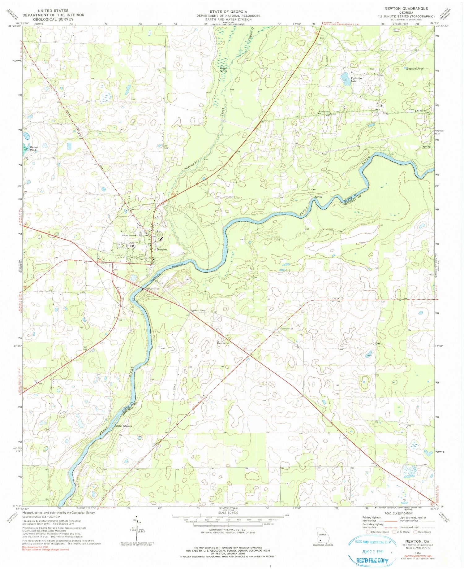
Classic USGS Newton Georgia 7.5'x7.5' Topo Map
Couldn't load pickup availability
Historical USGS topographic quad map of Newton in the state of Georgia. Map scale may vary for some years, but is generally around 1:24,000. Print size is approximately 24" x 27"
This quadrangle is in the following counties: Baker, Mitchell.
The map contains contour lines, roads, rivers, towns, and lakes. Printed on high-quality waterproof paper with UV fade-resistant inks, and shipped rolled.
Contains the following named places: Alligator Creek, Baker County Courthouse, Baker County Elementary School, Baker County Sheriff's Office, Baptism Pond, City of Newton, Cooleewahee Creek, James Henderson Hall Senior Bridge, Mount Airy Church, Newton, Newton Church, Newton Division, Newton Police Department, Newton Post Office, Newton Volunteer Fire Department, Reflection Lake, Sister Islands, White Corner Church, Wildcat Spring, Zion Grove Church


