MyTopo
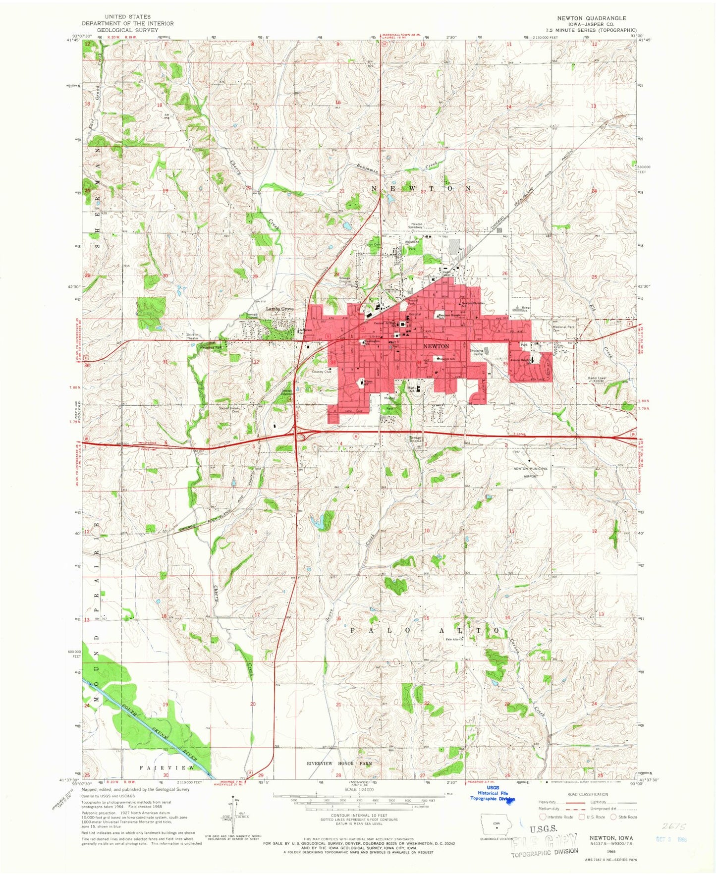
Classic USGS Newton Iowa 7.5'x7.5' Topo Map
Couldn't load pickup availability
Historical USGS topographic quad map of Newton in the state of Iowa. Map scale may vary for some years, but is generally around 1:24,000. Print size is approximately 24" x 27"
This quadrangle is in the following counties: Jasper.
The map contains contour lines, roads, rivers, towns, and lakes. Printed on high-quality waterproof paper with UV fade-resistant inks, and shipped rolled.
Contains the following named places: Agnes Patterson Memorial Park, Aurora Heights Elementary School, Aurora Park, Bailey Wildlife Area, Basics and Beyond Alternative School, Benjamin Creek, Berg Elementary School, Berg Middle School, Bible Missionary Church, Boyhood Home of Emerson Hough Historical Marker, Callison Park, Careage of Newton, Central Junior High School, Christian Reformed Church, Church of Christ, Church of the Nazarene, City of Lambs Grove, City of Newton, Coal Siding, Community Heights Alliance Church, Community of Christ Church, Congregational United Church, Denniston Knolls Park, Des Moines Area Community College - Newton Campus, Emerson Hough Elementary School, Family Foot Clinic of Newton, First Assembly of God Church, First Baptist Church, First Christian Church, First Lutheran Church, First Presbyterian Church, First Southern Baptist Church, First United Methodist Church, Foursquare Gospel Church, Grace Lutheran Church, Health Care Associates Center, Heritage Manor Care Center, Hillcrest Park, Holy Trinity Lutheran Church, Immanuel Baptist Church, International Wrestling Institute and Museum, Jasper County, Jasper County Courthouse, Jasper County Historical Museum, KCOB-AM (Newton), Kingdom Hall of Jehovahs Witnesses, KLVN-FM (Newton), Lambs Grove, Lincoln Park, Lincoln School, Livingston Cemetery, Maytag Park, Memorial Park Cemetery, Moffitt Family Cemetery, Nelson Manor Nursing Home, Newton, Newton Arboretum and Botanical Gardens, Newton Christian School, Newton Church of God, Newton Clinic, Newton Correctional Facility, Newton Country Club, Newton Fire Department, Newton Foot and Ankle Clinic, Newton High School, Newton Library, Newton Mall, Newton Municipal Airport-Earl Johnson Field, Newton Police Department, Newton Post Office, Newton Seventh Day Adventist Church, Newton Speedway, Newton Union Cemetery, Newton USA Healthcare Center, Our Savior Lutheran Church, Palo Alto Cemetery, Palo Alto Church, Pleasant Chapel Cemetery, Rolling Acres Family Campground, Sacred Heart Catholic Church, Sacred Heart Cemetery, Saint Luke United Methodist Church, Saint Stephen's Episcopal Church, Skiff Medical Center, Sunset Park, The Church of Jesus Christ of Latter Day Saints, The Way, Thirty Acre Park, Thomas Jefferson Elementary School, Township of Newton, Township of Palo Alto, United Pentecostal Church, Washington School, Westwood Park, Westwood Park Golf Course, Wilson, Woodland Park, Woodrow Wilson Elementary School, ZIP Code: 50208


