MyTopo
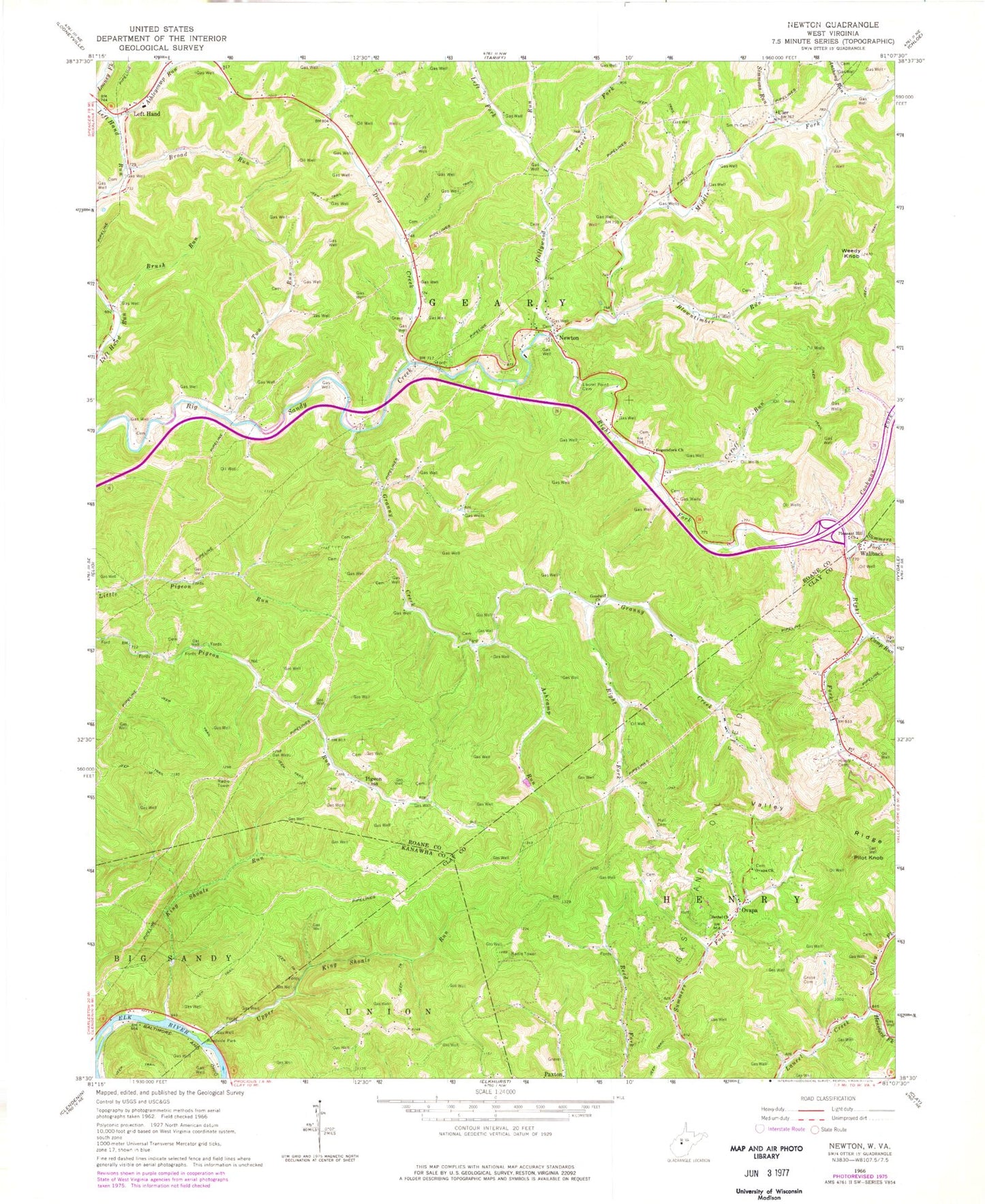
Classic USGS Newton West Virginia 7.5'x7.5' Topo Map
Couldn't load pickup availability
Historical USGS topographic quad map of Newton in the state of West Virginia. Map scale may vary for some years, but is generally around 1:24,000. Print size is approximately 24" x 27"
This quadrangle is in the following counties: Clay, Kanawha, Roane.
The map contains contour lines, roads, rivers, towns, and lakes. Printed on high-quality waterproof paper with UV fade-resistant inks, and shipped rolled.
Contains the following named places: Anthony Run, Ashcamp Run, Ashleycamp Run, Barton, Bee Run, Bethel Baptist Church, Bloomington, Blowntimber Run, Broad Run, Brush Run, Camp Run, Cookman Fork, Cross Country Christian Academy, Cutoff Run, Dog Creek, Geary Elementary School, Geary Public Library, Goodwill Church, Granny Creek, Grose Cemetery, Hall Cemetery, Hansford Fork, Hill Cemetery, Hively Cemetery, Hollywood Run, King, King Cemetery, King Shoals Run, Laurel Point Cemetery, Left Fork Hollywood Run, Left Hand, Left Hand Independent Baptist Church, Left Hand Post Office, Middle Fork Big Sandy Creek, Newton, Newton Baptist Church, Newton Cemetery, Newton Post Office, Newton Volunteer Fire Department, Ovapa, Ovapa Church, Ovapa Post Office, Phillips Cemetery, Pigeon, Pilot Knob, Pleasant Hill Cemetery, Pleasant Hill Church, Rand, Right Fork Big Sandy Creek, Right Fork Granny Creek, Roane County Emergency Squad 17, Rogers Fork School, Rogersfork Church, Simmons Run, Smith Cemetery, Summers Fork, Trace Fork, Trudice Carper Spring, Two Run, Uler, Uler Post Office, Upper King Shoals Run, Valley Fork, Valley Ridge, Wallback, Wallback Post Office, Wallback United Methodist Church, Wallback Wildlife Management Area, Weedy Knob, West Virginia Division of Forestry Roane - Clay County Field Office, ZIP Codes: 25164, 25251, 25266