
MyTopo
Classic USGS Newtonia Mississippi 7.5'x7.5' Topo Map
Couldn't load pickup availability
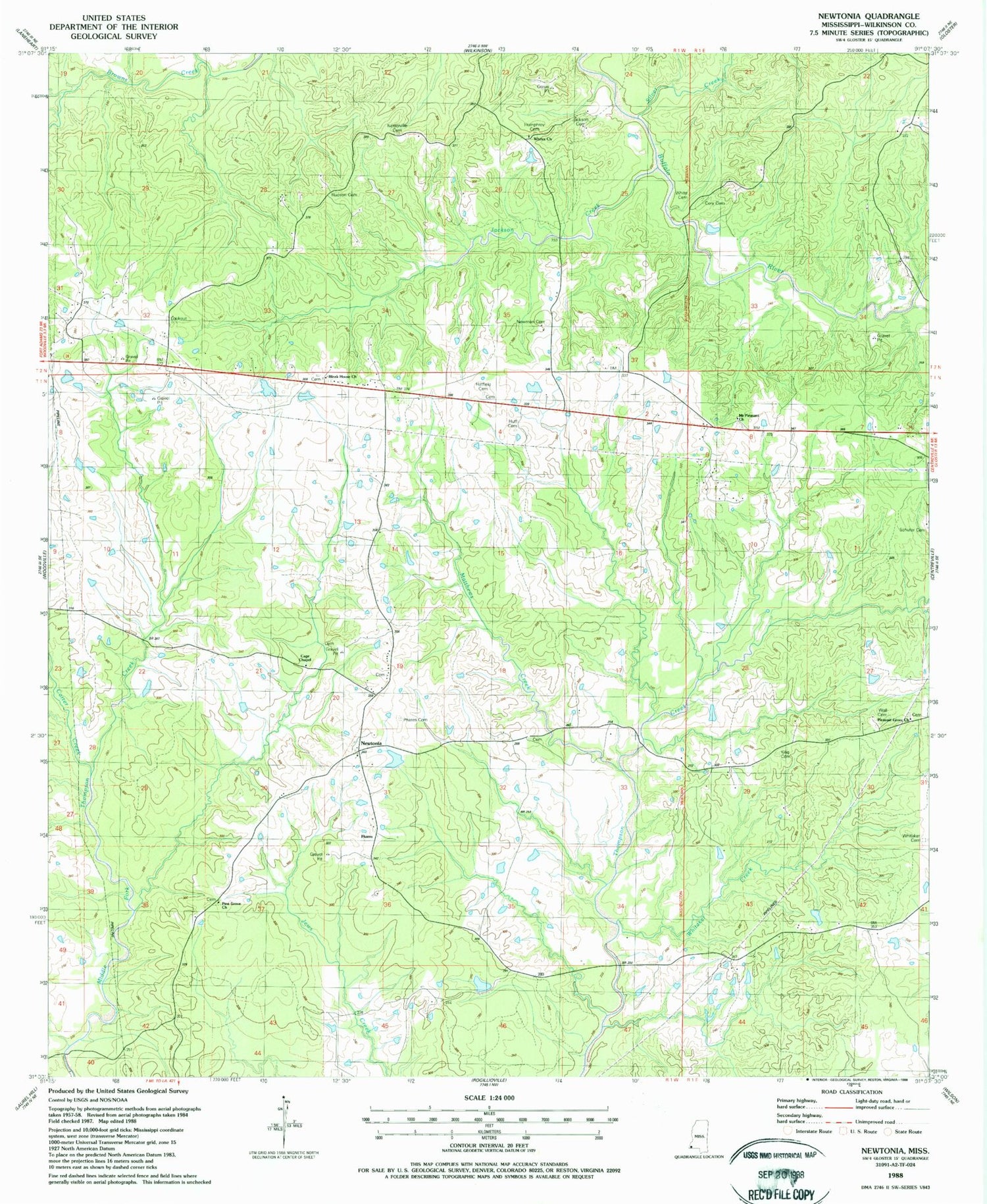
Historical USGS topographic quad map of Newtonia in the state of Mississippi. Map scale may vary for some years, but is generally around 1:24,000. Print size is approximately 24" x 27"
This quadrangle is in the following counties: Wilkinson.
The map contains contour lines, roads, rivers, towns, and lakes. Printed on high-quality waterproof paper with UV fade-resistant inks, and shipped rolled.
Contains the following named places: Bleak House Church, Cage Chapel, Carter Creek, Charlie Graves Lake Dam, Cory Cemetery, E M Kee Junior Lake Dam, Forest Home Airport, Hatfield Cemetery, Hudson Cemetery, Huff Cemetery, Humphrey Cemetery, Jackson Cemetery, Jackson Creek, King Cemetery, Lake Walthall Dam, Matthews Creek, Mount Pleasant, Mount Pleasant Church, Netterville 1 Cemetery, Newman Cemetery, Newtonia, Phares Cemetery, Pilgrim Rest Church, Pine Grove Church, Pleasant Grove Church, Schuter Cemetery, Silver Creek, Supervisor District 1, Trinity Church, Wall Cemetery, Whitaker Cemetery, Whitaker Creek, White Cemetery, Whites Church, ZIP Code: 39631


