MyTopo
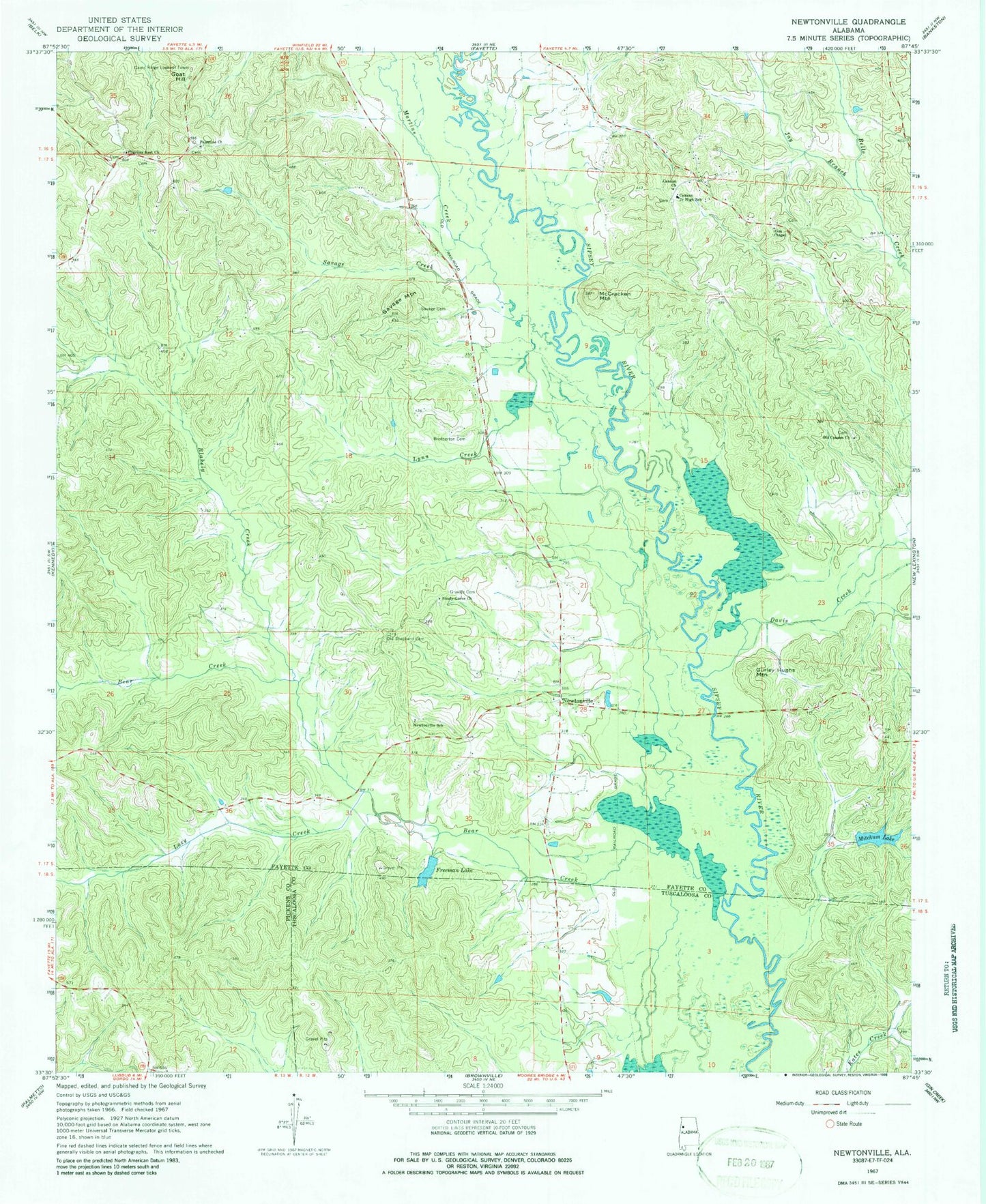
Classic USGS Newtonville Alabama 7.5'x7.5' Topo Map
Couldn't load pickup availability
Historical USGS topographic quad map of Newtonville in the state of Alabama. Typical map scale is 1:24,000, but may vary for certain years, if available. Print size: 24" x 27"
This quadrangle is in the following counties: Fayette, Pickens, Tuscaloosa.
The map contains contour lines, roads, rivers, towns, and lakes. Printed on high-quality waterproof paper with UV fade-resistant inks, and shipped rolled.
Contains the following named places: Blakely Creek, Brotherton Cemetery, Canaan Church, Canaan Junior High School, Davis Creek, Freeman Lake, Goat Hill, Gravlee Cemetery, Gurley Hughs Mountain, Jay Branch, Lazy Creek, Lynn Creek, Martins Creek, McCracken Mountain, Mitchum Lake, Newtonville, Old Canaan Church, Old Shepherd Cemetery, Palestine Church, Savage Cemetery, Savage Creek, Savage Mountain, Shady Grove Church, Mitchum Lake Dam, Freeman Lake Dam, Davis (historical), Walnut Lane (historical), Pilgrims Rest Baptist Church, Blakely Creek Oil Field, Newtonville Gas Field, Bear Creek, Jerusalem, Pilgrim Rest Cemetery, Wright Cemetery, Zion Chapel Cemetery, Palestine Cemetery, Shady Grove Cemetery, Shepherd Cemetery, New Canaan Cemetery, Old Canaan Cemetery, Zion Chapel Methodist Church, Shepherd Baptist Church, Cains Ridge Lookout Tower, Newtonville Elementary School, Stone Wall Volunteer Fire Department, Walnut Lane Volunteer Fire Department