MyTopo
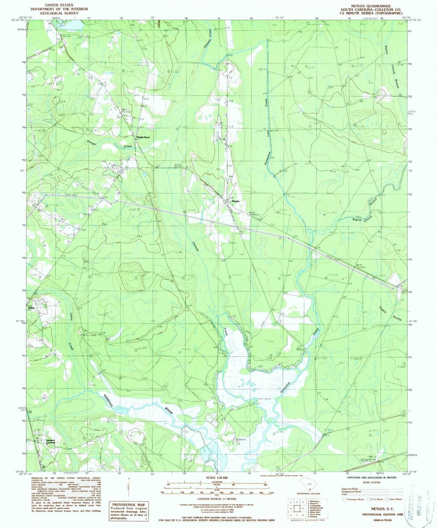
Classic USGS Neyles South Carolina 7.5'x7.5' Topo Map
Couldn't load pickup availability
Historical USGS topographic quad map of Neyles in the state of South Carolina. Map scale may vary for some years, but is generally around 1:24,000. Print size is approximately 24" x 27"
This quadrangle is in the following counties: Colleton.
The map contains contour lines, roads, rivers, towns, and lakes. Printed on high-quality waterproof paper with UV fade-resistant inks, and shipped rolled.
Contains the following named places: Aimwell Church, Ashepoo Crossing, Chessey Creek, Colleton Fire Department Station 12, Colleton Fire Department Station 30, Cumberland Church, Drawdy, Horseshoe Bridge, Isaiah Church, Ivanhoe Bridge, Johno Creek, Mashawville School, Neyles, Neyles School, Pendergrass Cross Roads, Price Bridge, Pringle Bend, Pringle Creek, Saint Johns Church, Saint Marks Church, Saint Pauls Church, Saint Peters Church, Saint Peters School, Salem Church, Sandy Dam Branch, Tupelo Swamp, Wards Cross School, Whitehouse Plantation