MyTopo
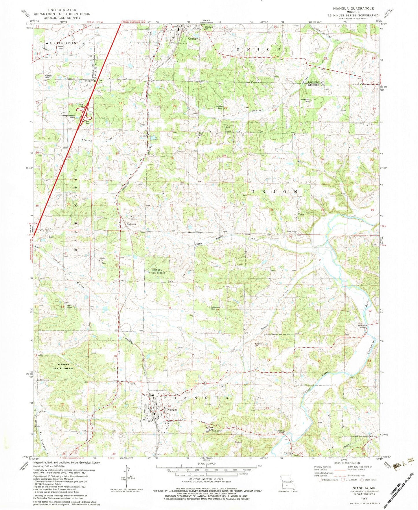
Classic USGS Niangua Missouri 7.5'x7.5' Topo Map
Couldn't load pickup availability
Historical USGS topographic quad map of Niangua in the state of Missouri. Map scale may vary for some years, but is generally around 1:24,000. Print size is approximately 24" x 27"
This quadrangle is in the following counties: Dallas, Laclede, Webster.
The map contains contour lines, roads, rivers, towns, and lakes. Printed on high-quality waterproof paper with UV fade-resistant inks, and shipped rolled.
Contains the following named places: Anderson Cemetery, Bowen Creek, Cantrell Creek, City of Niangua, Conway Cemetery, Conway Church, Conway Freewill Baptist Church, Copening Bridge, Copening Church, Copening School, Good Spring Cemetery, Good Spring Church, Graceland Cemetery, Graham Cemetery, Hamilton Bridge, Hendrix Cemetery, Letterman Cemetery, Little Bowen Creek, Macky School, Mathis Church, Niangua, Niangua Fire Department, Niangua Junction, Niangua Post Office, Niangua School, Oak Grove School, Reed Cemetery, Reed School, Salem Springs Creek, Sampson, Tindle Cemetery, Township of Niangua, Township of Union, Vance, Williams Cemetery, Youth Camp, ZIP Code: 65632