MyTopo
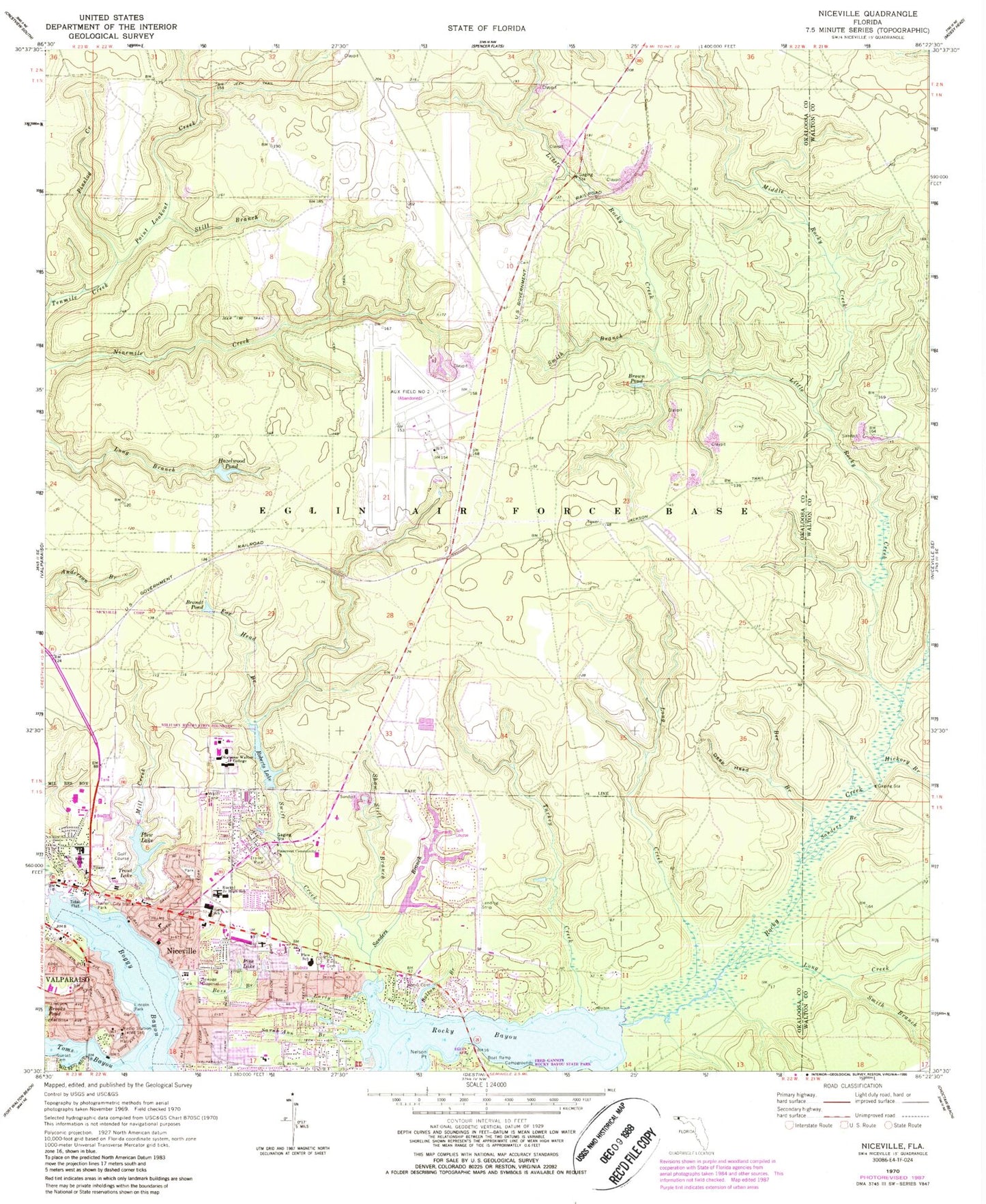
Classic USGS Niceville Florida 7.5'x7.5' Topo Map
Couldn't load pickup availability
Historical USGS topographic quad map of Niceville in the state of Florida. Typical map scale is 1:24,000, but may vary for certain years, if available. Print size: 24" x 27"
This quadrangle is in the following counties: Okaloosa, Walton.
The map contains contour lines, roads, rivers, towns, and lakes. Printed on high-quality waterproof paper with UV fade-resistant inks, and shipped rolled.
Contains the following named places: Bass Branch, Bee Branch, Boggy Bayou, Brandt Pond, Brooks Pond, Brown Pond, Cedar Head Branch, Deep Head, Early Branch, Early Cemetery, Lula J Edge Elementary School, Fox Head Branch, Hazelwood Pond, Hickory Branch, Little Rocky Creek, Long Creek, Long Creek, Middle Rocky Creek, Mill Creek, Nelson Point, Okaloosa-Watson College, Pine Lake, Pinecrest Community Church, Pinelog Creek, Plew Lake, Plew Elementary School, Point Lookout Creek, Roberts Lake, Rocky Bayou, Rocky Cemetery, Rocky Creek, Sanders Branch, Sanders Branch, Sarah Ann Branch, Shaw Still Branch, Smith Branch, Smith Branch, Still Branch, Swift Creek, Toms Bayou, Trout Lake, Deer Moss Creek, Turkey Creek, Niceville, Bayou Plaza, Palm Plaza, Niceville High School, C W Ruckel Middle School, Twin Cities Hospital, C G Melgs Bridge, Rocky Bayou State Park Aquatic Preserve, Bolton Branch, Sarah Ann Bayou, Ruckel Airport, WBZR-AM (Destin), WFSH-AM (Valparaiso-Niceville), City of Niceville, Niceville Fire Department, Valparaiso Volunteer Fire Department, East Niceville Fire District, Okaloosa County Emergency Medical Services Station 1, Niceville Police Department, Niceville Post Office, Valparaiso Post Office