MyTopo
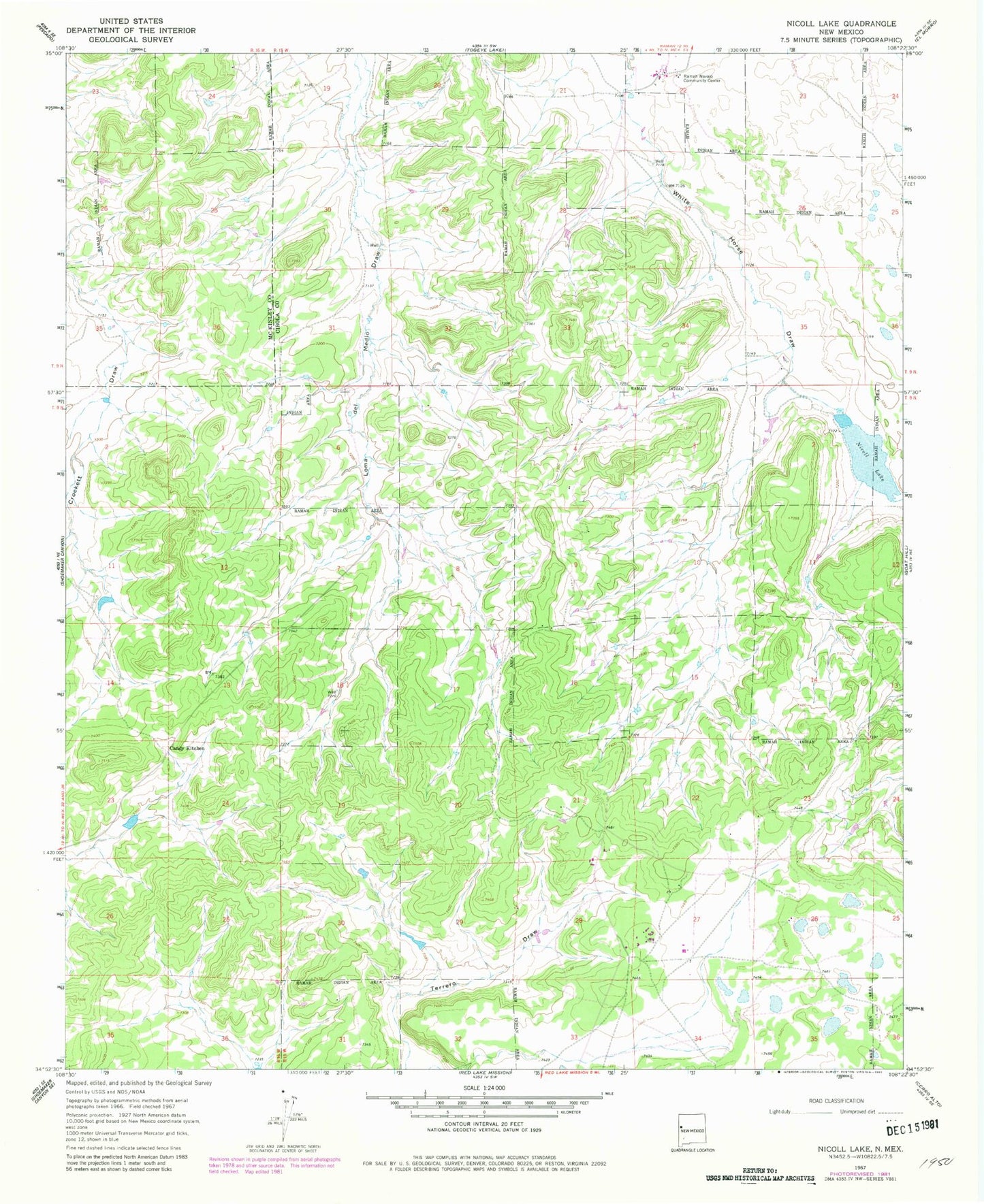
Classic USGS Nicoll Lake New Mexico 7.5'x7.5' Topo Map
Couldn't load pickup availability
Historical USGS topographic quad map of Nicoll Lake in the state of New Mexico. Map scale may vary for some years, but is generally around 1:24,000. Print size is approximately 24" x 27"
This quadrangle is in the following counties: Cibola, McKinley.
The map contains contour lines, roads, rivers, towns, and lakes. Printed on high-quality waterproof paper with UV fade-resistant inks, and shipped rolled.
Contains the following named places: Ashcroft Reservoir Dam, Candy Kitchen, Candy Kitchen Census Designated Place, Candy Kitchen Volunteer Fire Department / Emergency Medical Services, KTDB-FM (Ramah), Nicoll Lake, Pinehill, Pinehill Census Designated Place, Pinehill Emergency Medical Services, Pinehill Post Office, Pinehill Volunteer Fire Department, Ramah Navajo Community, Ramah Navajo Community Center, Ramah Navajo Police Department, Ramah Number 4 Water Well, Zuni - Ramah Service Unit Indian Health Service Pinehill Health Center