MyTopo
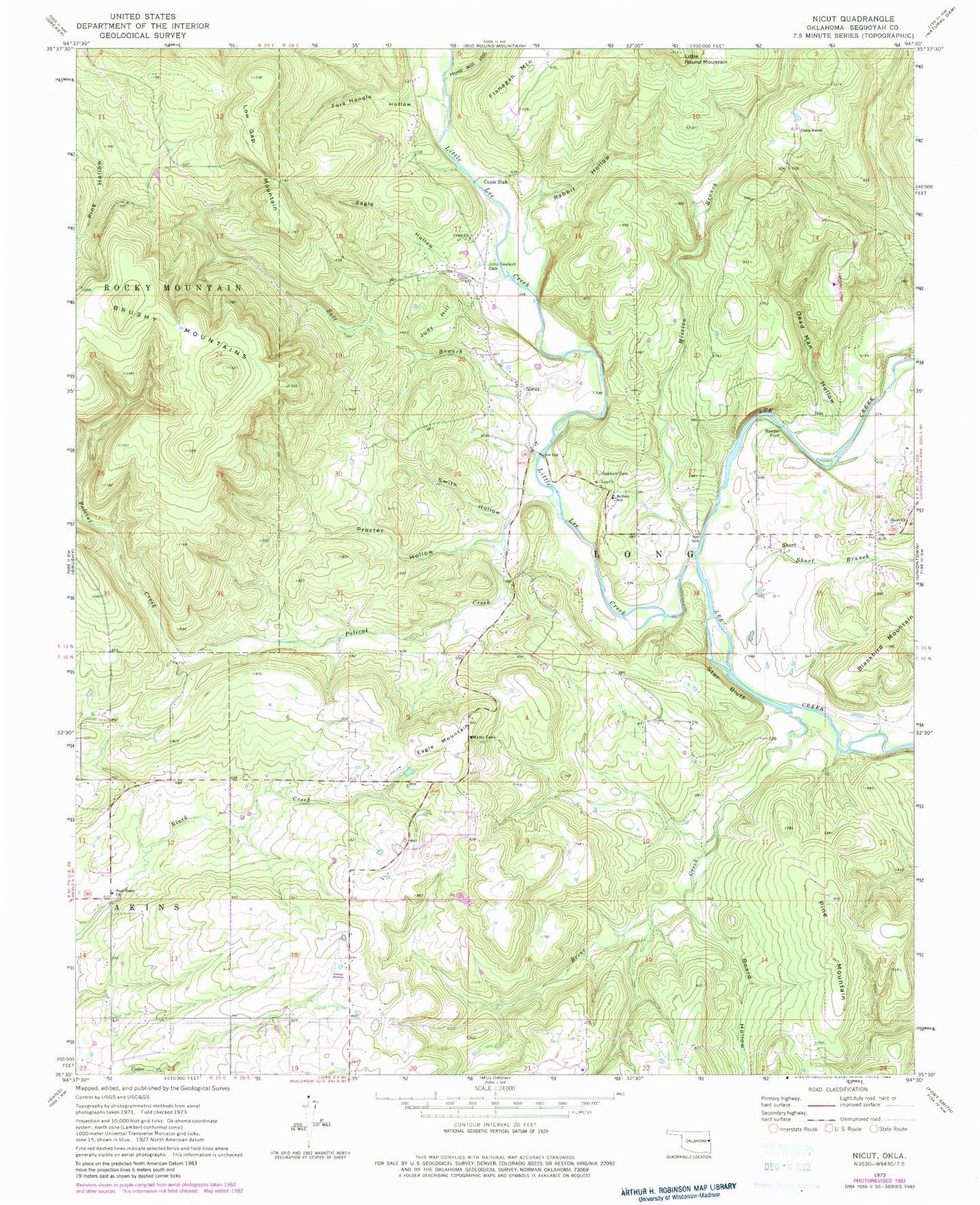
Classic USGS Nicut Oklahoma 7.5'x7.5' Topo Map
Couldn't load pickup availability
Historical USGS topographic quad map of Nicut in the state of Oklahoma. Map scale may vary for some years, but is generally around 1:24,000. Print size is approximately 24" x 27"
This quadrangle is in the following counties: Sequoyah.
The map contains contour lines, roads, rivers, towns, and lakes. Printed on high-quality waterproof paper with UV fade-resistant inks, and shipped rolled.
Contains the following named places: Belfonte, Belfonte Census Designated Place, Belfonte Elementary School, Blackbird Mountain, Board Hollow, Briar Creek, Copic Church, Copic Slab, Curts Ranch, Dead Man Hollow, Eagle Hollow, Eagle Mountain, Flanagan Mountain, Fork Handle Hollow, Hunt Mill Hollow, John Seabolt Cemetery, Judy Hill, Lee Church, Little Lee Creek, Low Gap Mountain, Mission Branch, New Hope Church, Nicut, Nicut Census Designated Place, Nicut Volunteer Fire Department Station 1, Nicut Volunteer Fire Department Station 2, Nicut Volunteer Fire Department Station 3, Pine Mountain, Polecat Creek, Procter Hollow, Rabbit Hollow, Reeder Ford, Roland Division, Salt Creek, Seabolt Cemetery, Short, Short Branch, Short Church, Smith Hollow, Star Bluff, Township of Long