MyTopo
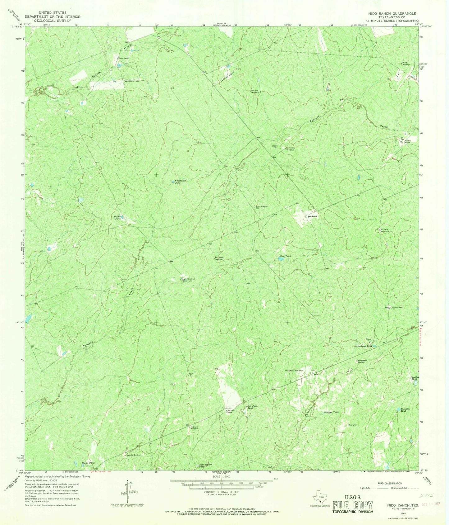
Classic USGS Nido Ranch Texas 7.5'x7.5' Topo Map
Couldn't load pickup availability
Historical USGS topographic quad map of Nido Ranch in the state of Texas. Map scale may vary for some years, but is generally around 1:24,000. Print size is approximately 24" x 27"
This quadrangle is in the following counties: Webb.
The map contains contour lines, roads, rivers, towns, and lakes. Printed on high-quality waterproof paper with UV fade-resistant inks, and shipped rolled.
Contains the following named places: Altos Windmill, Calabazas Pond, Comitas Tank, Del Alto Windmill, Docha Tank, El Laredo Windmill, El Llano Windmill, El Siete Windmill, El Trevino Windmill, Fresno Ranch, Guajillo Tank, Huisachosa Tank, Huisachosa Windmill, Middle Pond, Nido Ranch, Nido Tank, Nido Windmill, Palo Blanco Tank, Pratt Windmill, Rea Well, San Juan Ranch, San Juan Tank, South Windmill, Tordillo Windmill, Tule Windmill, Venados Tank