MyTopo
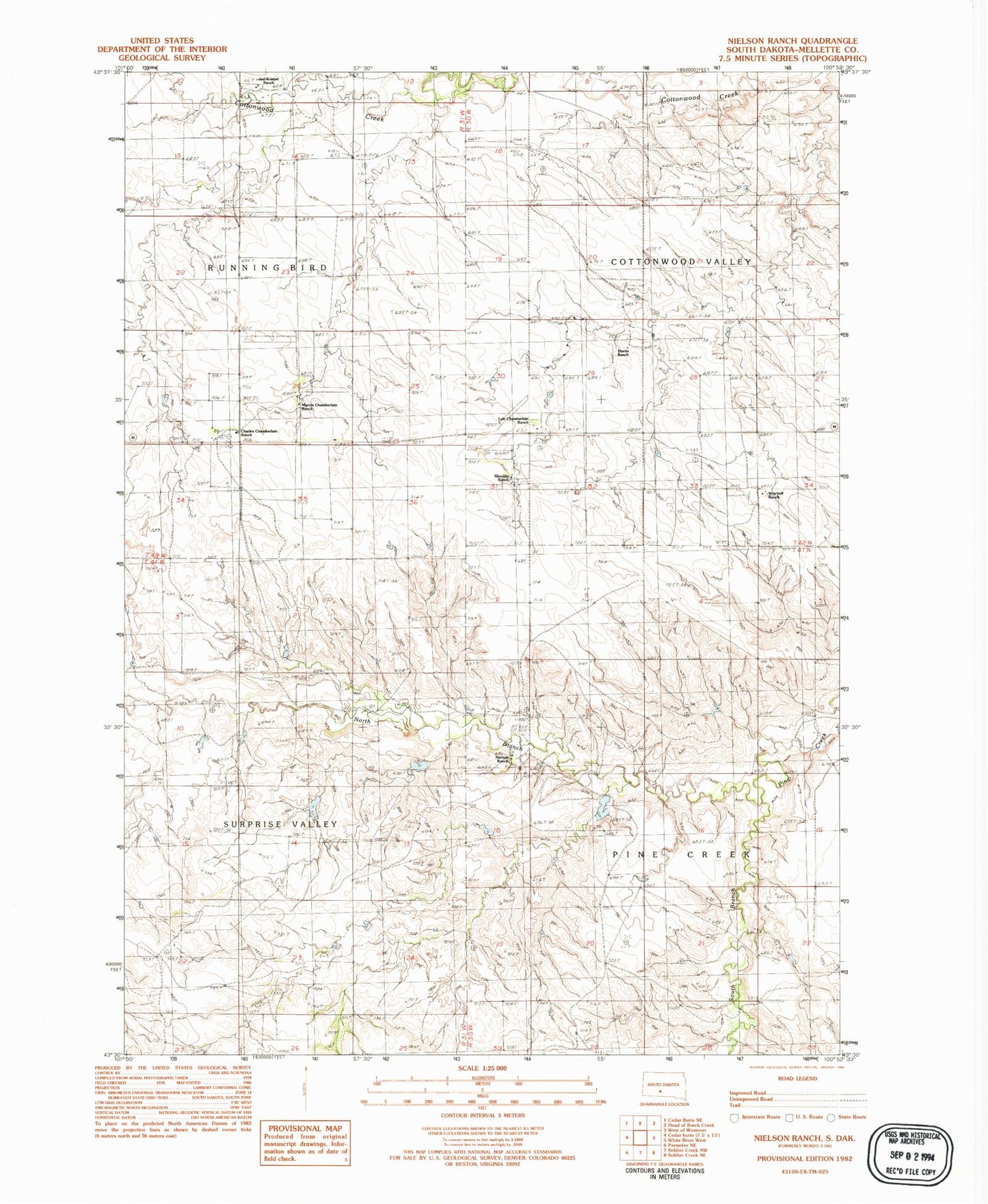
Classic USGS Nielson Ranch South Dakota 7.5'x7.5' Topo Map
Couldn't load pickup availability
Historical USGS topographic quad map of Nielson Ranch in the state of South Dakota. Map scale may vary for some years, but is generally around 1:24,000. Print size is approximately 24" x 27"
This quadrangle is in the following counties: Mellette.
The map contains contour lines, roads, rivers, towns, and lakes. Printed on high-quality waterproof paper with UV fade-resistant inks, and shipped rolled.
Contains the following named places: Carr Number 1 Dam, Carr Number 2 Dam, Carr Number 4 Dam, Carr Number 5 Dam, Charles Chamberlain Ranch, Harris Ranch, Jarl Knispel Ranch, Jarl Oswarld Number 2 Dam, John Catron Junior Number 3 Dam, Lyle Chamberlain Ranch, Marvin Chamberlain Ranch, Nielson Ranch, North Branch Pine Creek, Shouldis Ranch, South Branch Pine Creek, Township of Cottonwood Valley, Township of Pine Creek, Winchell Ranch