
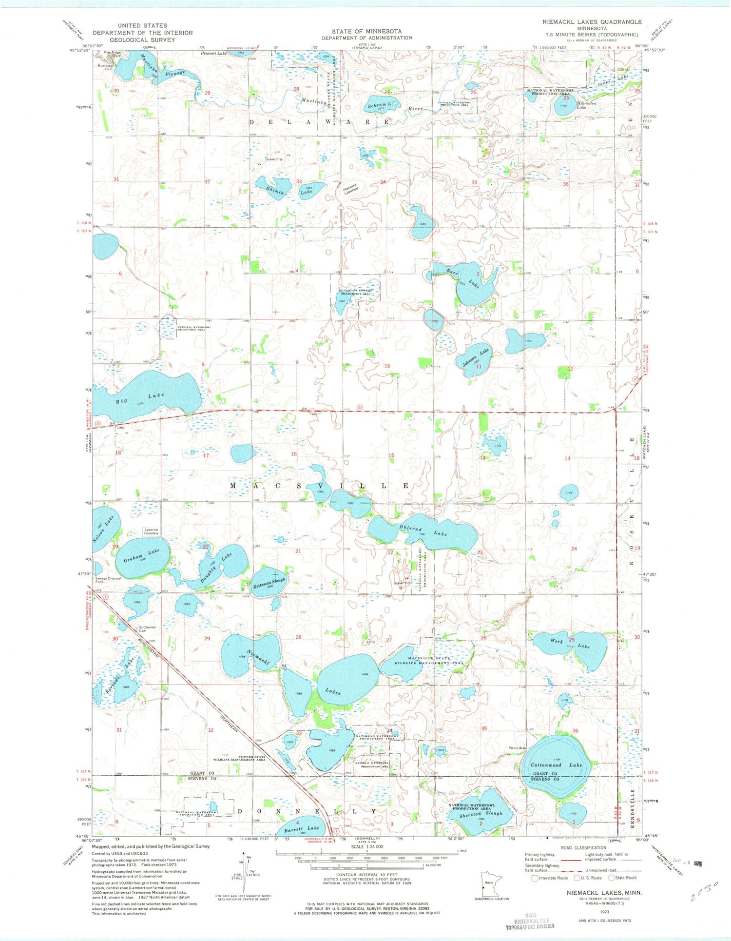
MyTopo
Classic USGS Niemackl Lakes Minnesota 7.5'x7.5' Topo Map
Couldn't load pickup availability
Historical USGS topographic quad map of Niemackl Lakes in the state of Minnesota. Map scale may vary for some years, but is generally around 1:24,000. Print size is approximately 24" x 27"
This quadrangle is in the following counties: Grant, Stevens.
The map contains contour lines, roads, rivers, towns, and lakes. Printed on high-quality waterproof paper with UV fade-resistant inks, and shipped rolled.
Contains the following named places: Barrows Lake, Big Lake, Burr Lake, Cottonwood Lake, Doughty Lake, Graham Lake, Hazzard Lakebed, Helsene State Wildlife Management Area, Hibrooten Lake, Johnson Lake, Jones Lake, Keitzman Slough, Lakeside Cemetery, Macsville State Wildlife Management Area, Moose Island, Moose Island Post Office, Mustinka Dam, Mustinka Flowage, Mustinka River Dam, Mustinka River Reservoir, Nelson Lake, Niemackl Lake Park Campground, Niemackl Lakes, Ohlsrud Lake, Pine Ridge Park, Rhimey Lake, Saint Charles Cemetery, School Number 19, School Number 21, School Number 58, School Number 62, Schram Lake, Sherstad Slough, Towner State Wildlife Management Area, Township of Macsville, Werk Lake, Wilts State Wildlife Management Area


