MyTopo
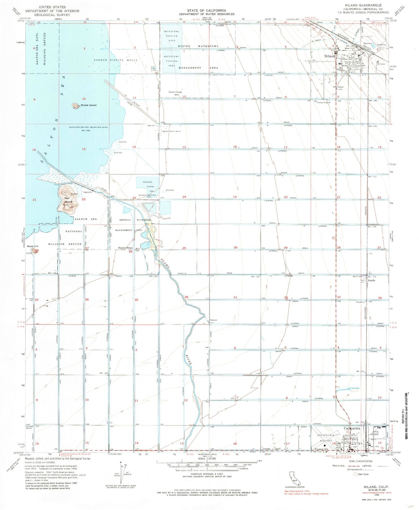
Classic USGS Niland California 7.5'x7.5' Topo Map
Couldn't load pickup availability
Historical USGS topographic quad map of Niland in the state of California. Map scale may vary for some years, but is generally around 1:24,000. Print size is approximately 24" x 27"
This quadrangle is in the following counties: Imperial.
The map contains contour lines, roads, rivers, towns, and lakes. Printed on high-quality waterproof paper with UV fade-resistant inks, and shipped rolled.
Contains the following named places: Alamo River, Calipatria, Calipatria Branch Imperial County Free Library, Calipatria City Hall, Calipatria Fire Department, Calipatria High School, Calipatria Park, Calipatria Police Department, Calipatria Post Office, Calipatria-Westmorland Division, Cliff Hatfield Memorial Airport, D Lateral West, Estelle, F Drain, Fremont Primary School, G Lateral Two, Grace Smith Elementary School, Hazard Headquarters, Imperial County Sheriff's Office Niland, Imperial Waterfowl Management Area, Mullet Island, Niland, Niland Branch Imperial County Free Library, Niland Census Designated Place, Niland Fire District Station 1 Headquarters, Niland Park, Niland Post Office, North End School, P Drain, Pumice Drain, Q Drain, Q Lateral, R Drain, R Lateral, Red Hill Marina, Red Island, Rock Hill, S Drain, S Lateral, Southend Sportsman Club, T Drain, U Drain, U Lateral, Vail Four Drain, Vail Four-A Drain, Vail Lateral, Vail Lateral Four, Vail Lateral Four-A, Vail Lateral Three, Vail Lateral Three-A, Vail Lateral Two, Vail Lateral Two-A, Vail Three Drain, Vail Three-A Drain, Vail Two Drain, Vail Two-A Drain, X Drain, X Lateral, ZIP Code: 92233