
MyTopo
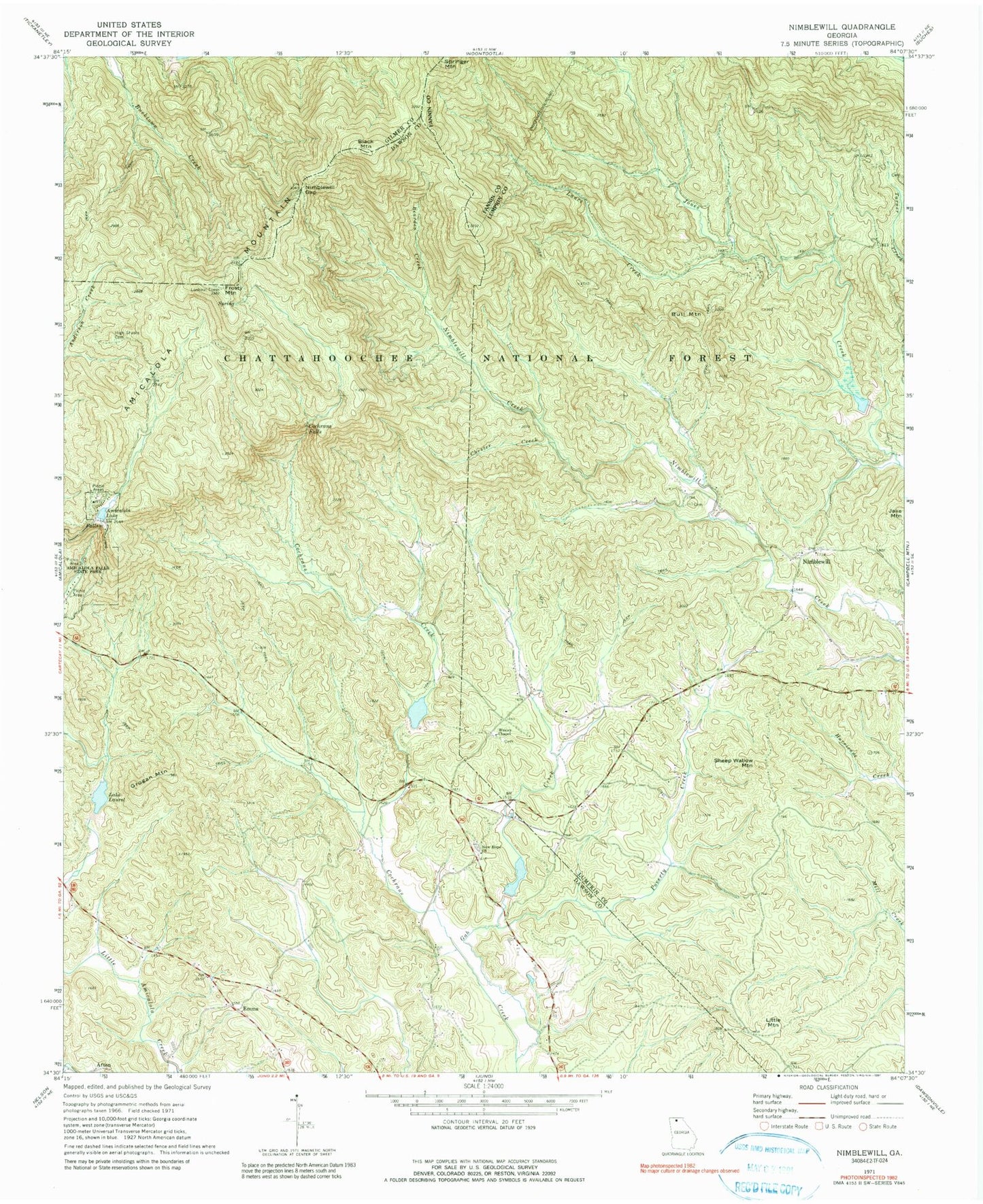
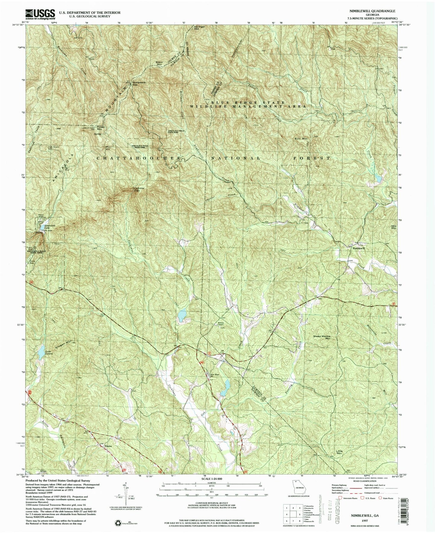
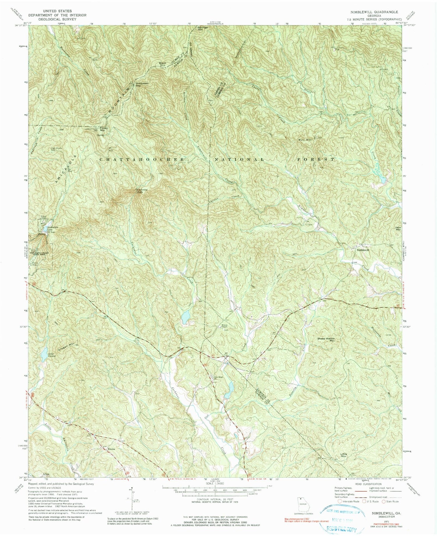
USGS Classic Nimblewill Georgia 7.5'x7.5' Topo Map
Couldn't load pickup availability
Historical USGS topographic quad map of Nimblewill in the state of Georgia. Scale: 1:24000. Print size: 24" x 27"
This quadrangle is in the following counties: Dawson, Fannin, Gilmer, Lumpkin.
The map contains contour lines, roads, rivers, towns, lakes, and grids including latitude / longitude and UTM / MGRS. Printed on high-quality waterproof paper with UV fade-resistant inks.
Contains the following named places: Amicalola Falls State Park, Amicalola Lake, Beaverdam Creek, Chester Creek, Frosty Mountain, Gab Creek, High Shoals Cemetery, Lance Creek, Lake Laurel, New Hope Church, Nimblewill Gap, Poverty Creek, Wesley Chapel, Amicalola Falls, Afton, Black Mountain, Bull Mountain, Emma, Grogan Mountain, Little Mountain, Nimblewill, Sheep Wallow Mountain, Amicalola Lake Dam, Amicalola Creek Watershed Dam Number Three, Rome Kraft Company Lake, Amicalola Creek Watershed Dam Number Four, Wehunt Lake, Etowah Number 32 Lake Dam, Etowah Number 32 Lake, Etowah Number 32 Dam, Etowah 32 Lake, Amicalola Creek Watershed Dam Number Two, Spriggs Summerour Cemetery, Amicalola Mountain, Cochrans Falls, Nimblewill Church, Wier (historical), Dawson County Fire Department Station 4, New Hope Baptist Church Cemetery