MyTopo
Classic USGS Nimrod Dam Arkansas 7.5'x7.5' Topo Map
Couldn't load pickup availability
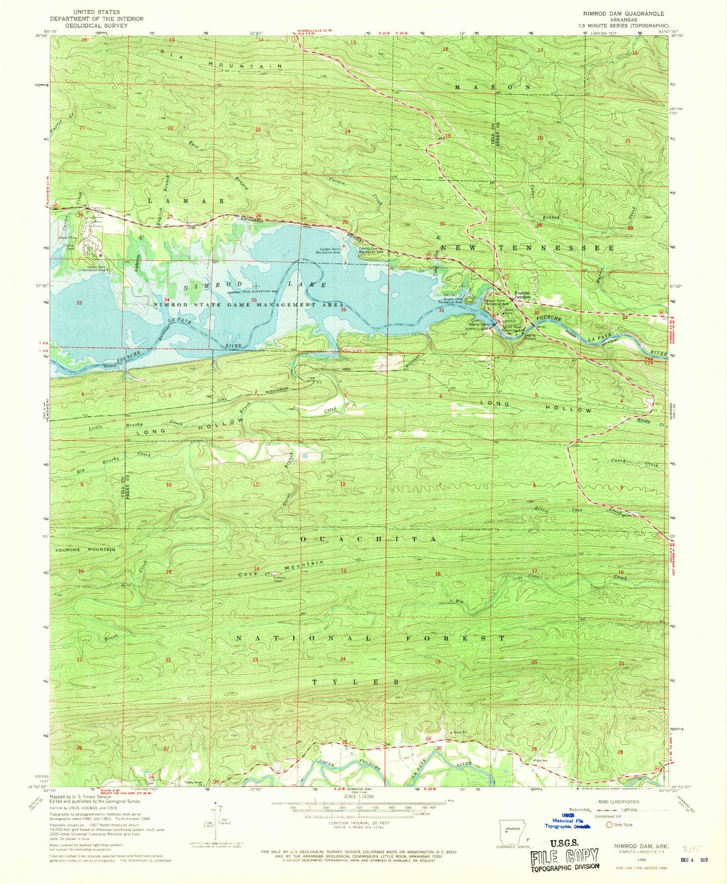
Historical USGS topographic quad map of Nimrod Dam in the state of Arkansas. Map scale may vary for some years, but is generally around 1:24,000. Print size is approximately 24" x 27"
This quadrangle is in the following counties: Perry, Yell.
The map contains contour lines, roads, rivers, towns, and lakes. Printed on high-quality waterproof paper with UV fade-resistant inks, and shipped rolled.
Contains the following named places: Anderson Branch, Ark School, Bales Ford, Big Brushy Creek, Brush Creek, Carden Creek, Carden Point Public Use Area, Carter Cemetery, Carter Cove Public Use Area, Carter Creek, Carters Chapel, Cedar Branch, Cedar Gap Branch, Chinquapin Mountain, County Line Recreation Area, Cove Mountain, Dawson School, Dry Fork, Earl Branch, English Branch, Fourche Junction, Guest Branch, Little Brushy Creek, New Mount Everett Church, Nimrod Dam, Nimrod Lake, Nimrod State Game Management Area, Ola Mountain, Project Point Recreation Area, Quarry Cove Recreation Area, River Road Recreation Area, The Narrows, Township of Dawson, Township of Howell, Township of McCool, Valley Home Church, Westlake School