MyTopo
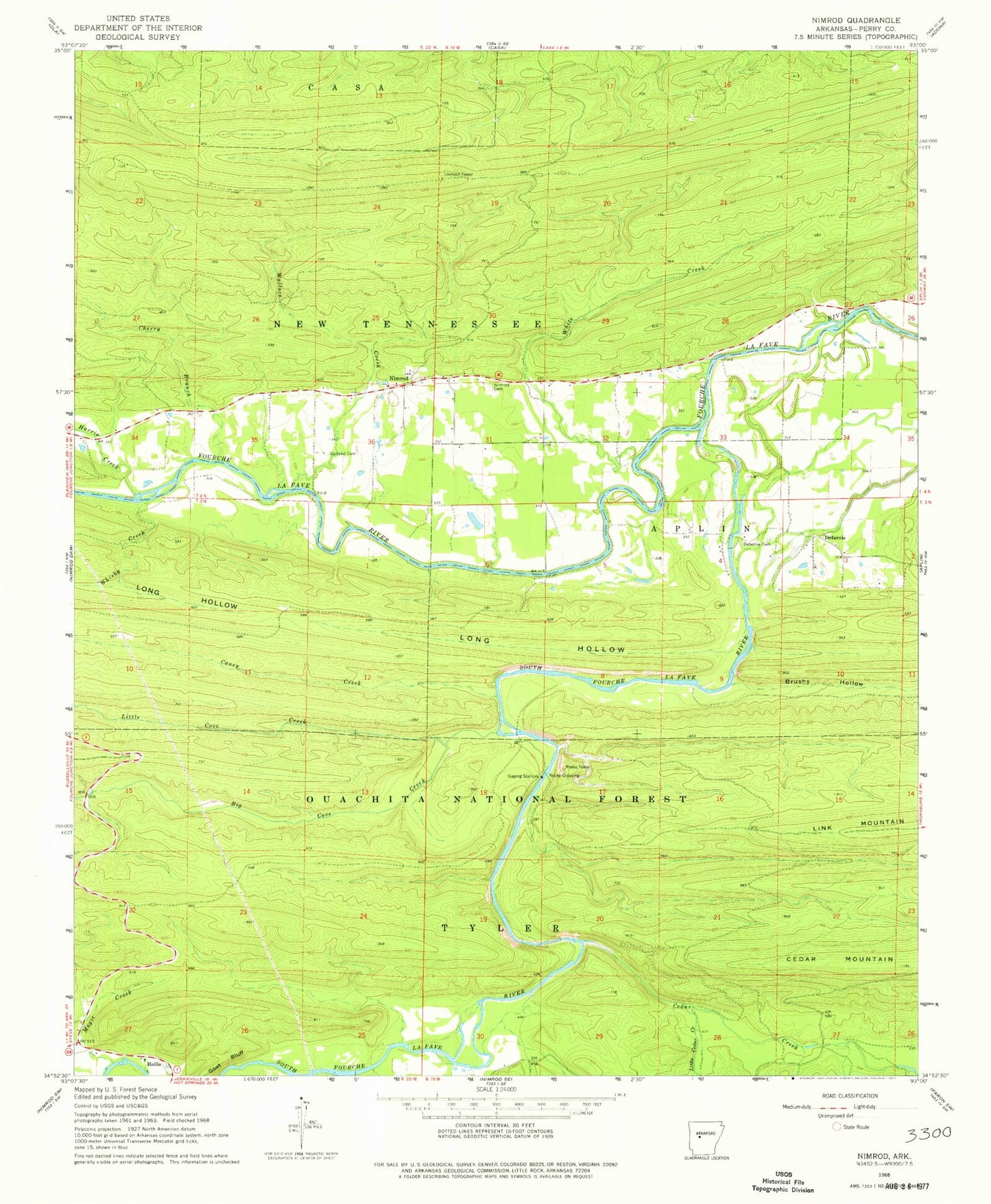
Classic USGS Nimrod Arkansas 7.5'x7.5' Topo Map
Couldn't load pickup availability
Historical USGS topographic quad map of Nimrod in the state of Arkansas. Map scale may vary for some years, but is generally around 1:24,000. Print size is approximately 24" x 27"
This quadrangle is in the following counties: Perry.
The map contains contour lines, roads, rivers, towns, and lakes. Printed on high-quality waterproof paper with UV fade-resistant inks, and shipped rolled.
Contains the following named places: Beene School, Big Cove Creek, Brushy Hollow, Caney Creek, Casa Mountain Lookout Tower, Cedar Creek, Cherry Branch, Cherry Ford, Cove Creek Lake, Deberrie, Deberrie Cemetery, Flynn Ford, Garland Cemetery, Gill Ford, Goat Bluff, Harris Creek, Little Cedar Creek, Little Cove Creek, Long Hollow, Magie Creek, Nimrod, Nimrod Baptist Church, Nimrod Cemetery, Nimrod Volunteer Fire Station, Rocky Crossing, Rocky Ford, South Fourche LaFave River, Spring Hollow, Township of New Tennessee, Township of Walnut Grove, Wallace Creek, Walnut Grove School, Whisky Creek, White Creek, Wright Branch