MyTopo
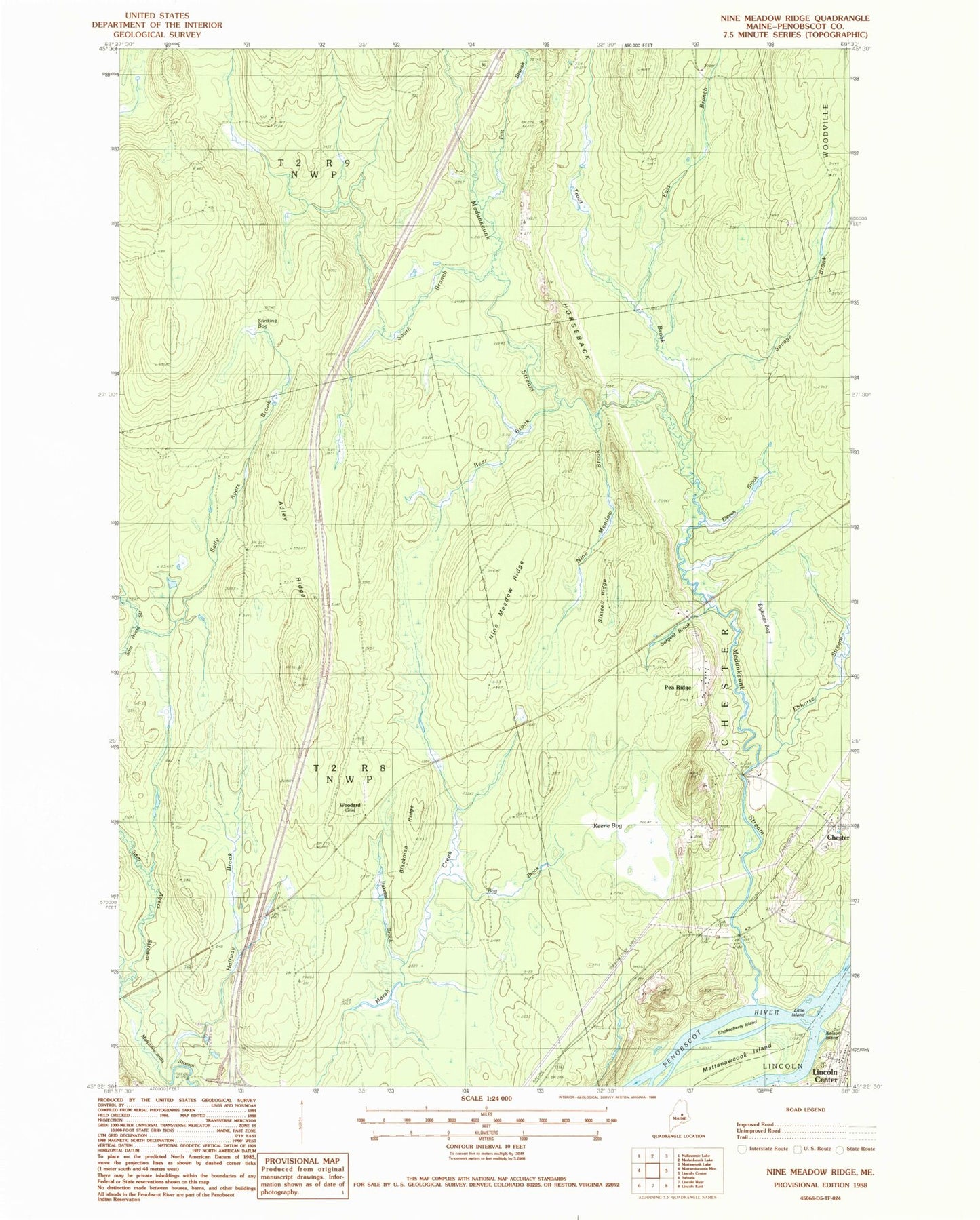
Classic USGS Nine Meadow Ridge Maine 7.5'x7.5' Topo Map
Couldn't load pickup availability
Historical USGS topographic quad map of Nine Meadow Ridge in the state of Maine. Map scale may vary for some years, but is generally around 1:24,000. Print size is approximately 24" x 27"
This quadrangle is in the following counties: Penobscot.
The map contains contour lines, roads, rivers, towns, and lakes. Printed on high-quality waterproof paper with UV fade-resistant inks, and shipped rolled.
Contains the following named places: Adley Ridge, Bear Brook, Blackman Ridge, Bog Brook, Bowerbank, Chokecherry Island, East Branch Medunkeunk Stream, East Branch Trout Brook, Ebhorse Stream, Eighteen Bog, Eleven Brook, Fairfield School, Halfway Brook, Horseback, Keene Bog, Little Island, Mattanawcook Island, Medunkeunk Stream, Nelson Island, Nine Meadow Brook, Nine Meadow Ridge, Pea Ridge, Penobscot Island Indian Reservation, Raketail Brook, Sally Ayers Brook, Sargent Brook, Savage Brook, Sixteen Ridge, South Branch Medunkeunk Stream, Stinking Bog, T2 R8 NWP, Town of Chester, Trout Brook, Woodard