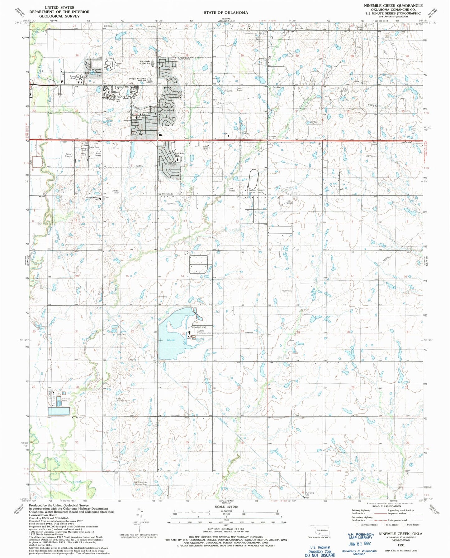
MyTopo
Classic USGS Ninemile Creek Oklahoma 7.5'x7.5' Topo Map
Couldn't load pickup availability
Historical USGS topographic quad map of Ninemile Creek in the state of Oklahoma. Map scale may vary for some years, but is generally around 1:24,000. Print size is approximately 24" x 27"
This quadrangle is in the following counties: Comanche.
The map contains contour lines, roads, rivers, towns, and lakes. Printed on high-quality waterproof paper with UV fade-resistant inks, and shipped rolled.
Contains the following named places: Aldersgate Church, Carriage Hills Church, Carriage Hills Elementary School, Church of Christ, Church of Christ-Sullivan Village, Cornerstone Fellowship Church, DJS Airport, East Church, Flower Mound Community Cemetery, Flower Mound Elementary School, Flower Mound Volunteer Fire Department, Hill Top Private Airport, Jehovahs Witnesses East Congregation, KCCU-FM (Lawton), KKRX-AM (Lawton), KKRX-FM (Lawton), KSWO-AM (Lawton), KTDA-TV (Lawton), KVRW-FM (Lawton), Lawton Correctional Facility, Lawton Downs, Lawton Fire Department Station 6, MacArthur High School, MacArthur Middle School, Ninemile Creek, Oknoname 031014 Dam, Oknoname 031014 Reservoir, Oknoname 031033 Dam, Oknoname 031033 Reservoir, Oknoname 031053 Dam, Oknoname 031053 Reservoir, Oknoname 031054 Dam, Oknoname 031054 Reservoir, Oknoname 031055 Dam, Oknoname 031055 Reservoir, Oknoname 031058 Dam, Oknoname 031058 Reservoir, Oknoname 031059 Dam, Oknoname 031059 Reservoir, Park Lane Elementary School, R and D Aviation Landing Strip, Skyline Missionary Baptist Church, Southeast Comanche Division, Sullivan Village Elementary School, Township of Lincoln, Trinity Assembly of God Church, ZIP Code: 73501