MyTopo
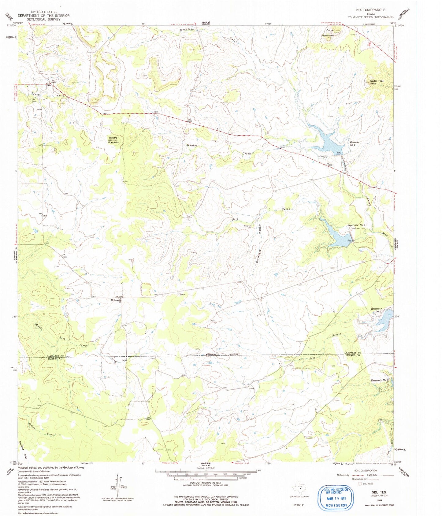
Classic USGS Nix Texas 7.5'x7.5' Topo Map
Couldn't load pickup availability
Historical USGS topographic quad map of Nix in the state of Texas. Map scale may vary for some years, but is generally around 1:24,000. Print size is approximately 24" x 27"
This quadrangle is in the following counties: Burnet, Lampasas.
The map contains contour lines, roads, rivers, towns, and lakes. Printed on high-quality waterproof paper with UV fade-resistant inks, and shipped rolled.
Contains the following named places: Carter Mountains, Cedar Top Peak, Donalson Creek, Graveyard Hollow, Hughes Creek, McCreaville Church, Nix, Nix Cemetery, Pecan Spring Branch, Pitt Creek, Pitt Creek Cemetery, Reservoir Number One, Reservoir Number Three, Reservoir Number Two, Soil Conservation Service Site 1 Dam, Soil Conservation Service Site 1 Reservoir, Soil Conservation Service Site 2 Dam, Soil Conservation Service Site 2 Reservoir, Soil Conservation Service Site 3 Dam, Waters Mountain, Yancey Creek Ranch Airport, ZIP Code: 76550