MyTopo
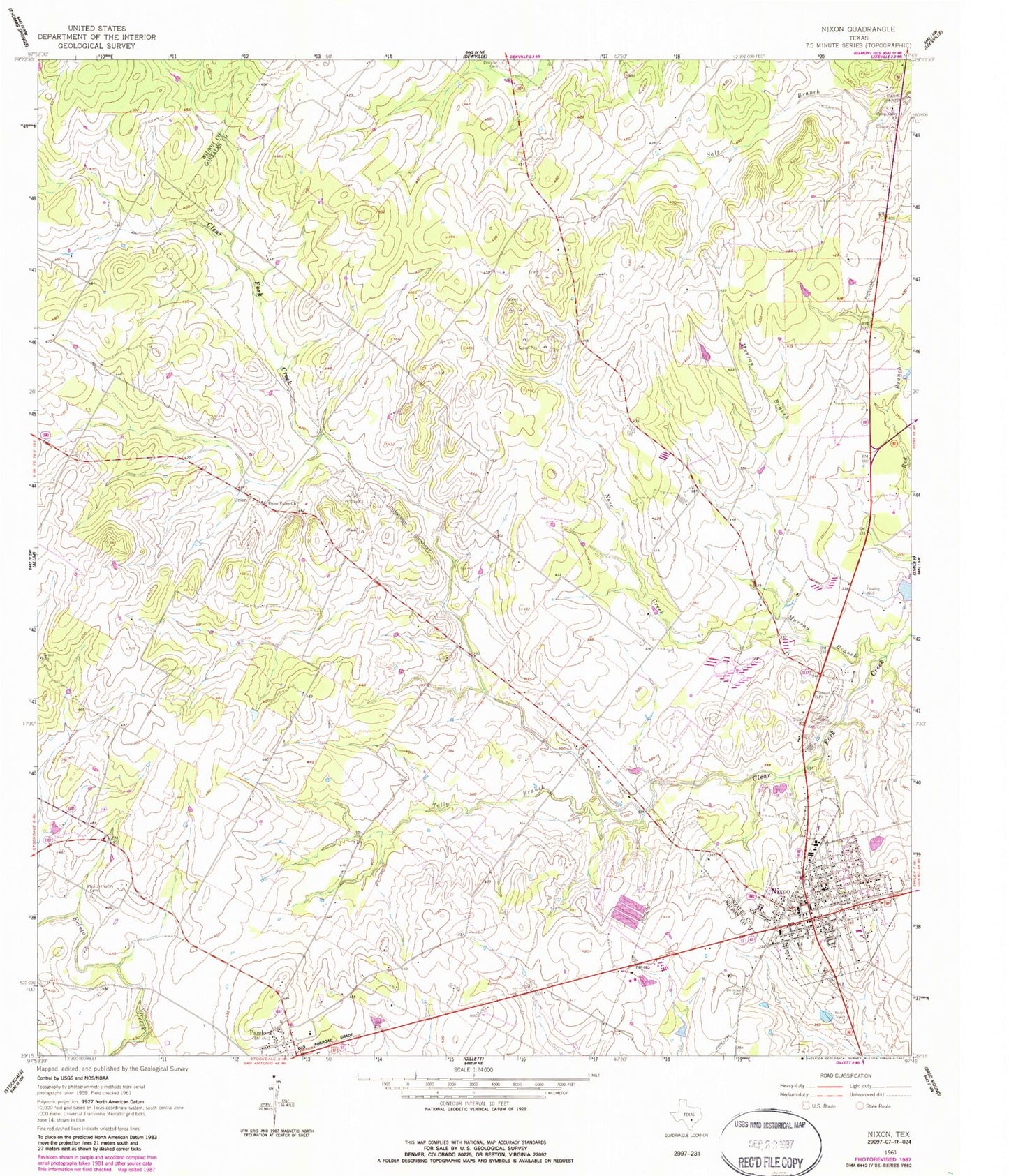
Classic USGS Nixon Texas 7.5'x7.5' Topo Map
Couldn't load pickup availability
Historical USGS topographic quad map of Nixon in the state of Texas. Map scale may vary for some years, but is generally around 1:24,000. Print size is approximately 24" x 27"
This quadrangle is in the following counties: Gonzales, Wilson.
The map contains contour lines, roads, rivers, towns, and lakes. Printed on high-quality waterproof paper with UV fade-resistant inks, and shipped rolled.
Contains the following named places: Camp Valley Church, City of Nixon, Demmer Cemetery, Dewville Cemetery, First Assembly of God Church, First Temple Assembly of God Church, Floresville Alternative Education Center, Gonzales County Emergency Medical Services / Rescue Station 2, Macedonia Baptist Church, Murray Branch, Nixon, Nixon - Smiley Elementary School, Nixon - Smiley High School, Nixon City Hall, Nixon Fire Department, Nixon Post Office, Nose Creek, Pandora, Pandora Post Office, Pleasant Valley Cemetery, Tally Branch, Union, Union Post Office, Union Valley Church, White Rancho Cemetery, ZIP Codes: 78140, 78143