MyTopo
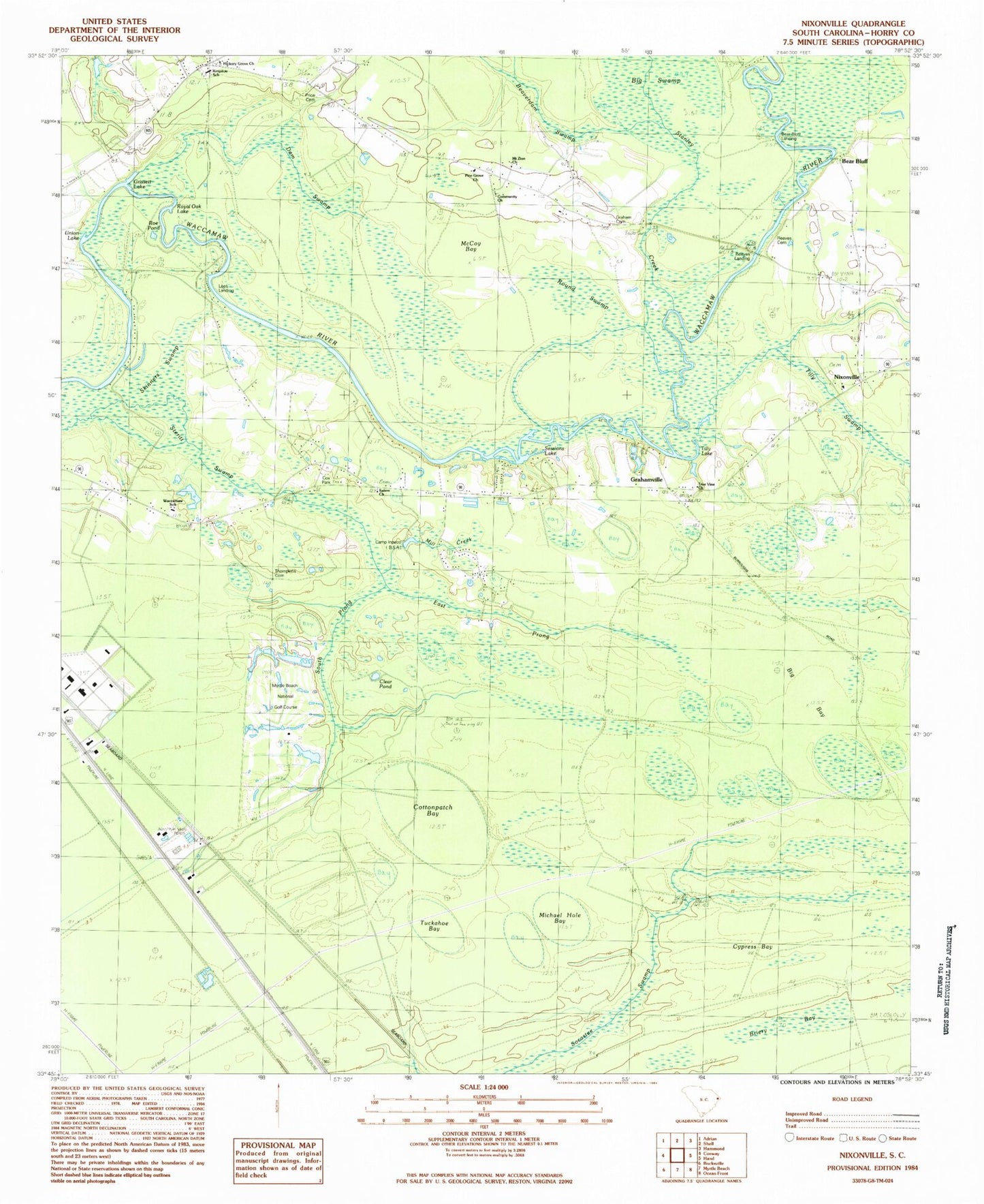
Classic USGS Nixonville South Carolina 7.5'x7.5' Topo Map
Couldn't load pickup availability
Historical USGS topographic quad map of Nixonville in the state of South Carolina. Typical map scale is 1:24,000, but may vary for certain years, if available. Print size: 24" x 27"
This quadrangle is in the following counties: Horry.
The map contains contour lines, roads, rivers, towns, and lakes. Printed on high-quality waterproof paper with UV fade-resistant inks, and shipped rolled.
Contains the following named places: Bear Bluff, Bear Bluff Lodge, Beaverdam Swamp, Big Bay, Big Swamp, Briery Bay, Clear Pond, Cottonpatch Bay, Cypress Bay, Dam Swamp, East Prong Steritt Swamp, Evans Lodge, Graham Cemetery, Grahamville, Grissett Lake, Harpers Lodge, Jones Big Swamp, Long Branch, McCoy Bay, Michael Hole Bay, Mill Creek, Murrells Lodge, Oak Grove School, Pine Tree Lodge, Roe Pond, Round Swamp, Royal Oak Lake, Salem School, Sessions Lake, Sessions Lodge, Skinners Swamp, South Prong Steritt Swamp, Stanley Creek, The Wild Horse, Tilly Lake, Timberdock Lodge, Tuckahoe Bay, Union Lake, Jaluco, Nixonville, South Carolina Noname 26037 D-3626 Dam, Myrtle Beach National Golf Number 10 Pond, Myrtle Beach National North Pond Dam D-3627, Myrtle Beach National North Pond, Camp Inpaco, Community Church, Cox Park, Fairtraid, Hardees Ferry (historical), Hickory Grove Church, Loblolly Swamp, Myrtle Beach National Golf Course, Myrtle Trace, Pine Grove Church, Reaves Cemetery, Salem Church, Thompkins Cemetery, Tilly Swamp Church (historical), True Vine Church, Vina, Lees Landing, Pine Grove School, Reaves Landing, Tilly Swamp, Conway East Division, Horry County Fire Department Station 12, Horry County Fire Department Carolina Forest Station 39, Horry County Fire Department Station 40, Horry County Fire Department Lees Landing, Carolina Forest Elementary School, Carolina Forest High School, Carolina Forest Middle School, Black Water Middle School, Horry County Education Center, Atlantic Center Industrial Park, Carolina Forest Post Office, Lighthouse Care Center of Conway Acute Care - Hospital, Carolina Bone and Joint Surgery Center, Meadowchase Farm, Celebration Presbyterian Church, Carolina Forest Census Designated Place