MyTopo
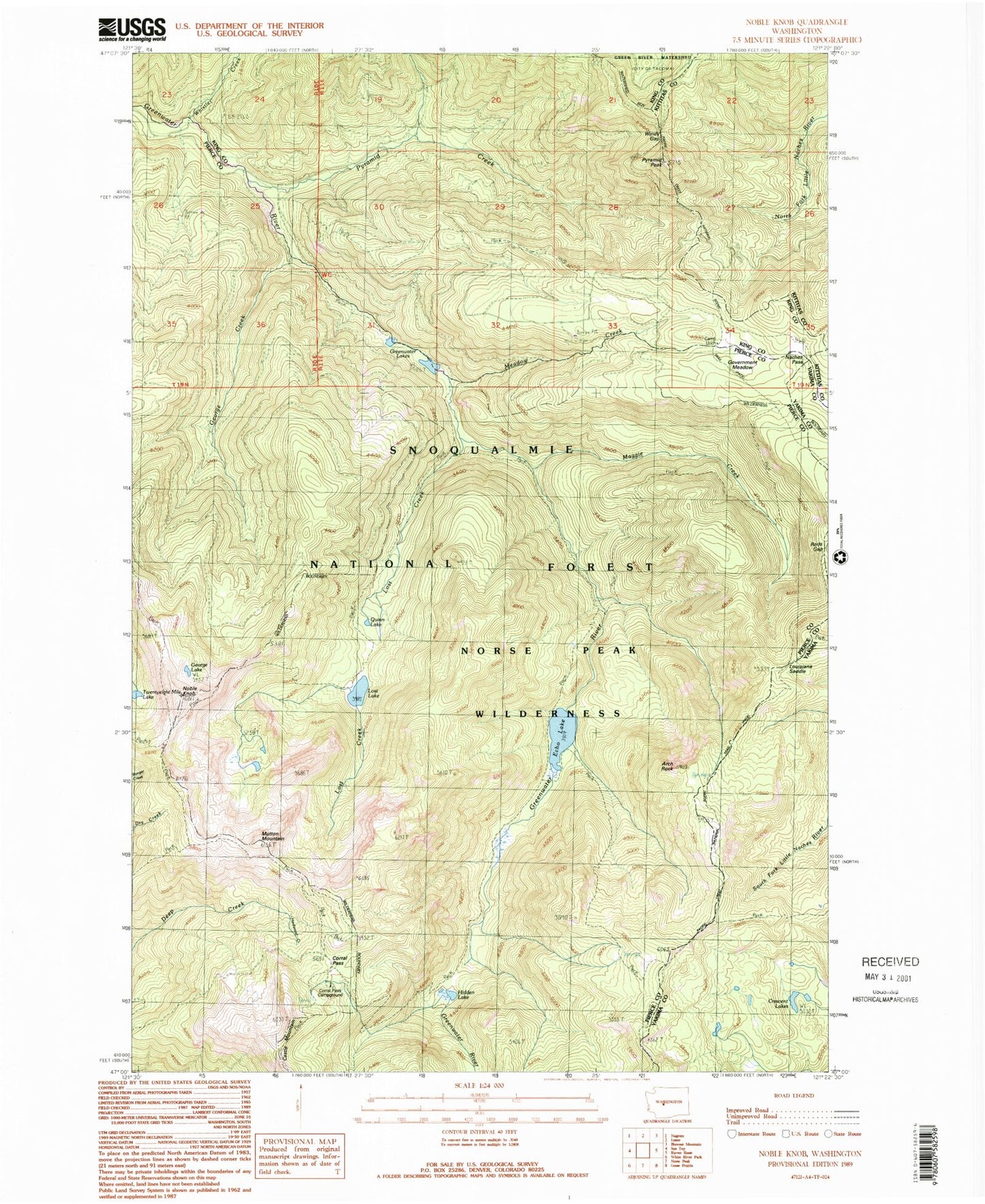
Classic USGS Noble Knob Washington 7.5'x7.5' Topo Map
Couldn't load pickup availability
Historical USGS topographic quad map of Noble Knob in the state of Washington. Typical map scale is 1:24,000, but may vary for certain years, if available. Print size: 24" x 27"
This quadrangle is in the following counties: King, Kittitas, Pierce, Yakima.
The map contains contour lines, roads, rivers, towns, and lakes. Printed on high-quality waterproof paper with UV fade-resistant inks, and shipped rolled.
Contains the following named places: Arch Rock, Arch Rock Shelter, Camp Urich, Corral Pass, Cougar Valley Trail, Crescent Lakes, Dalles Ridge Trail, Echo Lake, George Creek, George Lake, Government Meadow, Greenwater Lakes, Greenwater Trail, Hardwood Creek, Hidden Lake, Lost Creek, Lost Lake, Lost Lake Trail, Louisiana Saddle, Maggie Creek, Maggie Creek Trail, Meadow Creek, Mutton Mountain, Naches Pass, Noble Knob, Pyramid Creek, Pyramid Peak, Quinn Lake, Rods Gap, Whistler Creek, Windy Gap, Government Meadow Camp, Norse Peak Wilderness, Naches Pass-Greenwater Trail, Pyramid Peak Lookout, Last Crossing