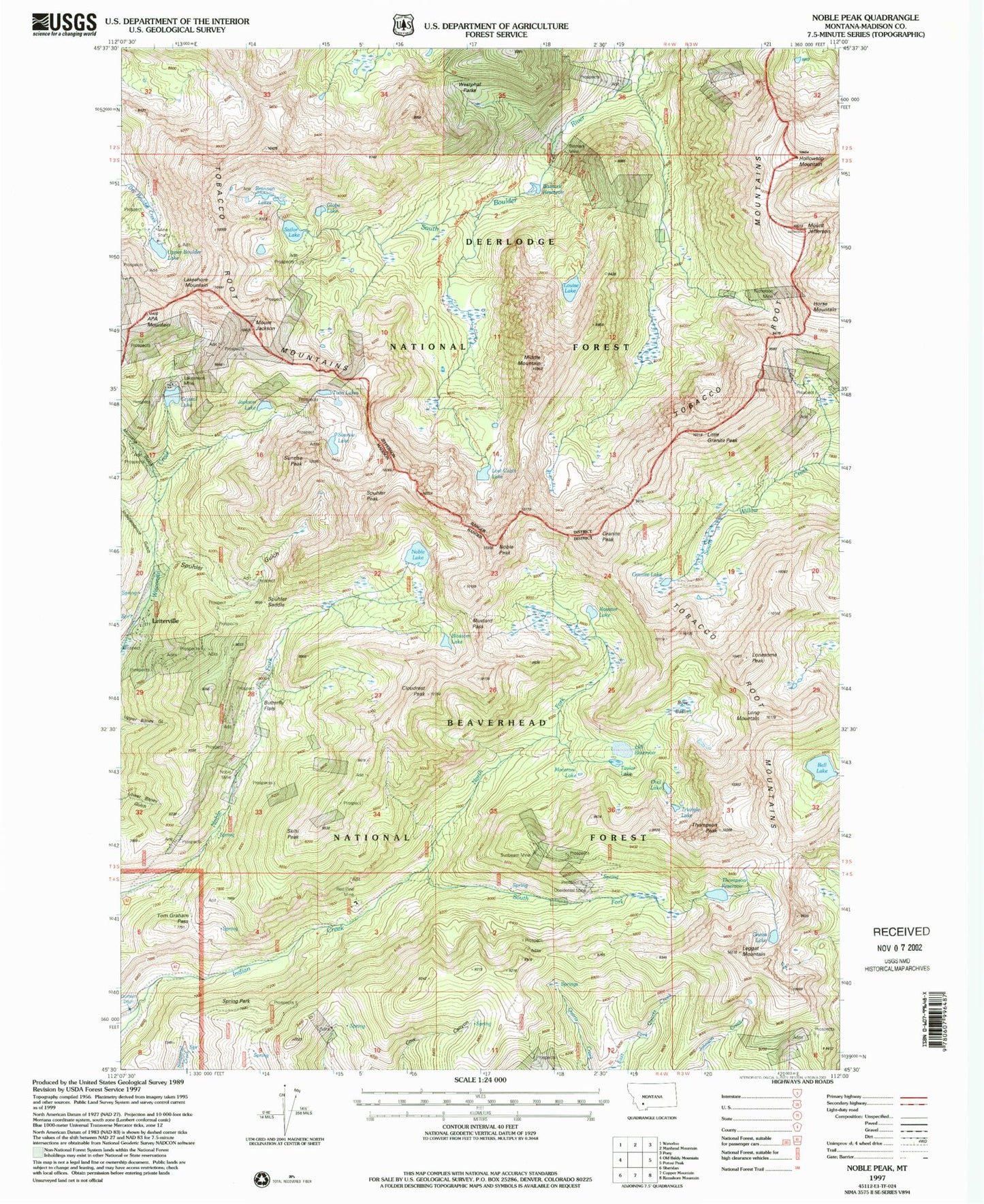
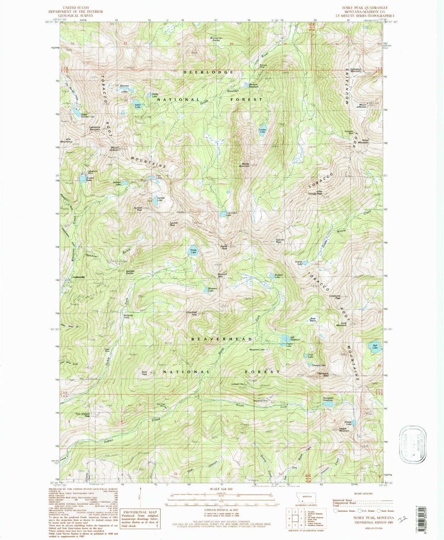
MyTopo
Classic USGS Noble Peak Montana 7.5'x7.5' Topo Map
Couldn't load pickup availability
Historical USGS topographic quad map of Noble Peak in the state of Montana. Typical map scale is 1:24,000, but may vary for certain years, if available. Print size: 24" x 27"
This quadrangle is in the following counties: Madison.
The map contains contour lines, roads, rivers, towns, and lakes. Printed on high-quality waterproof paper with UV fade-resistant inks, and shipped rolled.
Contains the following named places: A P A Mountain, Bell Lake, Bismark Mine, Bismark Reservoir, Blossom Lake, Bow Basin, Brannan Lakes, Buttertly Flats, Cloudrest Peak, Crystal Lake, Globe Lake, Gneiss Lake, Granite Lake, Granite Peak, Hill Reservoir, Mount Jefferson, Horse Mountain, Independence Gulch, Jackson Lake, Mount Jackson, Hollowtop Mountain, Lakeshore Mine, Lakeshore Mountain, Leggat Mountain, Leiterville, Little Granite Peak, Lonesome Peak, Long Mountain, Lost Cabin Lake, Louise Lake, Macaroni Lake, Middle Mountain, Montana Gulch, Mustard Pass, Nicholson Mine, Noble Lake, Noble Mine, Noble Peak, North Fork Indian Creek, Occidental Mine, Oval Lake, Red Pine Mine, Rossiter Lake, Sailor Lake, Skihi Peak, Snyders Mine, South Fork Indian Creek, Spring Park Flat, Spuhler Gulch, Spuhler Peak, Spuhler Saddle, Sunbean Mine, Sunrise Lake, Sunrise Peak, Thompson Peak, Thompson Reservoir, Tobacco Root Mountains, Tom Graham Pass, Triangle Lake, Twin Lakes, Upper Boulder Lake, Ziegler Reservoir, Spring Park, Louise Lake National Recreation Trail, Lost Cabin Lake Recreation Trail, Jackson Number 1 Dam, Jackson Lake, Sunrise Lake Dam, Noble Dam, Bell Lake Dam, Hill Reservoir Dam, Red Pine Mine, Nicholson Mine, Occidental Mine, Sunbeam Mine, Snyder Mine, Leiter Mine, Brannan Lake Mine, Spuhler Gulch Mine, Sunrise Lake Mine, South Fork Indian Creek Mine, Mount Jackson Mine, NE NW Section 36 Mine, SE NW Section 36 Mine, NW NE Section 9 Mine, SW NE Section 12 Mine, Sailor Lake Mine, Noble Mine, Sunnyside Mine, Upper Lakeshore Mine, Lakeshore Mine, Independence Gulch Mine, Helios Number 1/Big Tom Mine, Upper Boulder Lake Mine, Leggat Creek Mine, South Section 6 Mine, Nobleville (historical), Leiterville School (historical), Lakeshore (historical), Bismark (historical), Ferris Peak