MyTopo
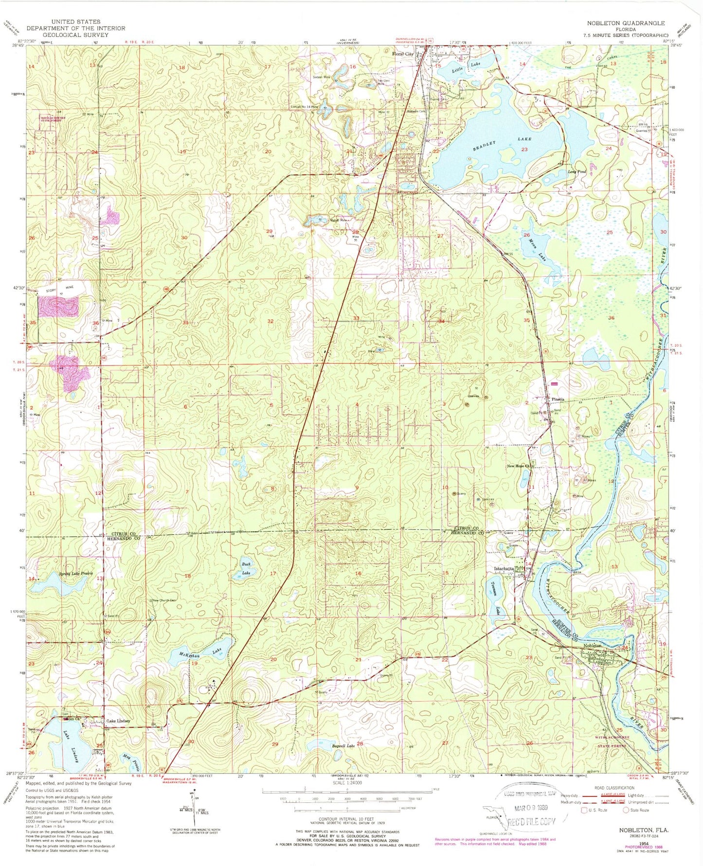
Classic USGS Nobleton Florida 7.5'x7.5' Topo Map
Couldn't load pickup availability
Historical USGS topographic quad map of Nobleton in the state of Florida. Typical map scale is 1:24,000, but may vary for certain years, if available. Print size: 24" x 27"
This quadrangle is in the following counties: Citrus, Hernando, Sumter.
The map contains contour lines, roads, rivers, towns, and lakes. Printed on high-quality waterproof paper with UV fade-resistant inks, and shipped rolled.
Contains the following named places: Lake Annie, Bagwell Lake, Bradley Lake, Buck Lake, Eden Baptist Church, Floral City, Frazier Cemetery, Istachatta, Lake Lindsey, Little Lake, Loncall Number 14 Mine, Long Pond, McKethan Lake, Moon Lake, Mutual Mine, Nelson Lake, New Church Cemetery, New Hope United Methodist Church, Nobleton, Sixteen Mine, Spring Lake Prairie, Ten Cent Mine, Lake Townsend, Williams Cemetery, Pineola, Eckerd Wilderness Educational System, New Testament Christian School, Jumeau, Hooper, Eden Christian School, Lake Lindsey, Floral City Post Office (historical), Floral City Fire Department, Floral City Public Library, Nobleton Community Church, Tri-County Fire Rescue, Nobleton Post Office, Withlacoochee Riverside Community Park, Istachatta Baptist Church, Withlacoochee Bicentennial Hall Library, Church of Christ, Floral City Electric Substation 9140, Citrus County Fire Rescue Station 24, Eden Christian School and Day Care, Lake Lindsey Cemetery, Lake Lindsey United Methodist Church, Hernando County Fire Rescue Station 9, Citrus County Fire Rescue Department Station 19, Floral City Census Designated Place, Istachatta Census Designated Place, Lake Lindsey Census Designated Place, Nobleton Census Designated Place, Duval Mobile Home Park, Istachatta Post Office