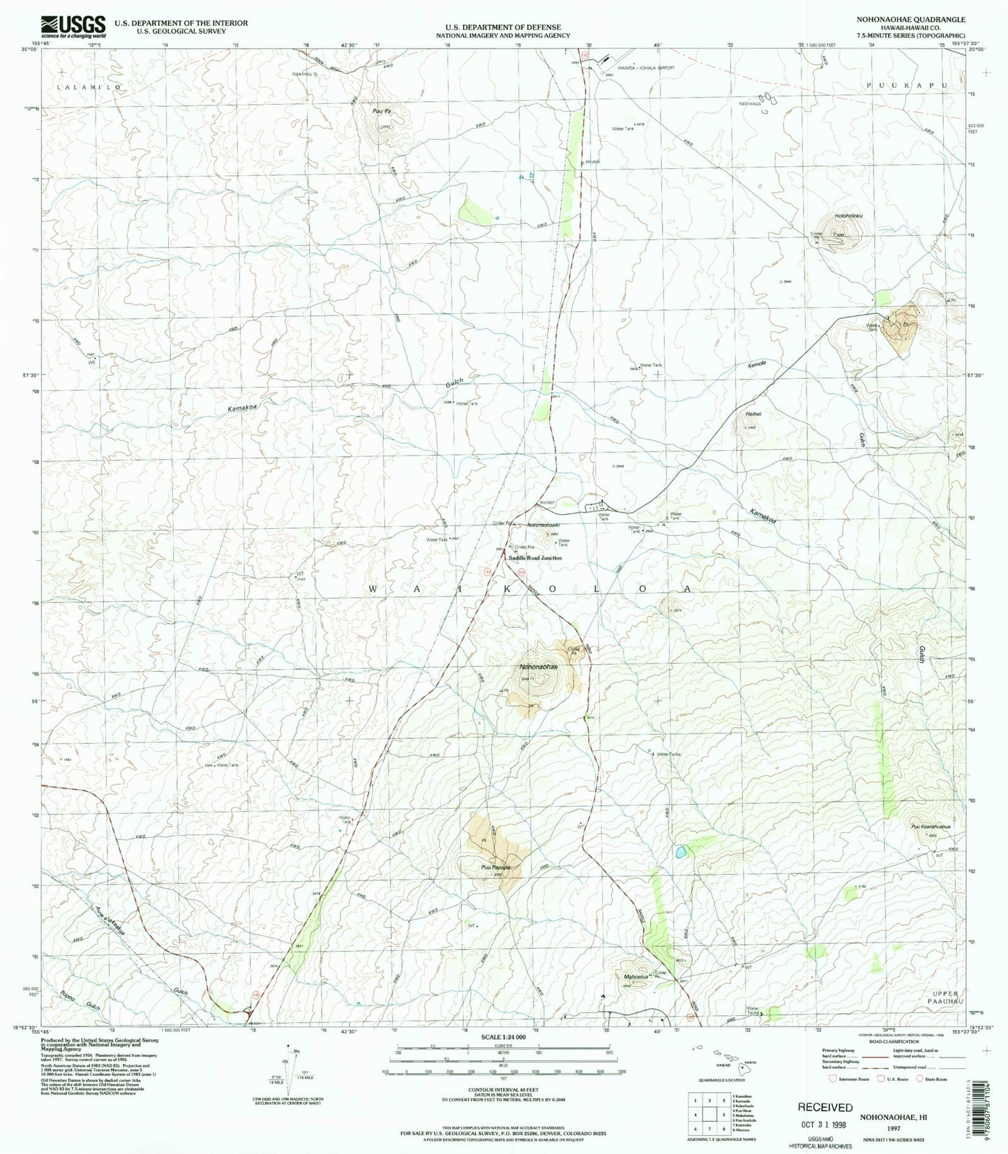
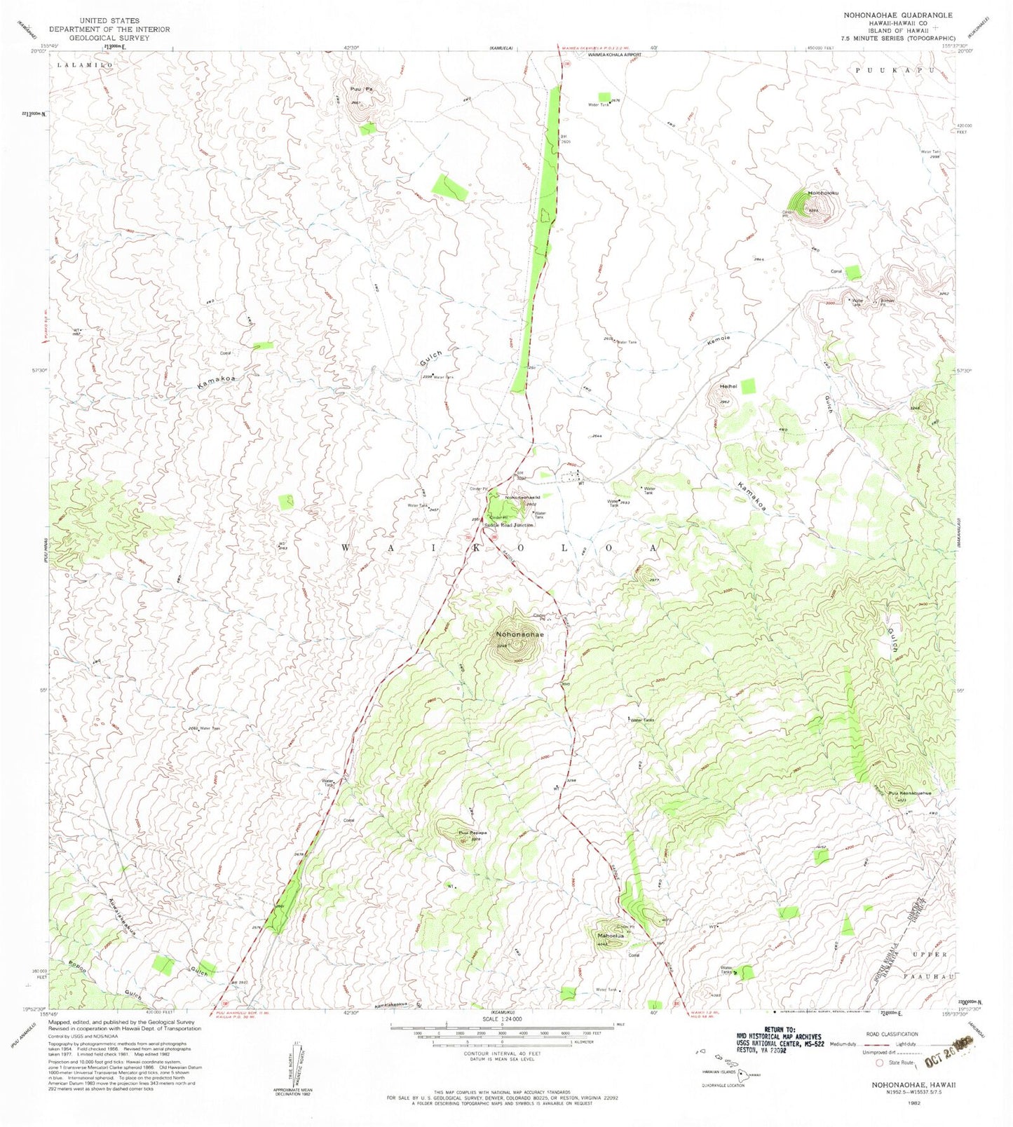
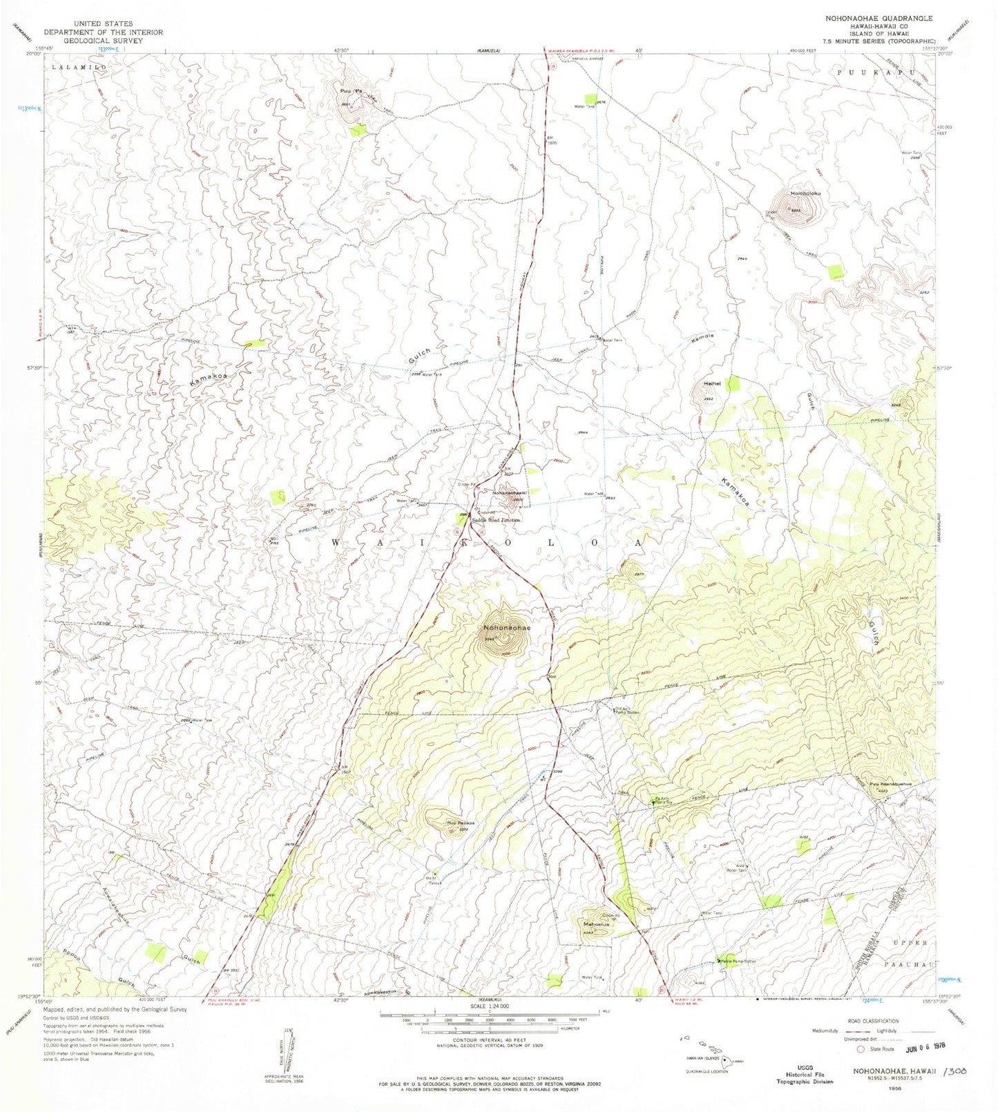
MyTopo
Classic USGS Nohonaohae Hawaii 7.5'x7.5' Topo Map
Regular price
$16.95
Regular price
Sale price
$16.95
Unit price
per
Couldn't load pickup availability
Historical USGS topographic quad map of Nohonaohae in the state of Hawaii. Map scale may vary for some years, but is generally around 1:24,000. Print size is approximately 24" x 27"
This quadrangle is in the following counties: Hawaii.
The map contains contour lines, roads, rivers, towns, and lakes. Printed on high-quality waterproof paper with UV fade-resistant inks, and shipped rolled.
Contains the following named places: Heihei, Holoholoku, Kemole Gulch, Mahoelua, Nohonaohae, Nohonaohaeiki, Old Aalii Pump Station, Pa Aalii Pump Station, Pakila Pump Station, Puu Keanahuehue, Puu Papapa, Pu'uhuluhulu, Pu'upa, Saddle Road Junction, South Kohala Division, Waikoloa, Waimea-Kohala Airport