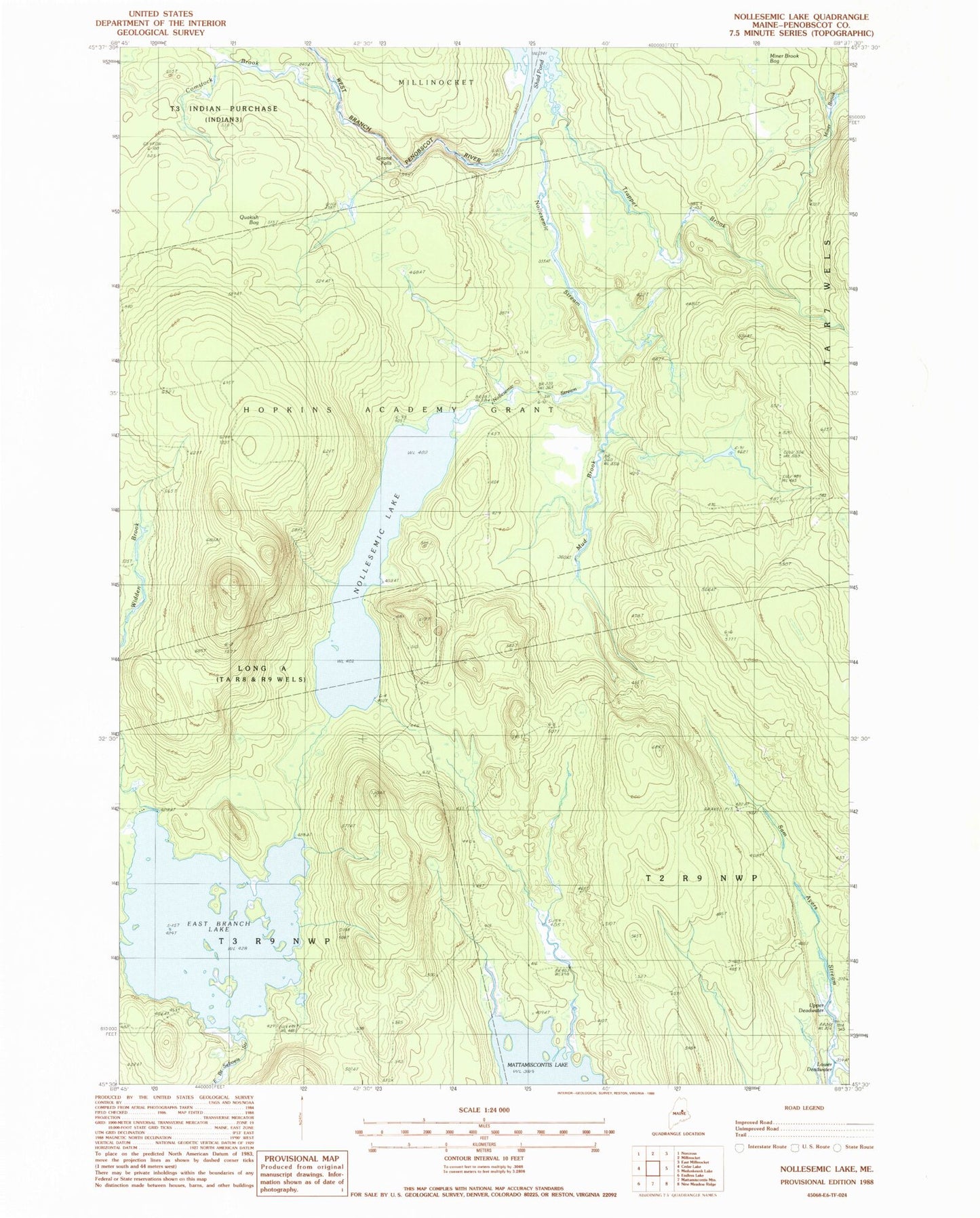
MyTopo
Classic USGS Nollesemic Lake Maine 7.5'x7.5' Topo Map
Couldn't load pickup availability
Historical USGS topographic quad map of Nollesemic Lake in the state of Maine. Map scale may vary for some years, but is generally around 1:24,000. Print size is approximately 24" x 27"
This quadrangle is in the following counties: Penobscot.
The map contains contour lines, roads, rivers, towns, and lakes. Printed on high-quality waterproof paper with UV fade-resistant inks, and shipped rolled.
Contains the following named places: Comstock Brook, East Branch Lake, Grand Falls, Hopkins Academy Grant - East, Hopkins Academy Grant - West, Hopkins Academy Grant Township, Lower Deadwater, Miner Brook Bog, Mud Brook, Nollesemic Lake, Nollesemic Stream, Quakish Bog, Shad Pond, Trapper Brook, Upper Deadwater, Widden Brook