MyTopo
Classic USGS Non Oklahoma 7.5'x7.5' Topo Map
Couldn't load pickup availability
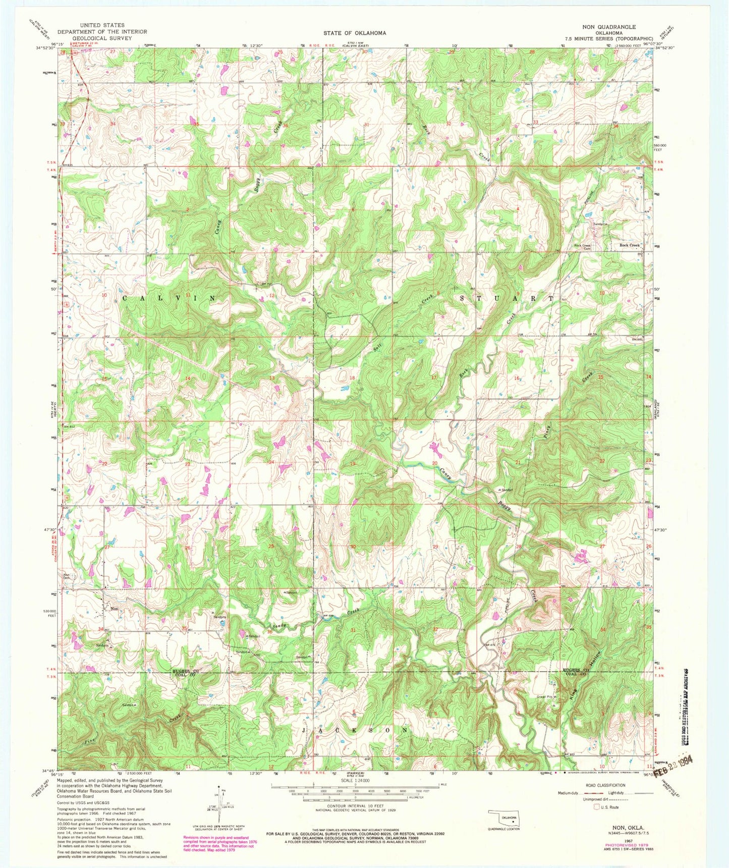
Historical USGS topographic quad map of Non in the state of Oklahoma. Map scale may vary for some years, but is generally around 1:24,000. Print size is approximately 24" x 27"
This quadrangle is in the following counties: Coal, Hughes.
The map contains contour lines, roads, rivers, towns, and lakes. Printed on high-quality waterproof paper with UV fade-resistant inks, and shipped rolled.
Contains the following named places: Christopher M Rippee Memorial Airport, County District 12, Elmo Tipton Dam, Elmo Tipton Reservoir, King Hollow, Non, Non Cemetery, Non Fire Department, Oknoname 063005 Dam, Oknoname 063005 Reservoir, Oknoname 063006 Dam, Oknoname 063006 Reservoir, Oknoname 063007 Dam, Oknoname 063007 Reservoir, Oknoname 121018 Dam, Oknoname 121018 Reservoir, Piney Creek, Rock Creek, Rock Creek Cemetery, Salt Creek, Sandy Creek, Upper Muddy Boggy Creek Site Number 25 Dam, Upper Muddy Boggy Site Number 24 Dam, Upper Muddy Boggy Site Number 24 Reservoir, Upper Muddy Boggy Site Number 25 Reservoir