MyTopo
Classic USGS Noonan North Dakota 7.5'x7.5' Topo Map
Couldn't load pickup availability
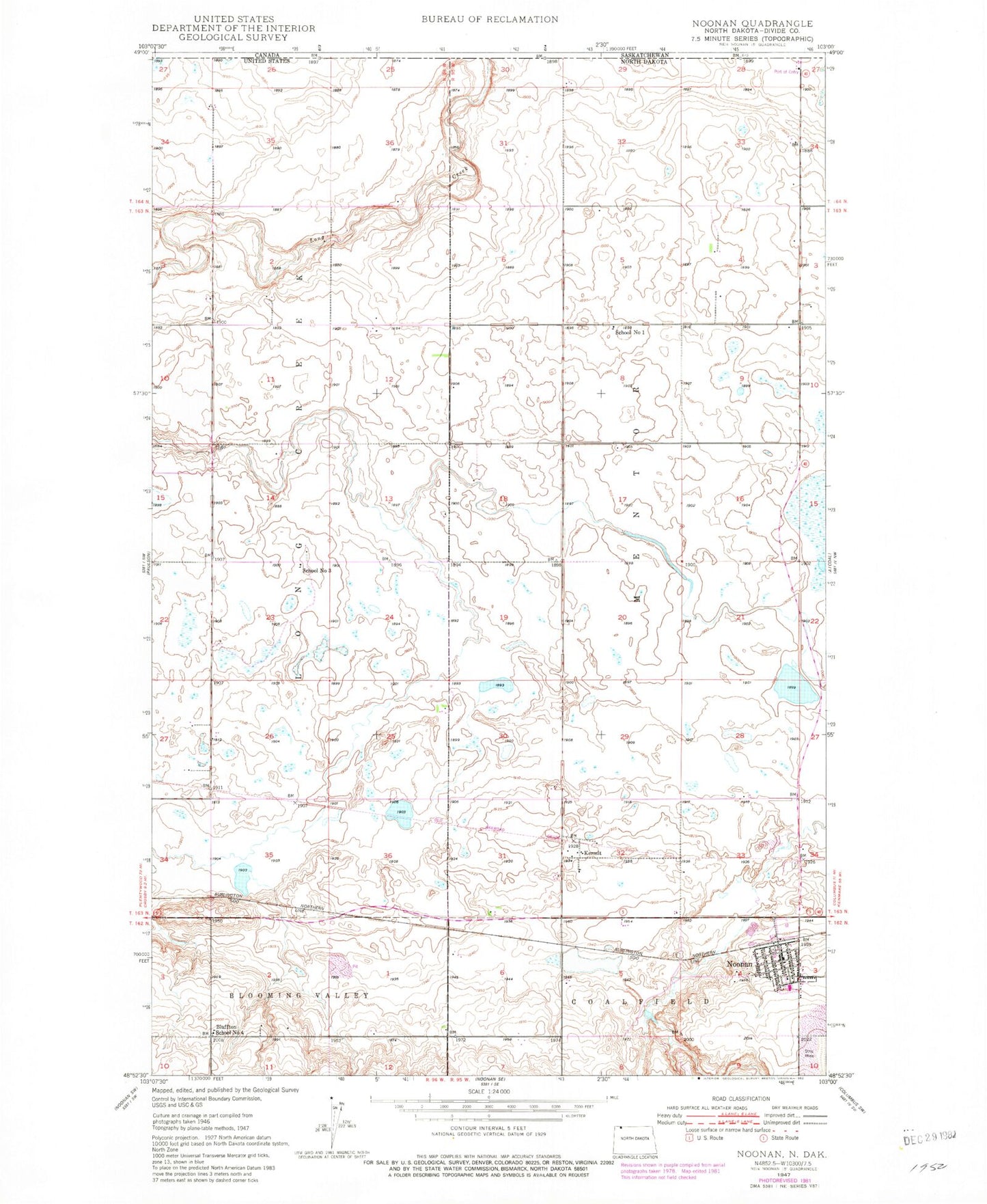
Historical USGS topographic quad map of Noonan in the state of North Dakota. Map scale may vary for some years, but is generally around 1:24,000. Print size is approximately 24" x 27"
This quadrangle is in the following counties: Divide.
The map contains contour lines, roads, rivers, towns, and lakes. Printed on high-quality waterproof paper with UV fade-resistant inks, and shipped rolled.
Contains the following named places: Bluffton School Number 4, Border International Airport, Brown School Number 4, City of Noonan, Kermit, Long Creek, Long Creek School, Noonan, Noonan City Hall, Noonan Community Center, Noonan Fire Department, Noonan Post Office, Saint Lukes Cemetery, School Number 1, School Number 3, Township of Mentor, Wilson Cemetery