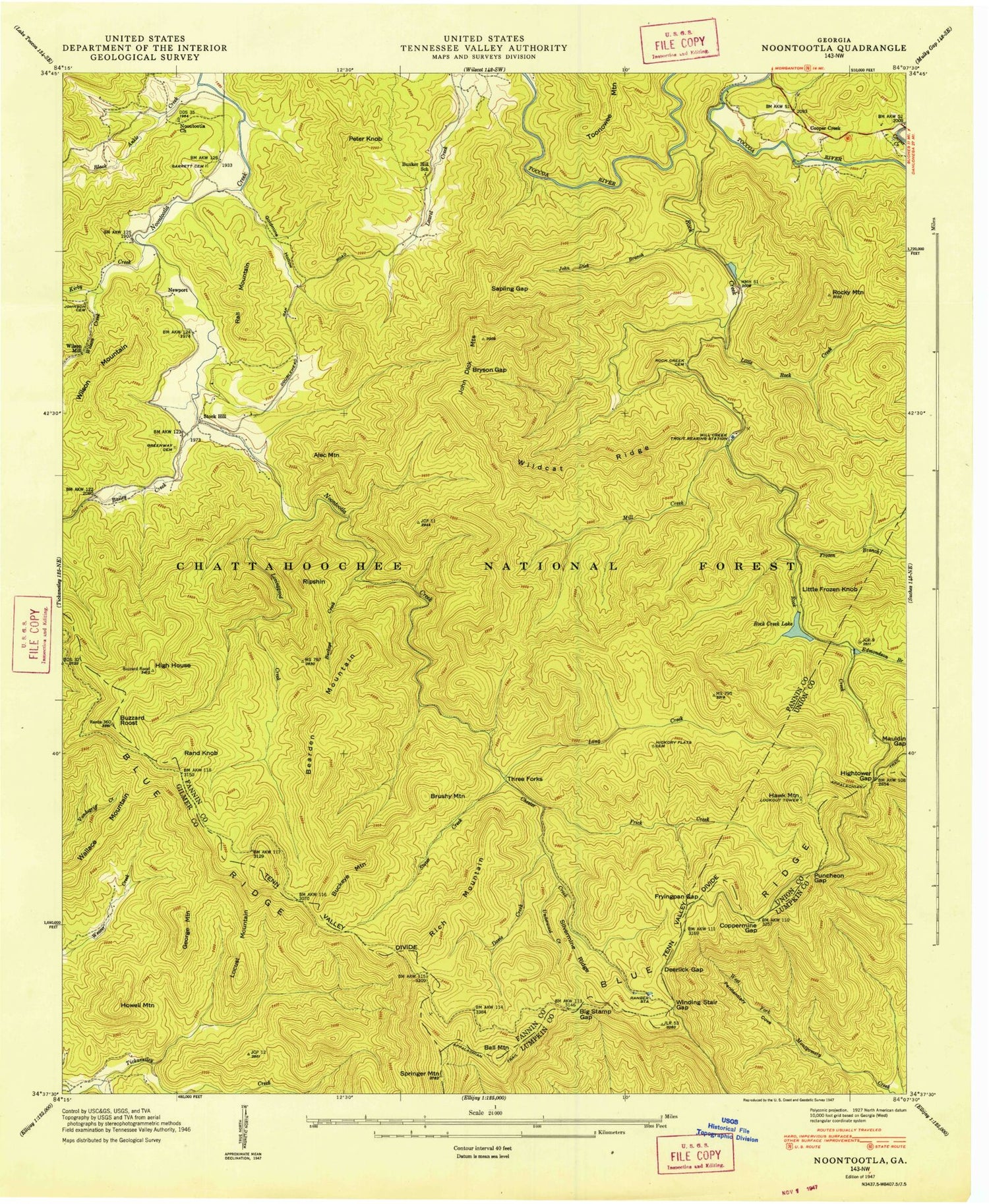
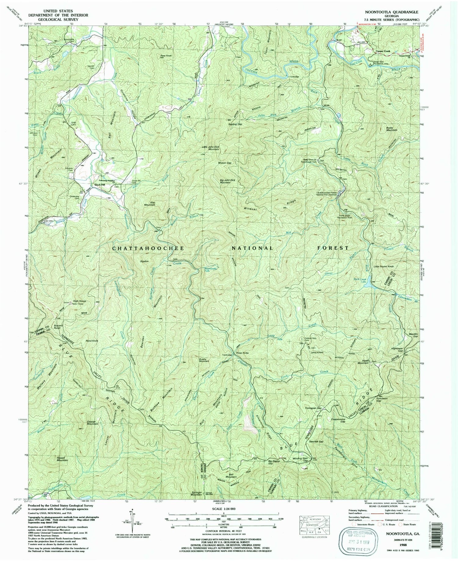
MyTopo
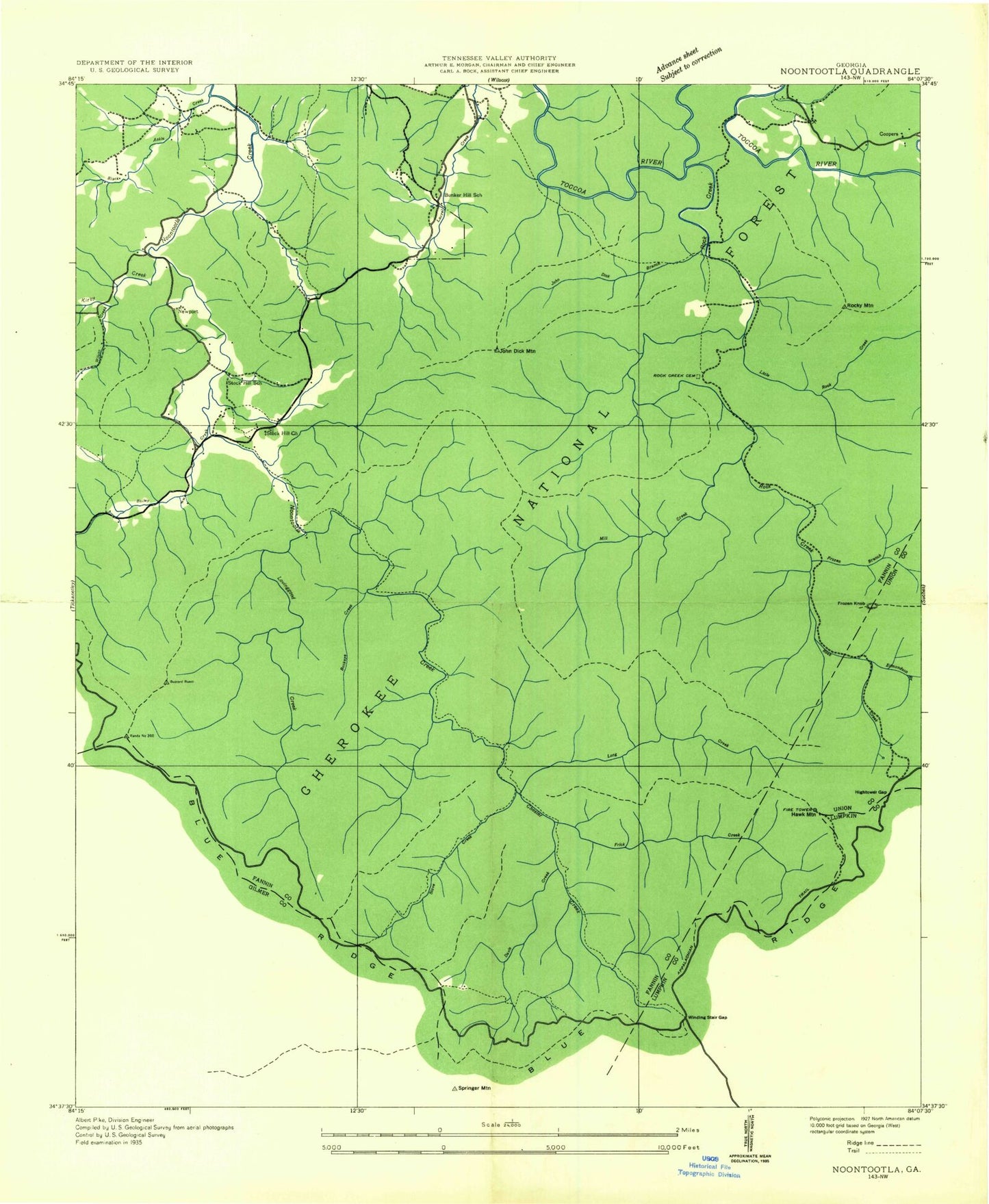
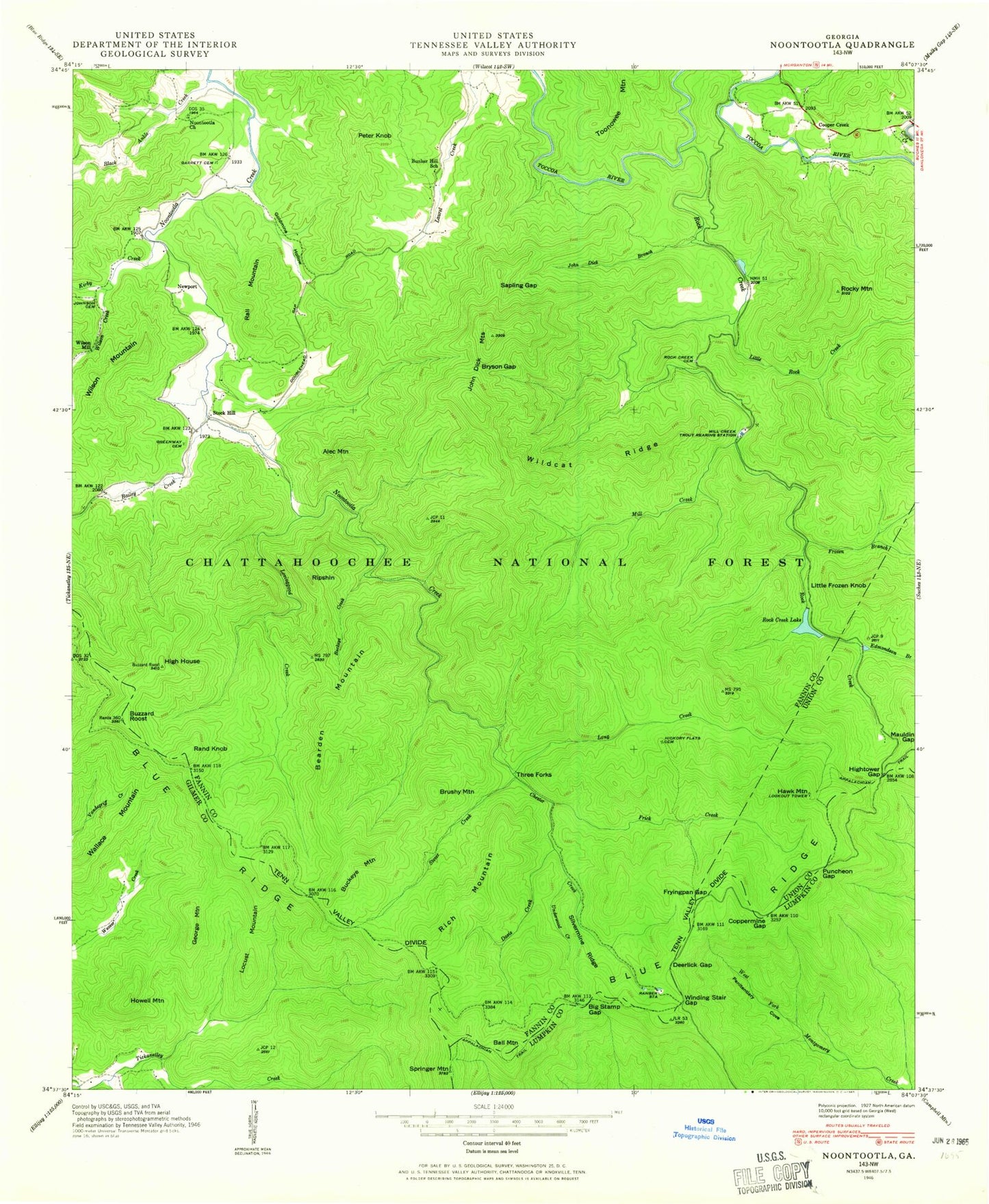
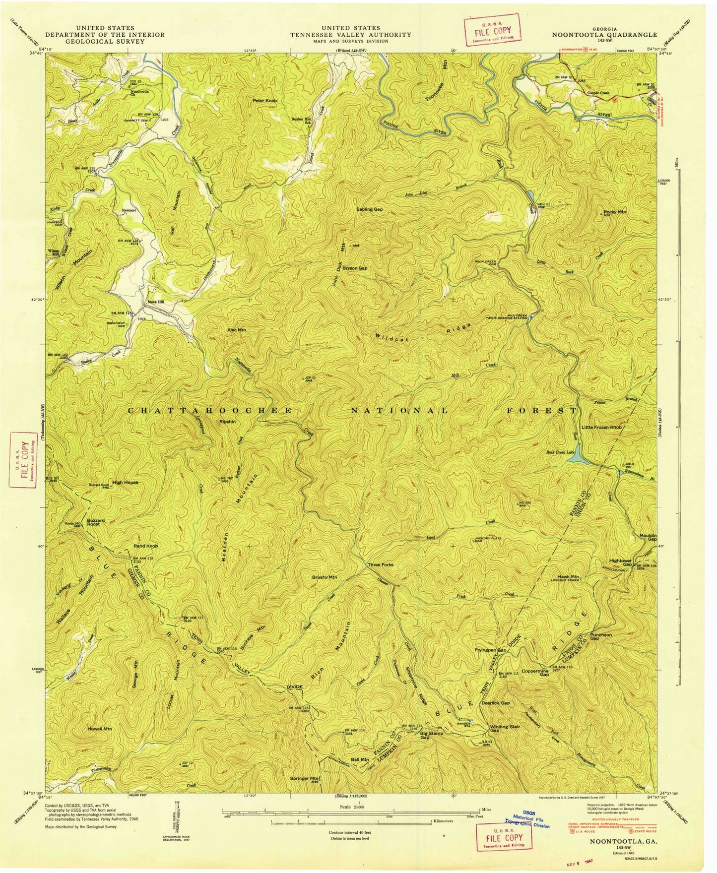
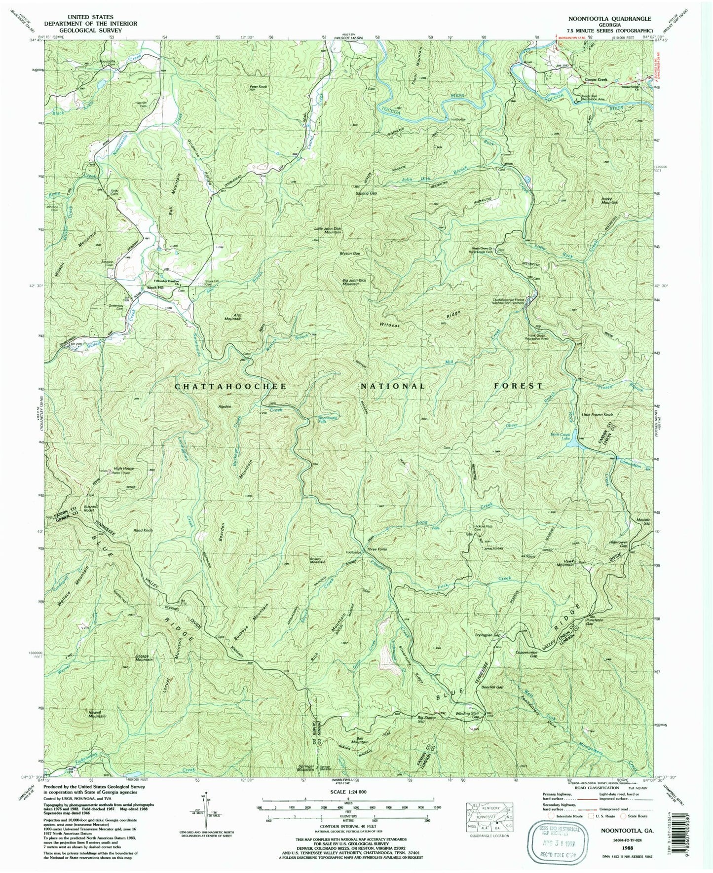
USGS Classic Noontootla Georgia 7.5'x7.5' Topo Map
Couldn't load pickup availability
Historical USGS topographic quad map of Noontootla in the state of Georgia. Scale: 1:24000. Print size: 24" x 27"
This quadrangle is in the following counties: Fannin, Gilmer, Lumpkin, Union.
The map contains contour lines, roads, rivers, towns, lakes, and grids including latitude / longitude and UTM / MGRS. Printed on high-quality waterproof paper with UV fade-resistant inks.
Contains the following named places: Bailey Creek, Big Stamp Gap, Black Ankle Creek, Bryson Gap, Buckeye Creek, Bucktown Creek, Bunker Hill School, Buzzard Roost, Coppermine Gap, Davis Creek, Deerlick Gap, Edmondson Branch, Frick Creek, Frozen Branch, Fryingpan Gap, Garrett Cemetery, Goldmine Hollow, Greenway Cemetery, Hickory Flats Cemetery, High House, Hightower Gap, John Dick Branch, Big John Dick Mountain, Johnson Cemetery, Kirby Creek, Little Rock Creek, Long Creek, Lovinggood Creek, Mill Creek, Noontootla Church, Penitentiary Cove, Puncheon Gap, Rock Creek Cemetery, Rock Creek Lake, Sapling Gap, Silvermine Ridge, Stover Creek, Underwood Creek, Wildcat Ridge, Wilson Creek, Winding Stair Gap, Little John Dick Mountain, Chester Creek, Stock Hill Cemetery, Alec Branch, Watkins Branch, Noontootla Falls, Noontootla Cemetery, Fellowship Primitive Church, Cooper Creek Church, Rock Creek, Oliver Branch, John Dick Mountains, Shady Grove Church, Deep Hole Recreation Area, Hawks Mountain Trail Shelter, Frank Gross Recreation Area, Springer Mountain Shelter, Cross Trail Shelter, Blue Ridge Wildlife Management Area, Alec Mountain, Ball Mountain, Bearden Mountain, Brushy Mountain, Buckeye Mountain, Cooper Creek, George Mountain, Hawk Mountain, Howell Mountain, Little Frozen Knob, Locust Mountain, Newport, Peter Knob, Rall Mountain, Rand Knob, Rich Mountain, Ripshin, Rocky Mountain, Stock Hill, Three Forks, Wallace Mountain, Wilson Mill, Cartecay River Watershed Dam Number Seven, Little Lake, Van Orsdal Lake Dam, Van Orsdal Lake, Rock Creek Lake Dam, Mill Creek Trout Rearing Station, Coopers Creek School (historical), Hickory Flats, High Falls, Springer Mountain, Argo (historical), Sids Mountain, Fannin County Fire Department Station 9, Chattahoochee Forest National Fish Hatchery