MyTopo
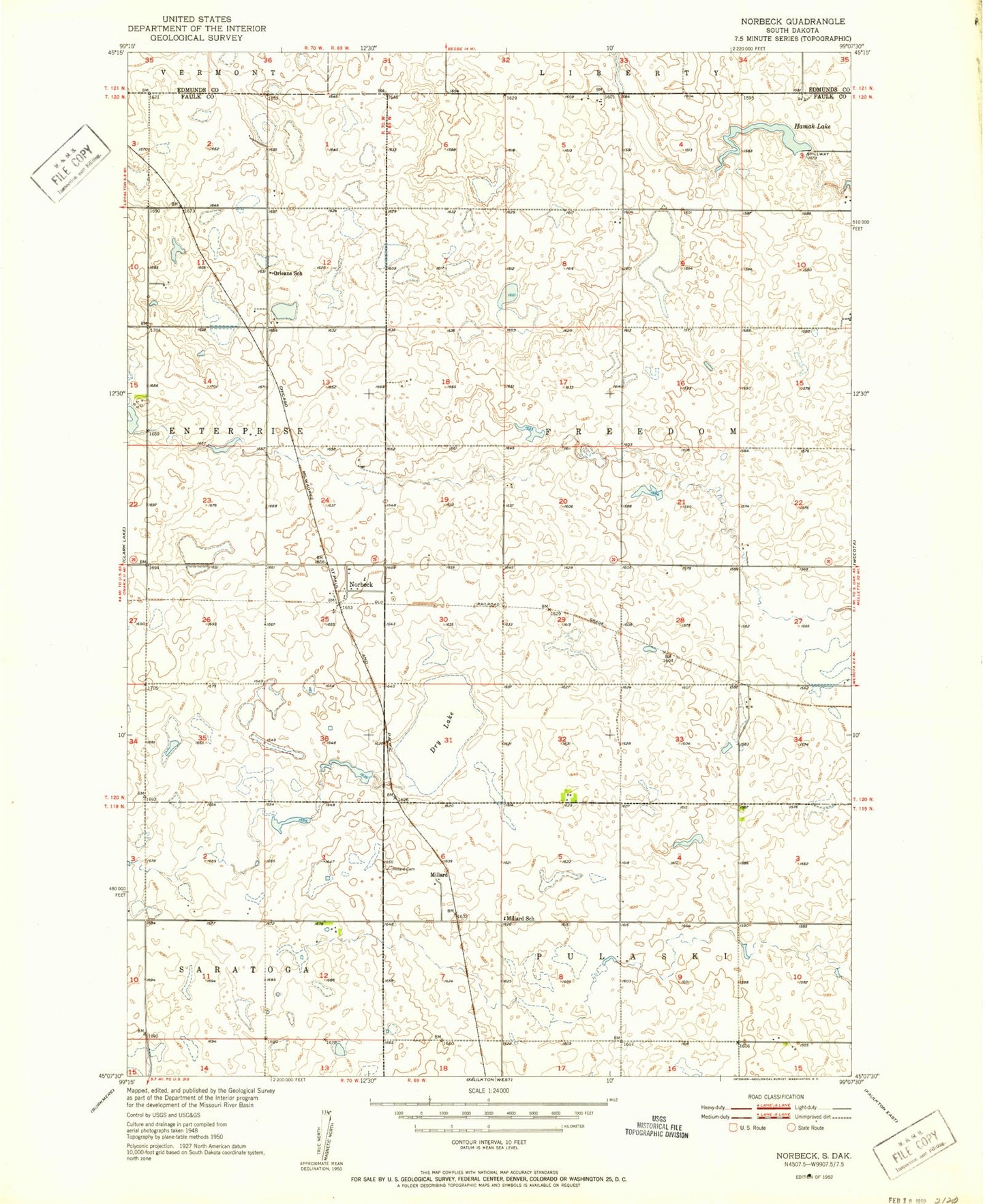
Classic USGS Norbeck South Dakota 7.5'x7.5' Topo Map
Couldn't load pickup availability
Historical USGS topographic quad map of Norbeck in the state of South Dakota. Map scale may vary for some years, but is generally around 1:24,000. Print size is approximately 24" x 27"
This quadrangle is in the following counties: Edmunds, Faulk.
The map contains contour lines, roads, rivers, towns, and lakes. Printed on high-quality waterproof paper with UV fade-resistant inks, and shipped rolled.
Contains the following named places: Blumengard Colony, Blumengard Colony Census Designated Place, Blumengard Colony Elementary School, Dry Lake, Hamak Dam, Hamak Lake, Hammok Lake, Millard, Millard Cemetery, Millard School, Norbeck, Orleans, Orleans School, South Dakota State University Pasture Research Center, Township of Freedom