MyTopo
Classic USGS Norborne Missouri 7.5'x7.5' Topo Map
Couldn't load pickup availability
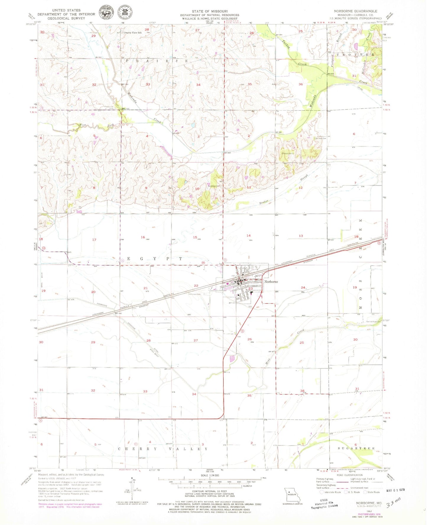
Historical USGS topographic quad map of Norborne in the state of Missouri. Map scale may vary for some years, but is generally around 1:24,000. Print size is approximately 24" x 27"
This quadrangle is in the following counties: Carroll.
The map contains contour lines, roads, rivers, towns, and lakes. Printed on high-quality waterproof paper with UV fade-resistant inks, and shipped rolled.
Contains the following named places: Chapel Hill School, City of Norborne, Cloudis Cemetery, Double E Heliport, Fairhaven Cemetery, Fairview School, Fishpond Branch, German Cemetery, Marshall School, Matthews Lake Dam, McCroskie Creek, Nimrod School, Norborne, Norborne Drainage Ditch, Norborne Elementary School, Norborne High School, Norborne Police Department, Norborne Post Office, Norborne Volunteer Fire Department, Prairie View School, Providence Cemetery, Rolling Green School, Swan Lake School, Township of Egypt, Trinity Lutheran Cemetery, Turkey Creek, West Fork Wakenda Creek, Wetherholt School, White Lake, White Lake Dam, ZIP Code: 64668