MyTopo
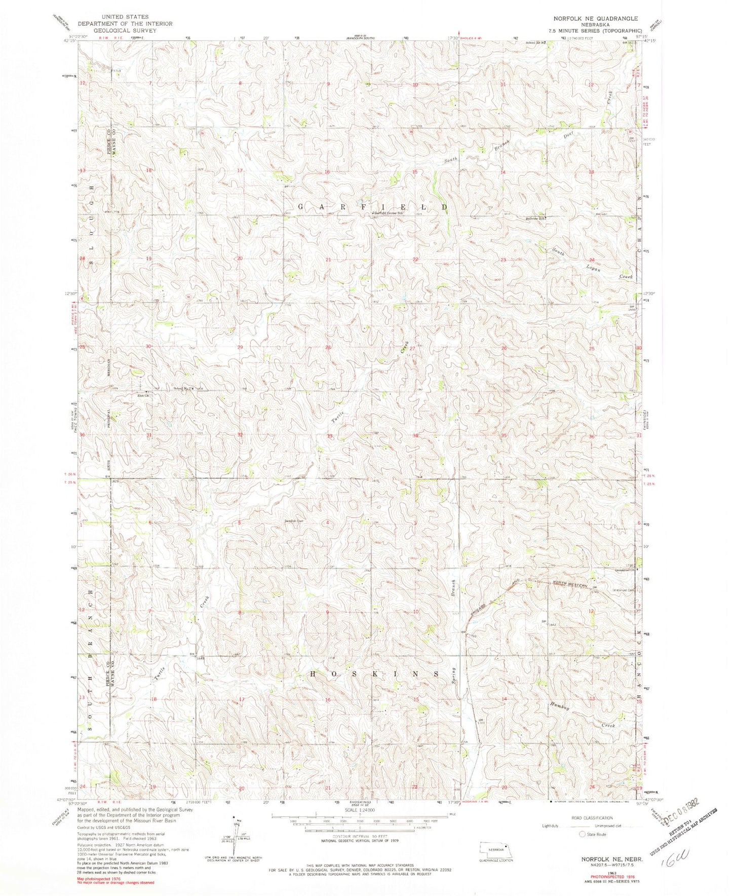
Classic USGS Norfolk NE Nebraska 7.5'x7.5' Topo Map
Couldn't load pickup availability
Historical USGS topographic quad map of Norfolk NE in the state of Nebraska. Map scale may vary for some years, but is generally around 1:24,000. Print size is approximately 24" x 27"
This quadrangle is in the following counties: Pierce, Wayne.
The map contains contour lines, roads, rivers, towns, and lakes. Printed on high-quality waterproof paper with UV fade-resistant inks, and shipped rolled.
Contains the following named places: Apex, Bellview School, Garfield Center School, Garfield Election Precinct, Hoskins Election Precinct, Immanuel Cemetery, Immanuel Church, KXNE-FM (Norfolk), KXNE-TV (Norfolk), Scheurich Dam, Scheurich Reservoir, School Number 77, Township of Garfield, Township of Hoskins, Zion Church, ZIP Code: 68740