MyTopo
Classic USGS Norfork Dam South Arkansas 7.5'x7.5' Topo Map
Couldn't load pickup availability
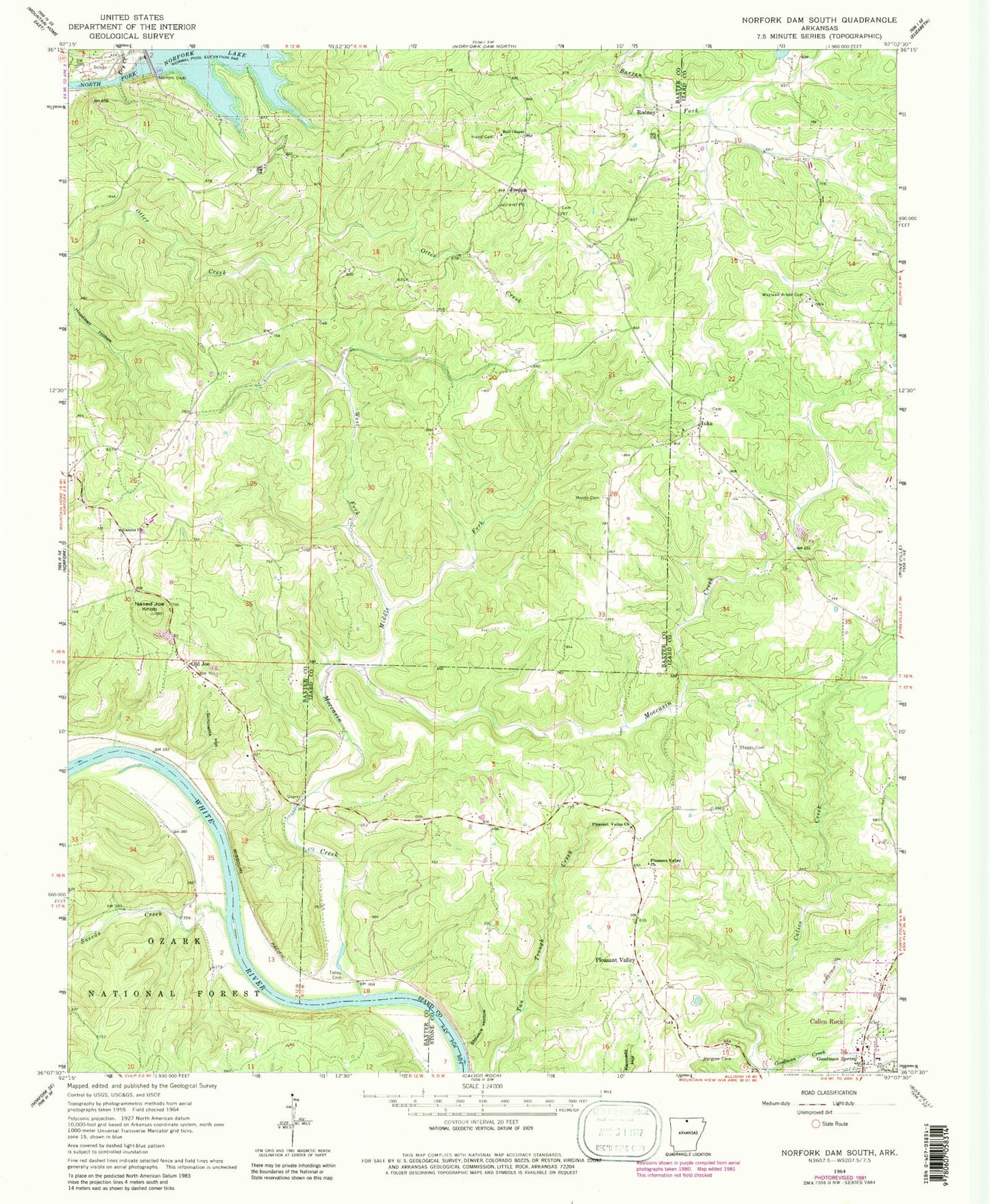
Historical USGS topographic quad map of Norfork Dam South in the state of Arkansas. Map scale may vary for some years, but is generally around 1:24,000. Print size is approximately 24" x 27"
This quadrangle is in the following counties: Baxter, Izard, Stone.
The map contains contour lines, roads, rivers, towns, and lakes. Printed on high-quality waterproof paper with UV fade-resistant inks, and shipped rolled.
Contains the following named places: Arkansas Department of Corrections North Central Unit, Arkansas Emergency Transport Calico Rock, Arkansas Game and Fish Commission Law Enforcement North Central Regional Office, Berry, Calico Rock Volunteer Fire Department, Calico Rock-Izard County Airport, Community Medical Center of Izard County, Dry Creek, Galatia Cemetery, Galatia Church, Goodman Creek, Goodman Spring, Hall Chapel, Hand Cemetery, Hopewell, Iuka, Jordan, Jordan Post Office, KKTZ-FM (Mountain Home), Middle Fork Moccasin Creek, Moccasin Creek, Moody Cemetery, Naked Joe Knob, Norfork Dam, Old Joe, Pleasant Valley, Pleasant Valley Church, Rodney, Rodney Volunteer Fire Department, Rodney Volunteer Fire Department Station 1, Schinette Hollow, Sneeds Creek, Staggs Cemetery, Stowers Hollow, Talley Cemetery, Township of North Fork, Township of Union, Wayland Arbor Cemetery, West Fork Moccasin Creek, ZIP Codes: 72519, 72528