MyTopo
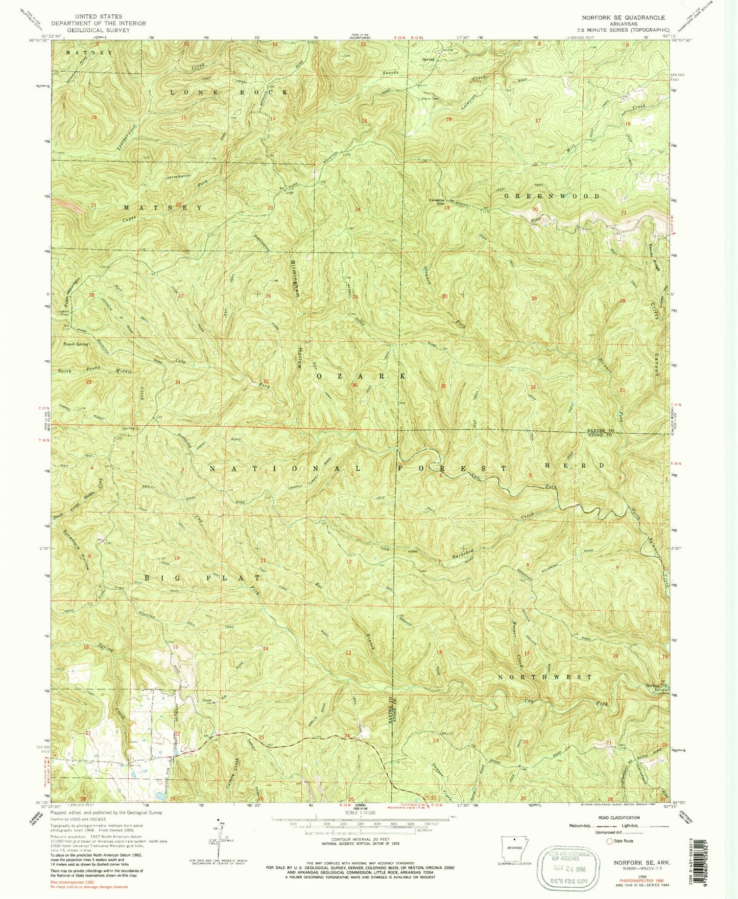
Classic USGS Norfork SE Arkansas 7.5'x7.5' Topo Map
Couldn't load pickup availability
Historical USGS topographic quad map of Norfork SE in the state of Arkansas. Typical map scale is 1:24,000, but may vary for certain years, if available. Print size: 24" x 27"
This quadrangle is in the following counties: Baxter, Stone.
The map contains contour lines, roads, rivers, towns, and lakes. Printed on high-quality waterproof paper with UV fade-resistant inks, and shipped rolled.
Contains the following named places: Push Mountain, Jonesdale (historical), Township of Big Flat, Township of Greenwood, Acklin Cemetery, Barkshed Creek, Bee Branch, Birmingham Hollow, Cap Fork, Caroline Gap, Clifty Canyon, Cole Fork, Grassy Hollow, Hooper Creek, Sandy Ridge, Stewart Fork, Sycamore Hollow, Tassel Spring, Clifty Canyon Special Interest Area, Push Mountain Lookout Tower, Barkshed Picnic Area, Spring Beech Creek