MyTopo
Classic USGS Norman Arkansas 7.5'x7.5' Topo Map
Couldn't load pickup availability
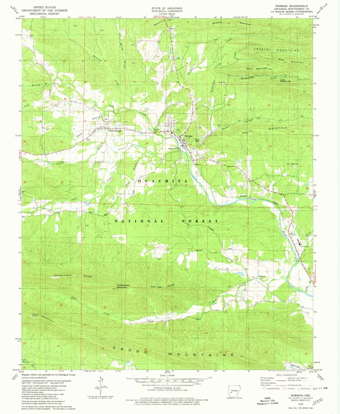
Historical USGS topographic quad map of Norman in the state of Arkansas. Map scale may vary for some years, but is generally around 1:24,000. Print size is approximately 24" x 27"
This quadrangle is in the following counties: Montgomery.
The map contains contour lines, roads, rivers, towns, and lakes. Printed on high-quality waterproof paper with UV fade-resistant inks, and shipped rolled.
Contains the following named places: Barr Memorial Presbyterian Church, Beck Mountain, Beech Creek, Black Springs, Black Springs Cemetery, Black Springs First Baptist Church, Black Springs School, Caddo Hills Elementary School, Caddo Hills High School, Caddo Mountains, Caddo Valley Academy, Cedar Bluff School, Chapel Cemetery, Collier Creek, Crystal Recreation Area, Ferguson Cemetery, Fodderstack Mountain, Fodderstack Range, Gap Mountain, Hall Branch, Hamilton Creek, Harvey Branch, Hewing Branch, Huddleston Creek, Hyatt Creek, Irby Cemetery, Lick Creek, Manfred, Manfred Colored School, Manfred School, Middleton-Crooks Cemetery, Mill Creek, Montgomery Cemetery, Montgomery Creek, Nealy Branch, Norman, Norman Assembly of God Church, Norman First Baptist Church, Norman Post Office, Norman United Methodist Church, Norman Volunteer Fire Department, Oklahoma School, Pleasant Valley Baptist Church, Pleasant Valley School, Polk Creek, Red Oak Range, Robbins Cemetery, Rowton Cemetery, Sardis School, Sloan Branch, Smith Creek, Smoky Hollow, Swindle Creek, Town of Black Springs, Town of Norman, Township of Gap, Township of Womble, Tweedle-Vaught Cemetery, Waco School, Waco School Cemetery, Wheeler Mountain, Williams Ranch Airport, Yellow Jacket School, ZIP Code: 71960