MyTopo
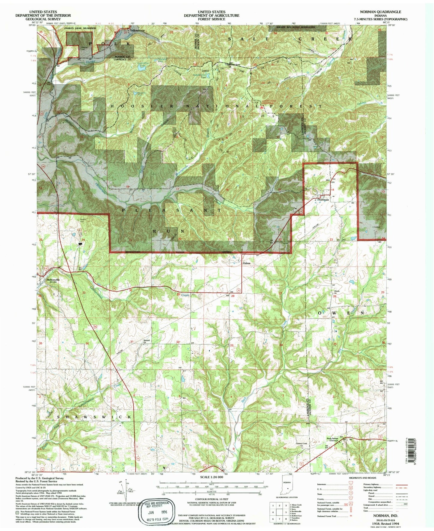
Classic USGS Norman Indiana 7.5'x7.5' Topo Map
Couldn't load pickup availability
Historical USGS topographic quad map of Norman in the state of Indiana. Typical map scale is 1:24,000, but may vary for certain years, if available. Print size: 24" x 27"
This quadrangle is in the following counties: Jackson, Lawrence, Monroe.
The map contains contour lines, roads, rivers, towns, and lakes. Printed on high-quality waterproof paper with UV fade-resistant inks, and shipped rolled.
Contains the following named places: Orchard Run, Pitzer Run, Pole Branch, Brannaman Branch, Callahan Cemetery, Dennis Murphy Hollow, Dry Creek, Guthrie Creek Church, Hickory Grove Church, Hunter Creek, Liberty Church, McPike Branch, Mitchell Cemetery, Mundell Church, Norman, Shady Springs Tabernacle, Tanyard Branch, Terrill Branch, Yellowstone, Zelma, Faubion Cemetery, Me Pike Pond, Jackie Branch, Hickory Grove Pond, Mitchell Ridge, Township of Pleasant Run, Pleasant Run Volunteer Fire Department, Scott - Wray Cemetery, Norman Post Office