MyTopo
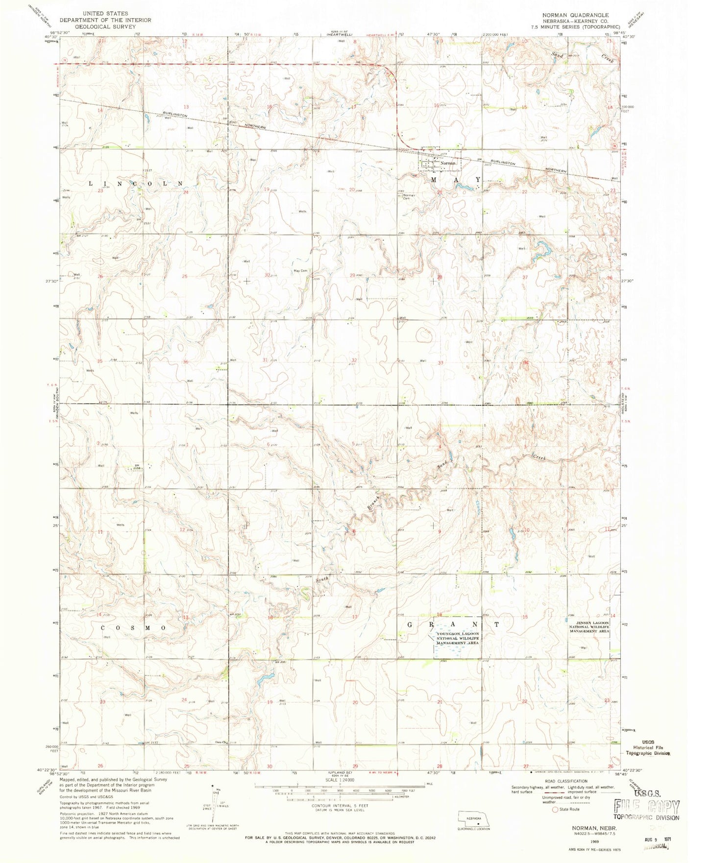
Classic USGS Norman Nebraska 7.5'x7.5' Topo Map
Couldn't load pickup availability
Historical USGS topographic quad map of Norman in the state of Nebraska. Map scale may vary for some years, but is generally around 1:24,000. Print size is approximately 24" x 27"
This quadrangle is in the following counties: Kearney.
The map contains contour lines, roads, rivers, towns, and lakes. Printed on high-quality waterproof paper with UV fade-resistant inks, and shipped rolled.
Contains the following named places: Christensen Dam, Christensen Reservoir, Hieb Dam, Hieb Reservoir, May Cemetery, Norman, Norman Cemetery, Norman Post Office, Osco Church, Osco Post Office, Petersen Dam, Petersen Reservoir, Reiss Dam Number 1, Reiss Dam Number 2, Reiss Reservoir Number 1, Reiss Reservoir Number 2, South Branch Sand Creek, Township of Grant, Township of May, Village of Norman, Youngson Lagoon Nat Wildlife Mgt Area