MyTopo
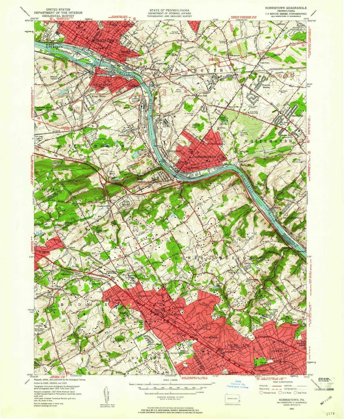
Classic USGS Norristown Pennsylvania 7.5'x7.5' Topo Map
Couldn't load pickup availability
Historical USGS topographic quad map of Norristown in the state of Pennsylvania. Typical map scale is 1:24,000, but may vary for certain years, if available. Print size: 24" x 27"
This quadrangle is in the following counties: Chester, Delaware, Montgomery, Philadelphia.
The map contains contour lines, roads, rivers, towns, and lakes. Printed on high-quality waterproof paper with UV fade-resistant inks, and shipped rolled.
Contains the following named places: Academy of Notre Dame De Namur, Ardmore, Arnold Field, Arrowmink Creek, Baldwin School, Baptist Institute, Barbadoes Island, Barren Hill, Belmont Hills, Belmont School, Belmont Terrace, Black Horse, Booth School, Brandywine Village, Bridgeport, Browns Run, Bryn Mawr, Bryn Mawr College, Bryn Mawr Station, Cabrini College, Calvary Cemetery, Candlebrook School, Cedar Heights, Cold Point, Connaughtown, Conshohocken, Conshohocken Station, Coopertown School, County Line Station, Diamond Run, Dove Lake, Foxes Run, Friends School, Garrett Hill, George Washington Memorial Park Cemetery, Gladwyne, Gotwalls School, Gulph Mills, Harcum Junior College, Hardings Run, Harmonville, Harmonville Impounding Basin, Harriton High School, Hartranft School, Haverford, Haverford College, Henderson Park, Henderson Road School, Holland School, Holy Saviour School, Hughes Park, Ithan School, Kings Manor, Lafayette Consolidated School, Lafayette Hill, Lincoln School, Lower Merion High School, Marble Hall, Mater Misericordia Academy, Matsunk Creek, Meadowbrook Run, Merion Square School, Mill Creek, Miquon, Miquon School, Mogees Station, Montgomery Cemetery, Montgomery Country Day School, Montgomery Hospital, Norristown Dam, Narberth, New Sharon School, Or Ami Synagogue, Our Mother of Sorrows School, Plymouth Creek, Plymouth Dam, Plymouth Meeting, Plymouth Whitemarsh High School, Radnor, Radnor Station, Riverside Cemetery, Riverview Hospital, Roberts Cemetery, Roland School, Roosevelt School, Rosemont, Rosemont College, Rosemont Station, Sacred Heart Hospital, Saint Aloysius Academy, Saint Augustine's Cemetery, Saint Augustines School, Saint Benedicts Cemetery, Saint Christophers Church, Saint Edmunds Home, Saint Francis School, Saint John the Baptist School, Saint Josephs Protectorate, Saint Marys Seminary, Saint Mathews Cemetery, Saint Matthews Cemetery, Saint Matthews High School, Saint Matthews School, Saint Paul's Lutheran Cemetery, Saint Peter Evangelical Lutheran Church Cemetery, Saint Peters Church, Saint Philip Neri School, Sawmill Run, Sawmill Run, Seven Stars, Sherry Lake, Shipley School, Spring Mill, Spring Mill Impounding, Spring Mill School, Sunnybrook Country Club, Swedeland, Swedeland Impounding, Swedesburg, Treemont Cemetery, Trinity Mission, Trout Run, University of Pennsylvania Graduate School, Valley Run, Villanova, Villanova University, Washington School, West Conshohocken, Whitemarsh Junior High School, Willowburn, Wynnewood, Gulph Creek, Ithan, Kirks Run, Stony Creek, Valley Forge Memorial Gardens, Radnor Heliport, Flat Rock Airport (historical), Trout Lake Dam, Lake Lenape Dam, Schuylkill River Reservoir, Upton, Mechanicsville, West Spring Mills, Lafayette, Henderson, Shainline, Mill Road, William Penn Post Office (historical), Lafayette Hill Post Office (historical), Philadelphia Electric Dam, Hickorytown, Griscom Dam, Register Dam, Sinott Dam, Morris Estate Dam, Mitchell Dam, Upper Dam, Middle Dam, WFIL-AM (Philadelphia), WZZD-AM (Philadelphia), Finn Run, Doom Run, Penn Valley, Cherry Dale, Andorra Woods, Hollow Woods, Wynnebrook Manor, Merion Hills, School Side Manor, Gulph Mills Village, Gulph Terrace, Rampart Ridge, Valley Forge Homes, Bob White Farms, Valley Forge Acres, Hamilton Court, Corsons, Ernest, Ivy Rock, Roseglen, Eagle Lodge Golf Course, Plymouth Meeting Mall, Gulph Mills Golf Course, Rockdale, Henderson Station (historical), Ridge Station, Ithan Mills, Villanova Station, Upton Station, Radnor Station, Spring Mill County Park, Miguon Station, Lower Merion Township Park, Haverford Station, Ardmore Presbyterian Church School, Wynnewood Plaza, Union Hill Industrial Park, Saint Gertrudes Church, Saint Gertrudes School, Holiness Christian Church, Primitive Methodist Church, Plymouth Industrial Center, Sutcliff Park, Saints Cosmos and Damian Catholic Church, Saint Marys Catholic Church, Saint Marys Catholic School, Conshohocken Station, Conshohocken United Methodist Church, Spring Mill Station, Saints Peter and Paul Ukrainian Greek Cemetery, Vanquard School, Saint Colmans School, Wynnewood Station, Saint Pauls Church, Rosemont Park, Rosemont Station, Mermont Plaza, Bryn Mawr Court, Church of the Redeemer, Bryn Mawr Hospital, Our Mother of Good Counsel Catholic School, Lee Park, Gladwyne Elementary School, Dove Lake Dam, Radnor Senior High School, Archbishop Carroll High School, Conshohocken Elementary School, Foerderer, Rebel Hill, Shainline Station, Mill Street Station, Earnest Street Yard Station, Whitemarsh Junction Station, Whitemarsh Junction Station, Mogeetown


